Overview
Executive Summary
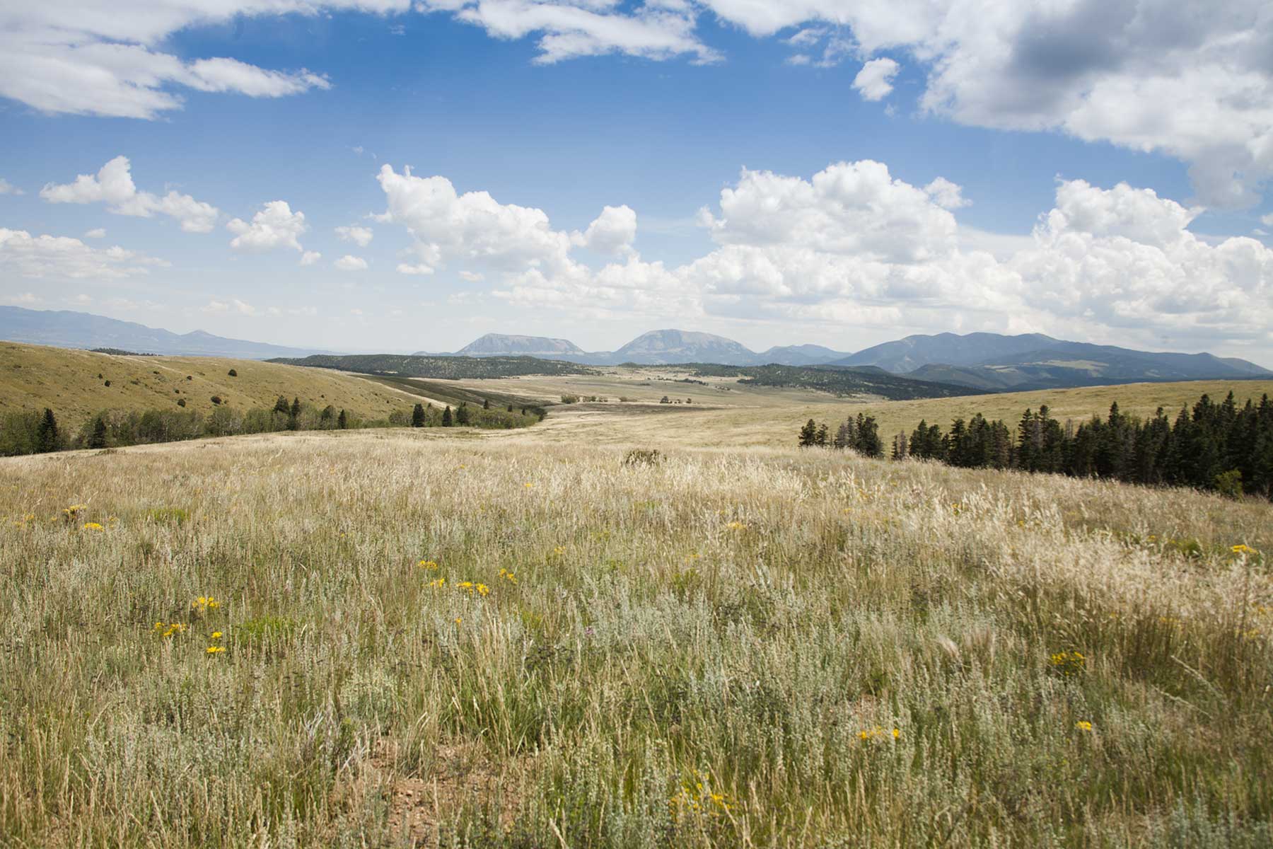
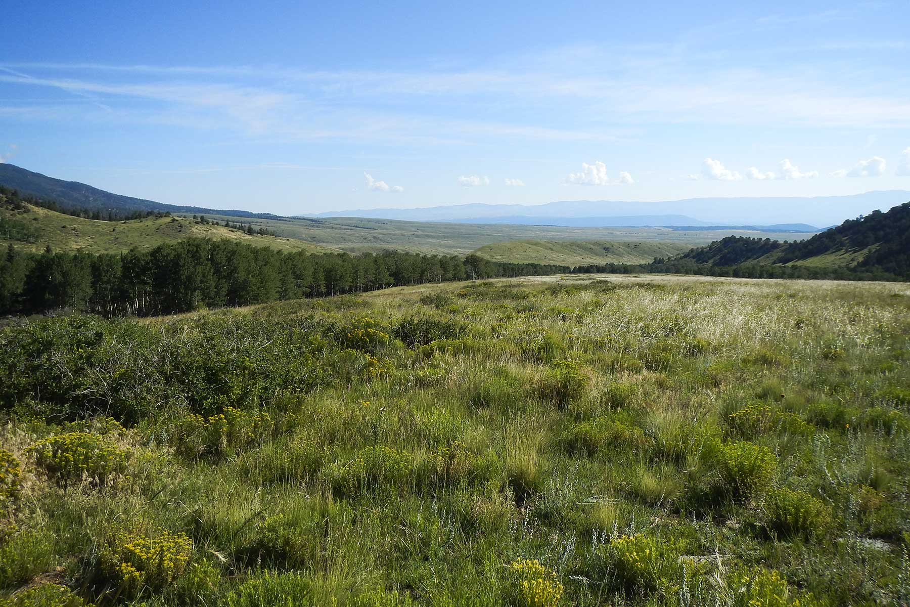
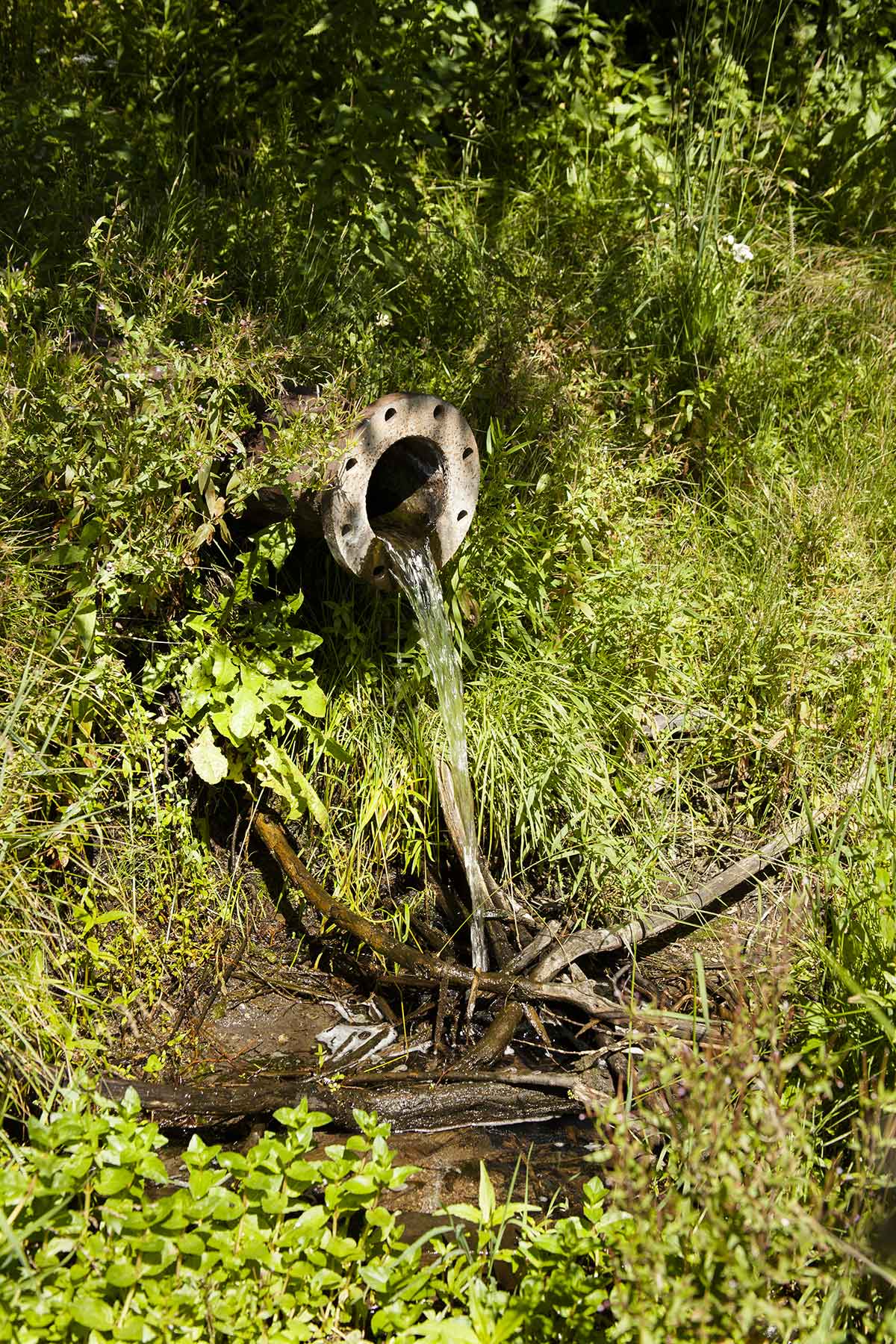
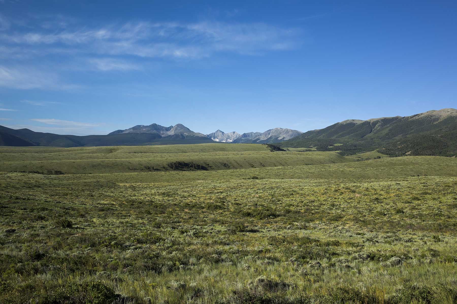
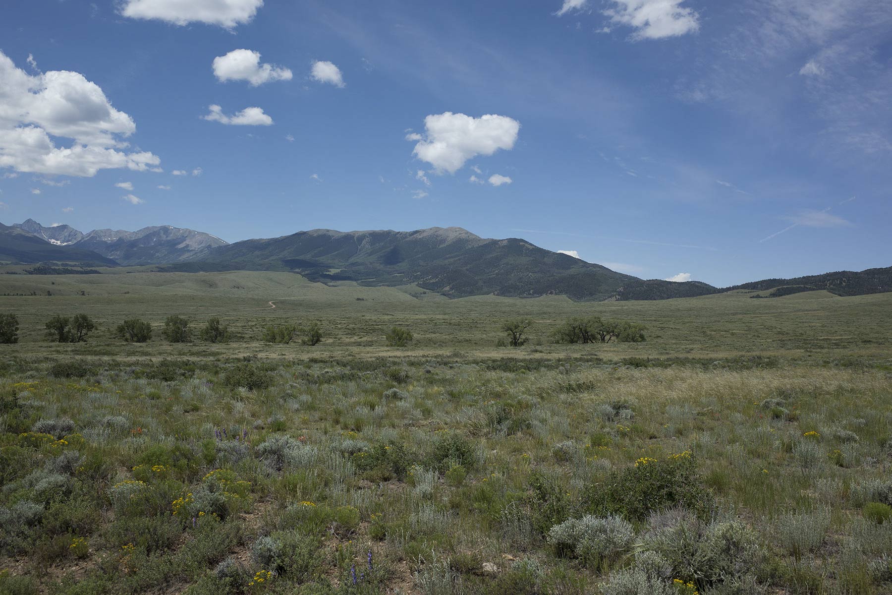
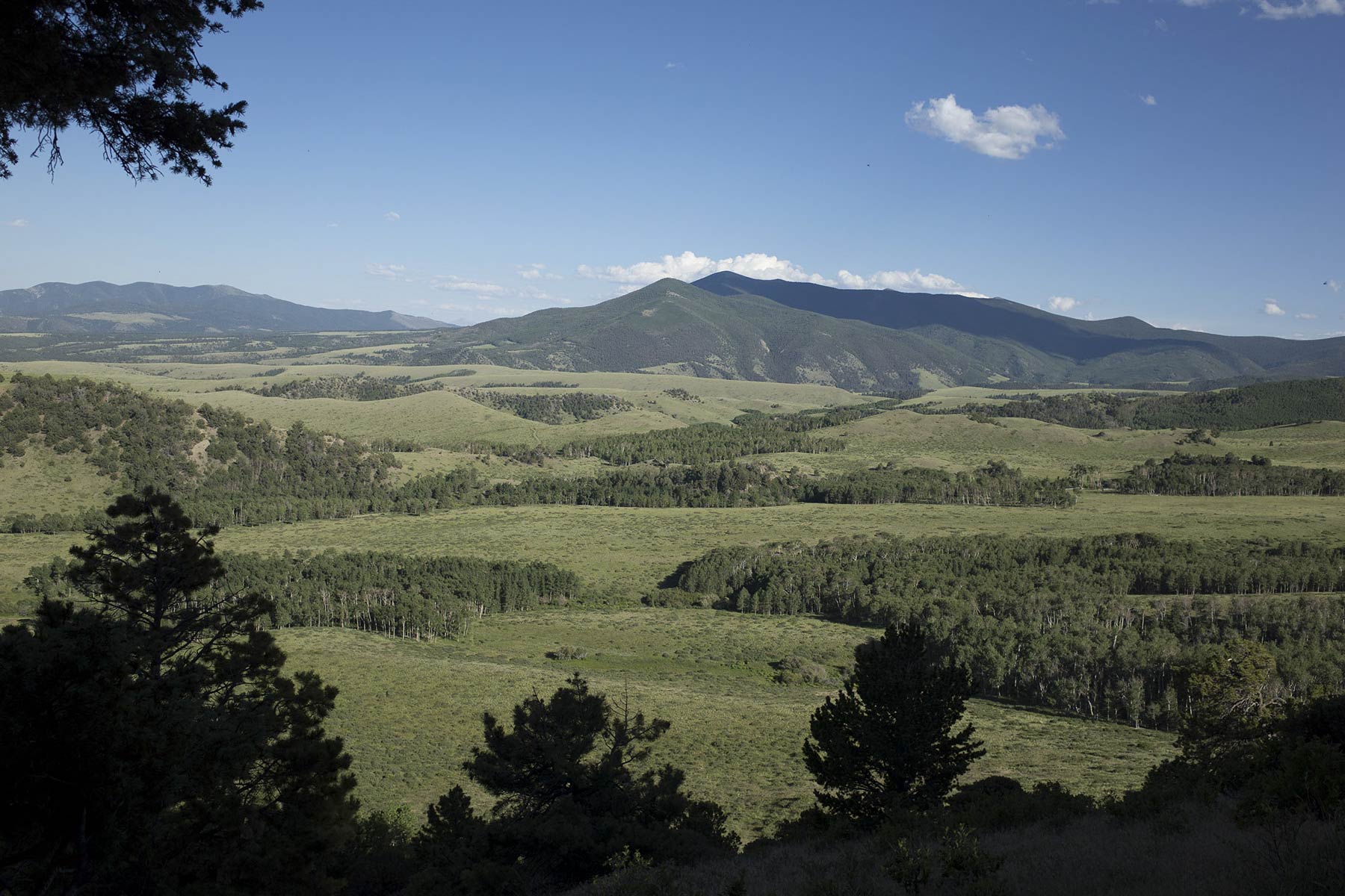
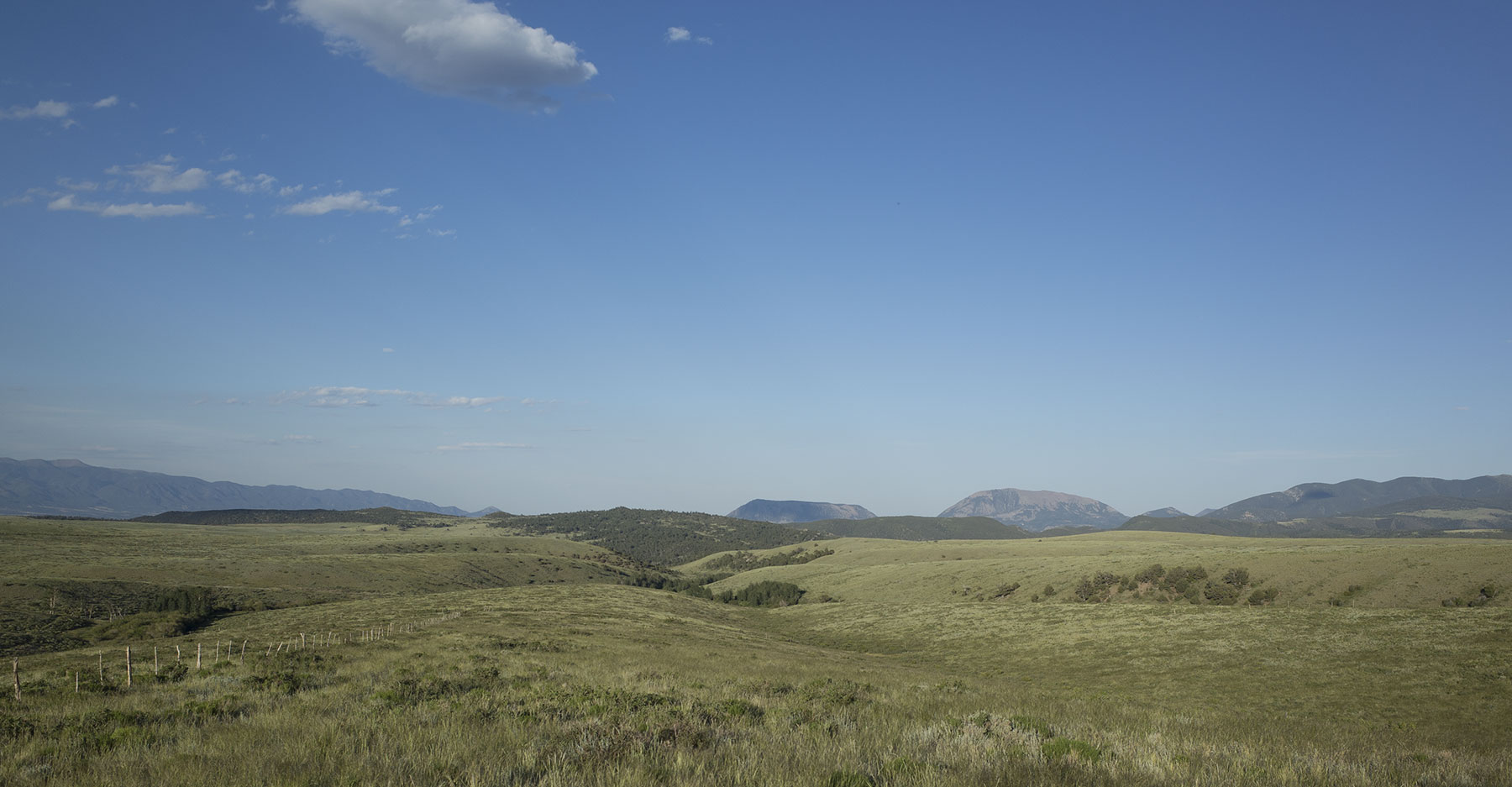
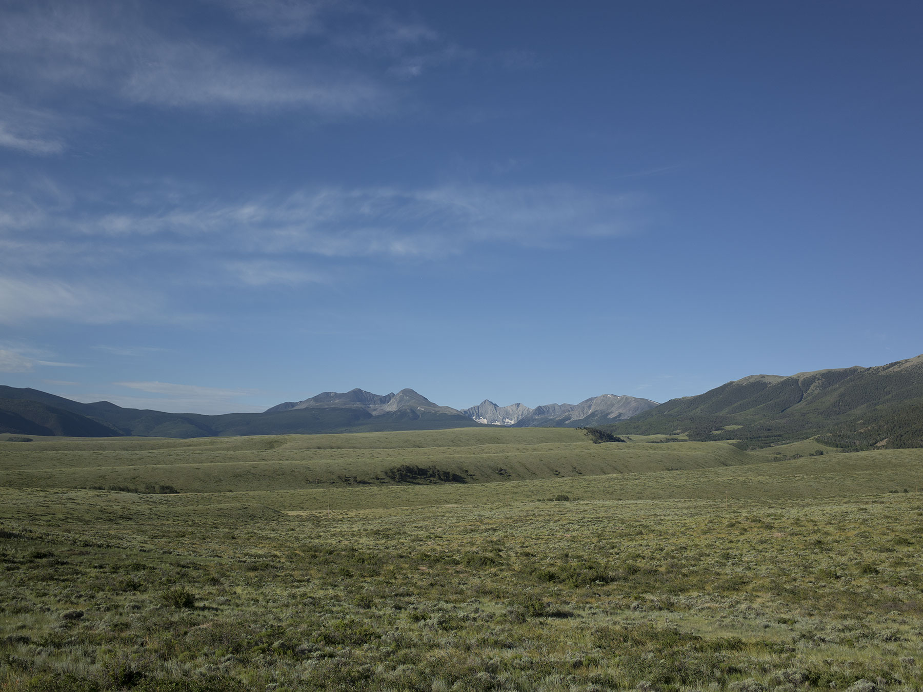
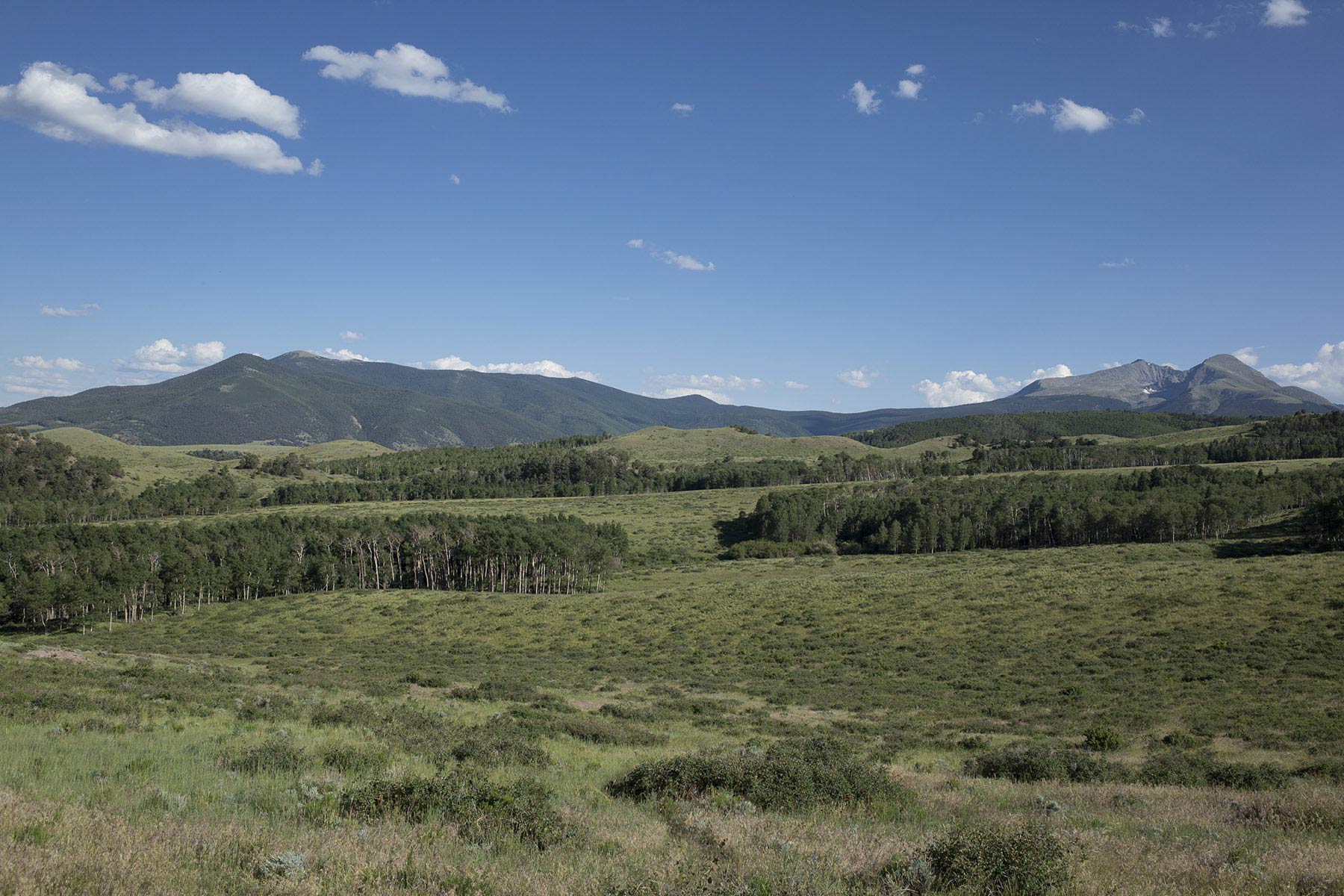
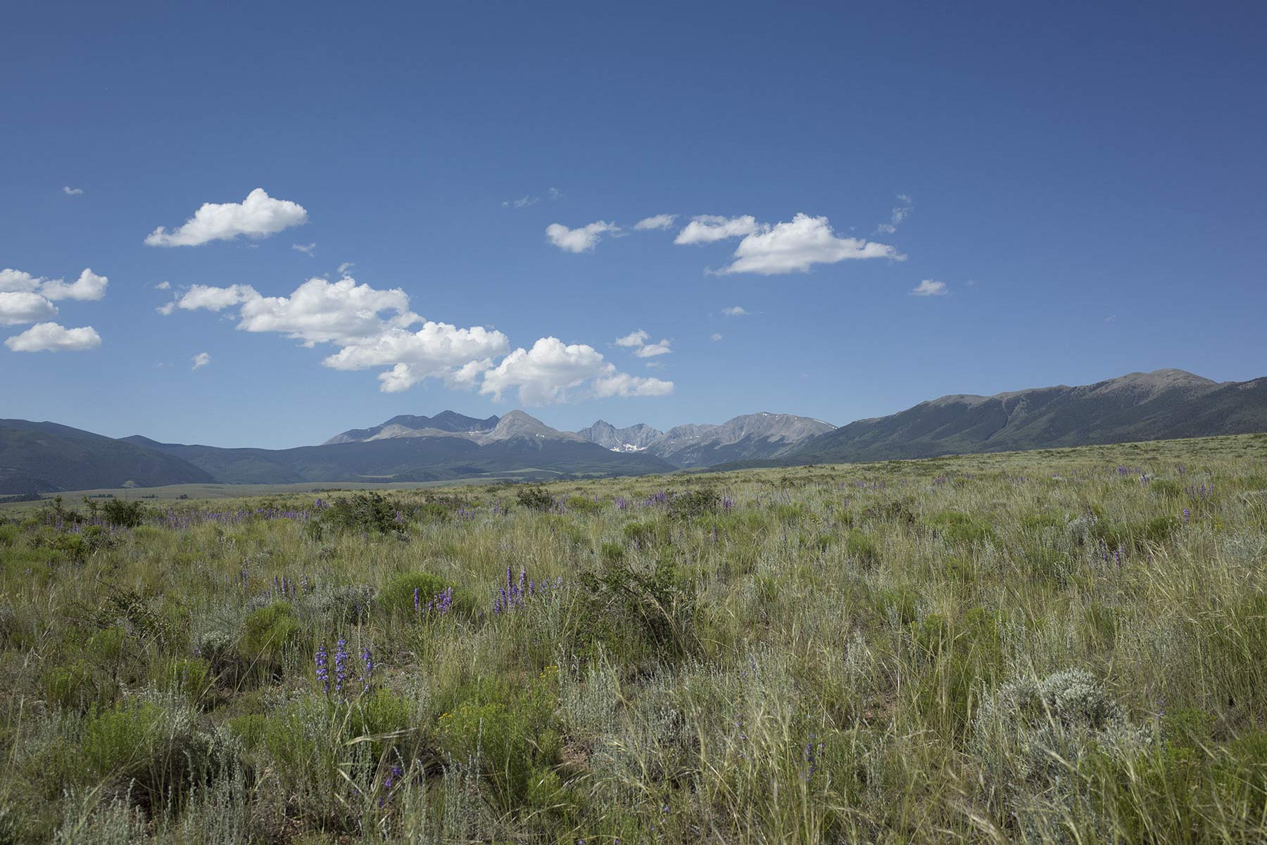
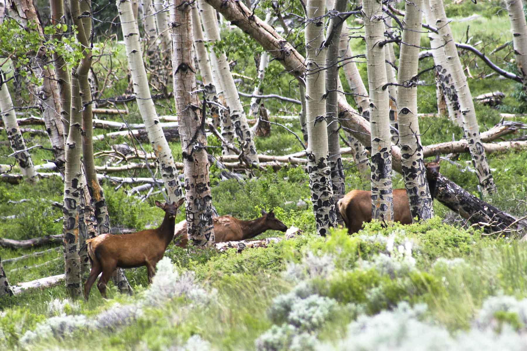
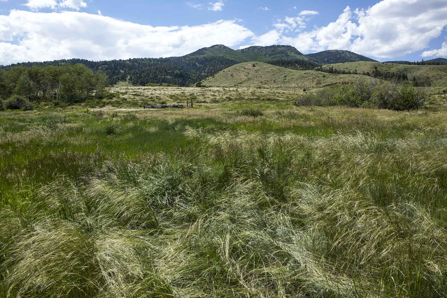
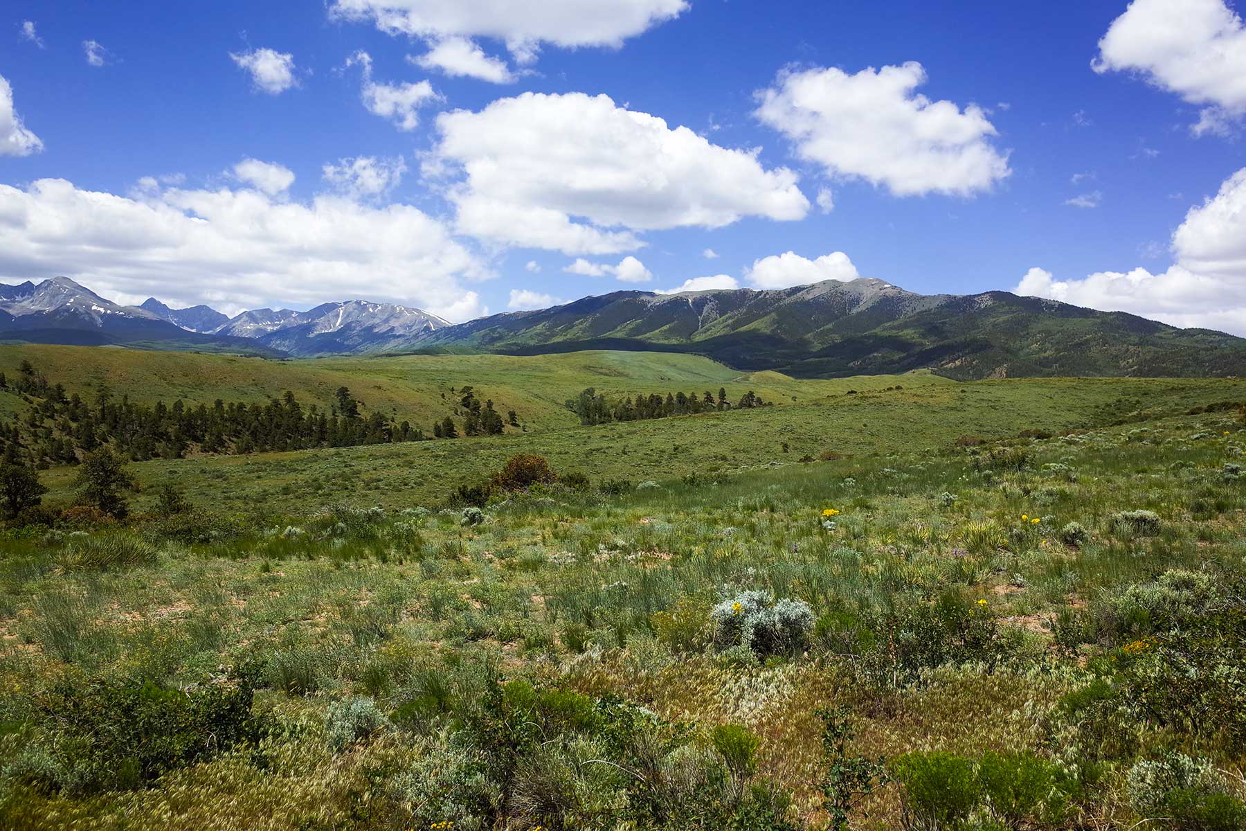
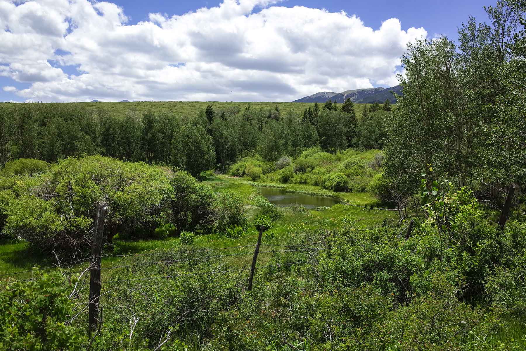
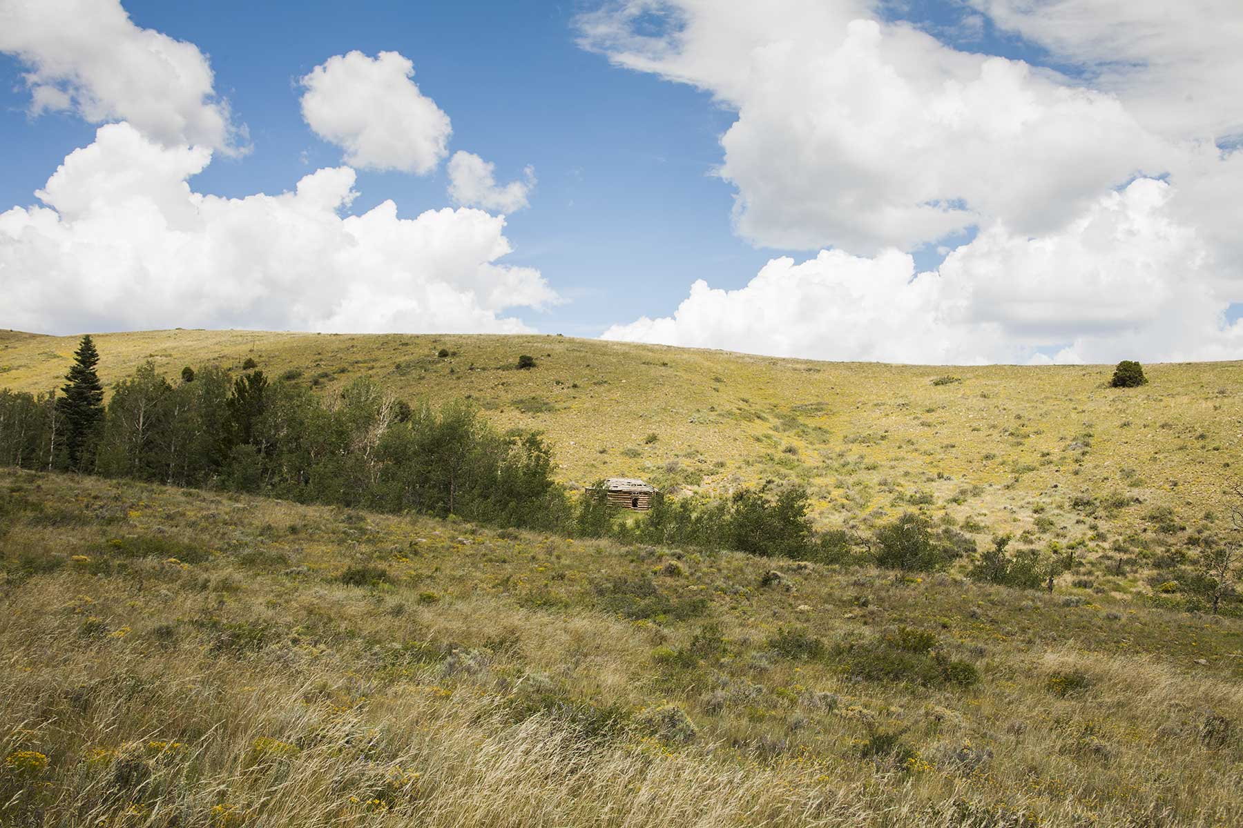
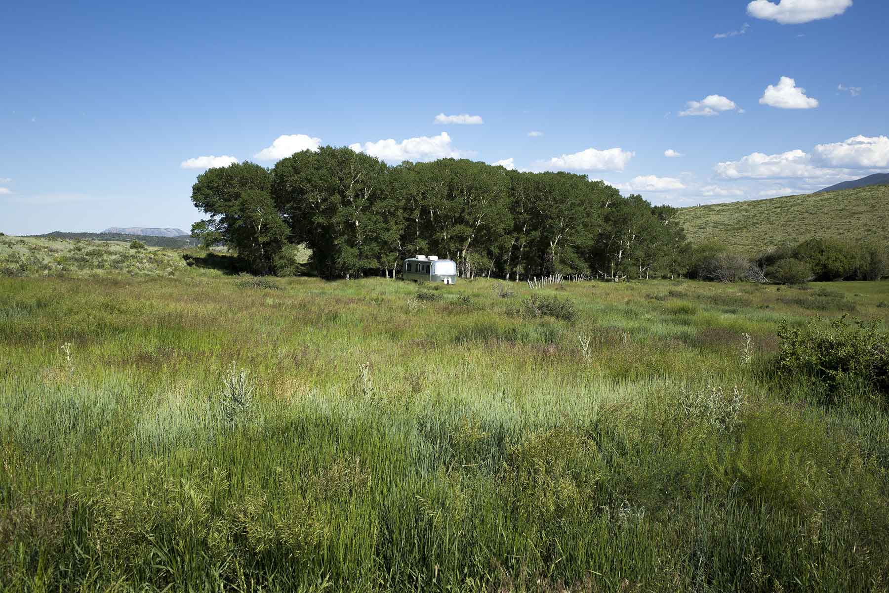
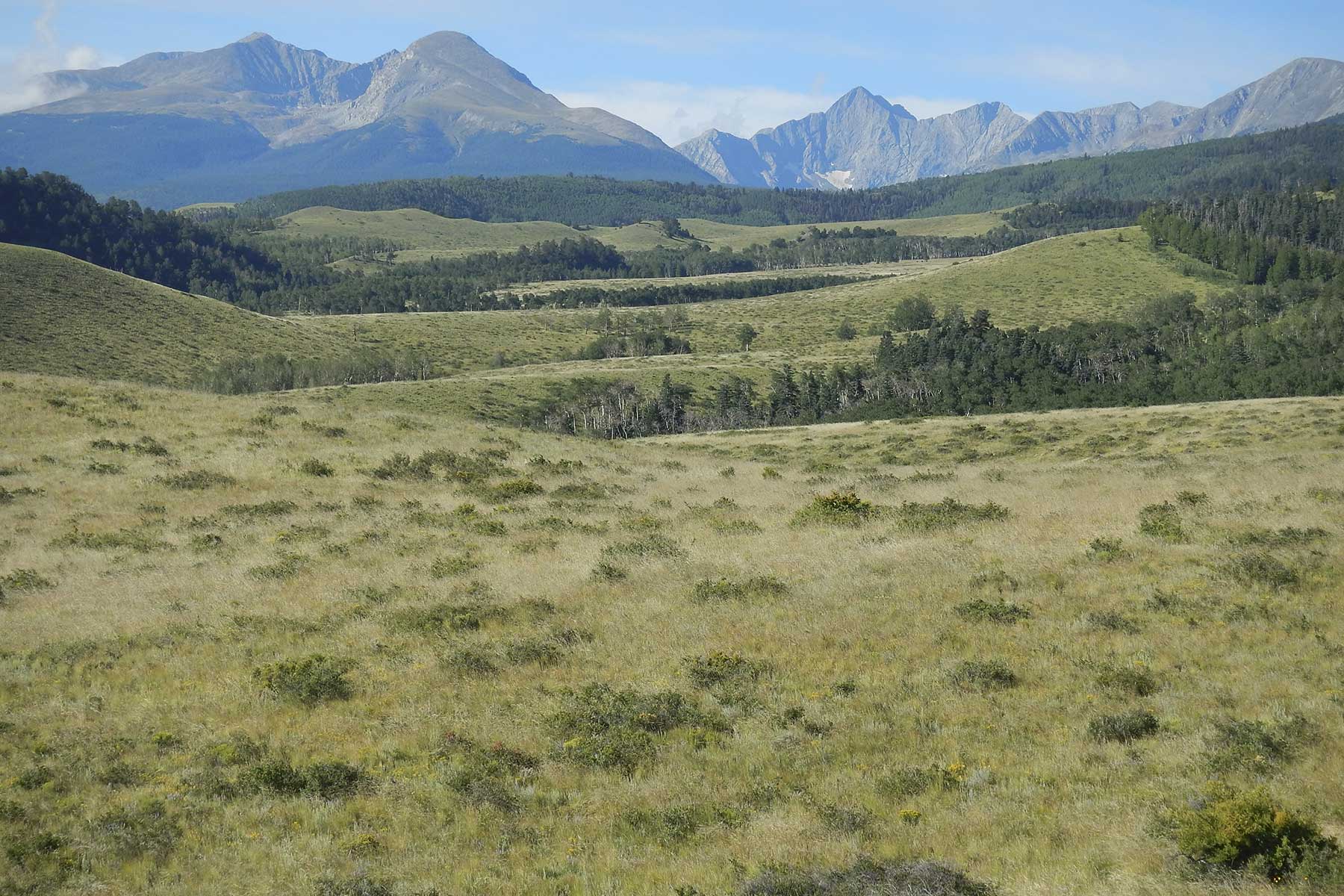
The 6,416± acre (5,056± deeded) Mosca Pass Ranch is located 15 miles west of Gardner, Colorado. This ranch enjoys a dramatic and scenic setting against a backdrop of the jagged 14,000+ foot peaks along the eastern base of the Sangre De Cristo Range, which is the southern portion of the Sangre de Cristo Mountains. In addition to its unmatched views, Mosca Pass Ranch is distinguished by the fact that it offers a large block of private land that adjoins national forest and provides access to the Great Sand Dunes National Park. The ranch is accessed by a county road which traverses through the ranch and dead ends at the Mosca Pass Trailhead on the San Isabel National Forest located just above, but beyond the western boundary of the ranch. An historic mountain thoroughfare, Mosca Pass Trail serves as an eastern access point to the Great Sand Dunes National Park. The property has historically supported a livestock grazing operation, although the current owners have been more interested in conservation and have permitted limited grazing and no hunting during their tenure. Home to a resident population of mature mule deer, elk and pronghorn, the ranch currently serves as a sanctuary between the national forest and large neighboring ranches that are renowned for trophy big game hunting. Several hundred head of elk join the resident herds each fall, utilizing the property as a core wintering ground. The diverse landscape includes creek-lined meadows and lush valleys that transition into rolling rangelands before ascending west into the aspen groves and timbered slopes of the Sangre de Cristo Range. Water resources include over six miles of frontage along three small creeks, two ponds and ten adjudicated springs. The property has no buildings and is unencumbered by conservation easements. Tucked against the eastern base of the Sangre De Cristo Range, the ranch enjoys tremendous views of the Wet Mountains, the Sheep Mountains as well as prominent views of the nearby jagged peaks of Mt. Lindsey and Blanca Peak – the eighth highest peak in the contiguous United States.
Just the Facts
- Scenic 6,416± acres (5,056± deeded) located in a stunning setting at the base of the Sangre De Cristo Range
- Adjacent to San Isabel National Forest
- Access to Mosca Pass Trail and Great Sand Dunes National Park
- Excellent views of Blanca Peak, Mt. Lindsey, Sheep Mountains and Wet Mountains
- 6± miles of frontage on two small creeks
- There are no buildings and the property is unencumbered by conservation easements
- Several sheltered homesites near the creeks with tremendous views
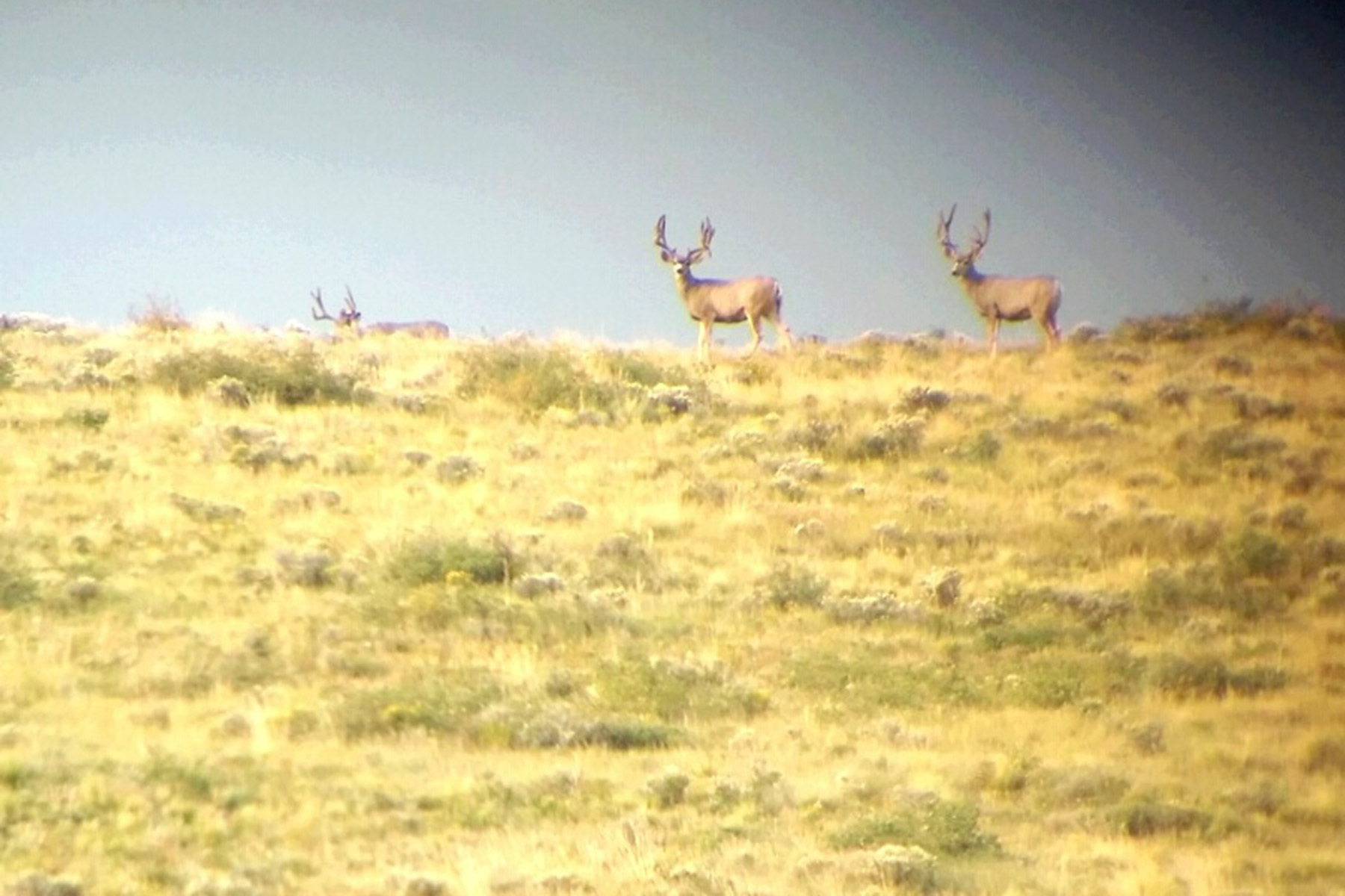
- Resident deer, elk and pronghorn herds
- Critical wintering range for hundreds of elk
- Excellent candidate for conservation, or grazing and hunting property
General Description
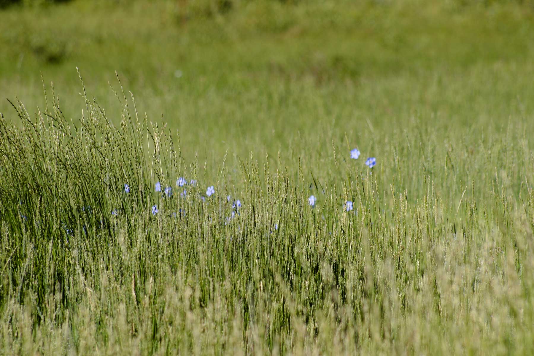
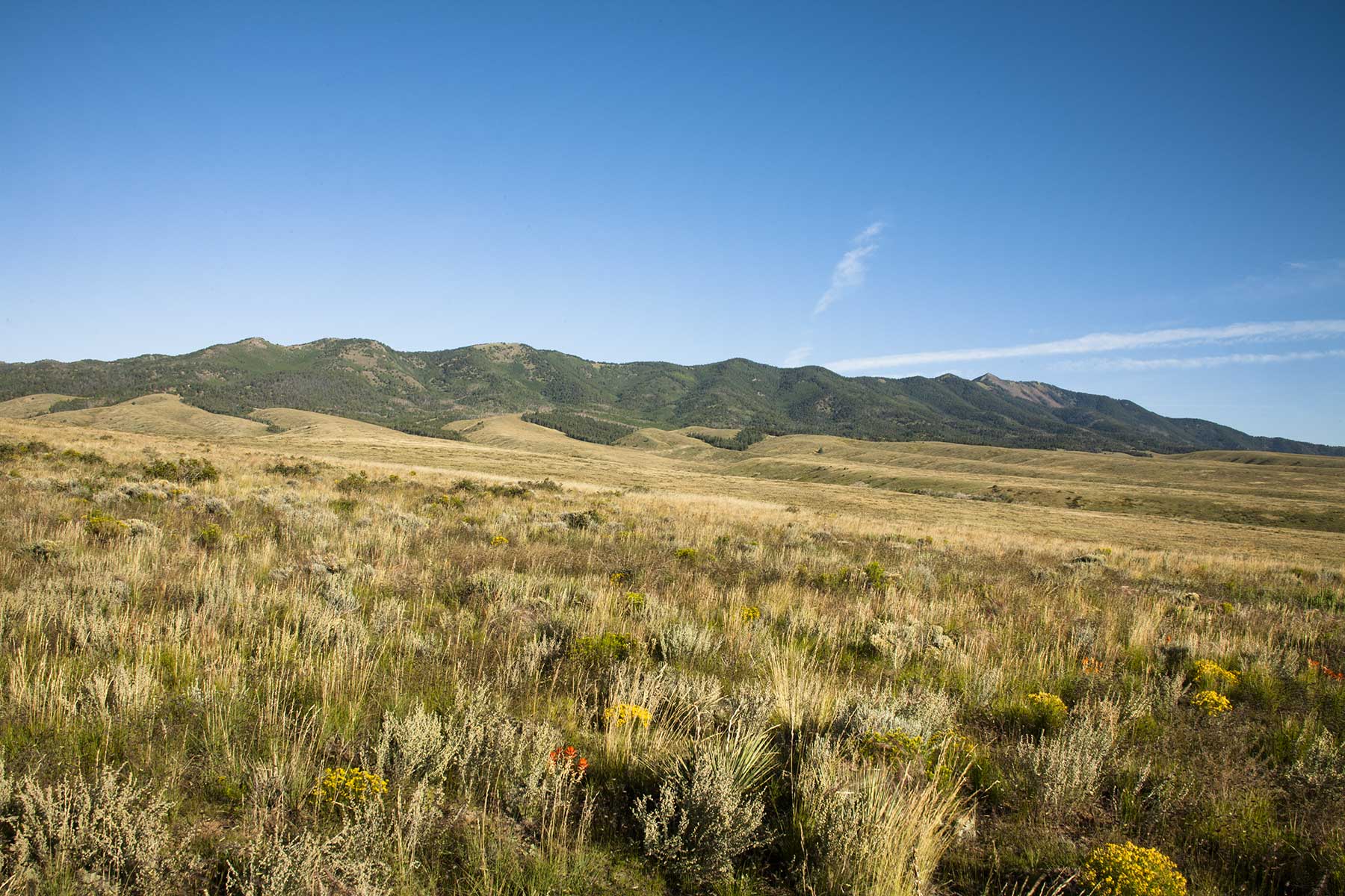
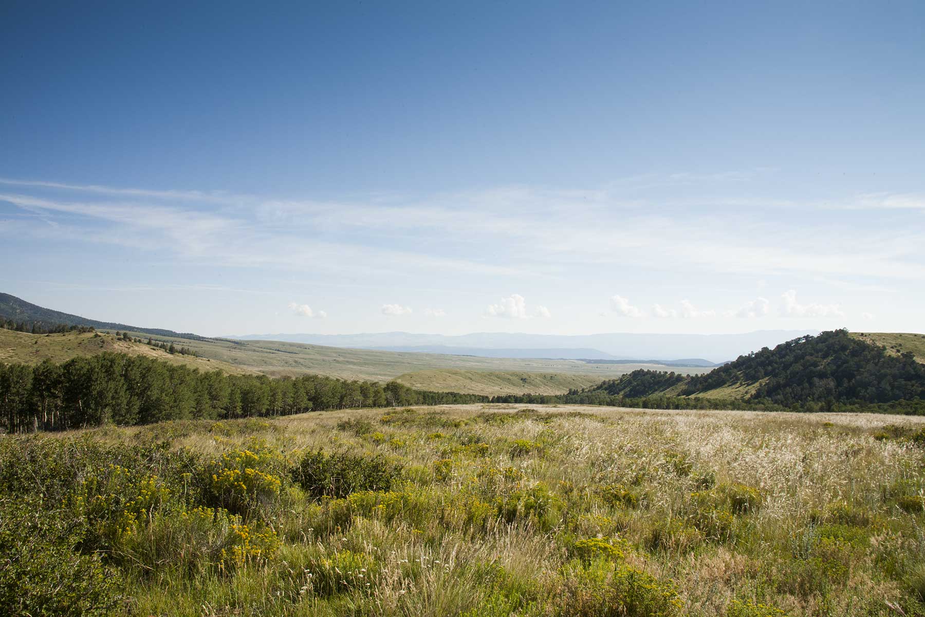
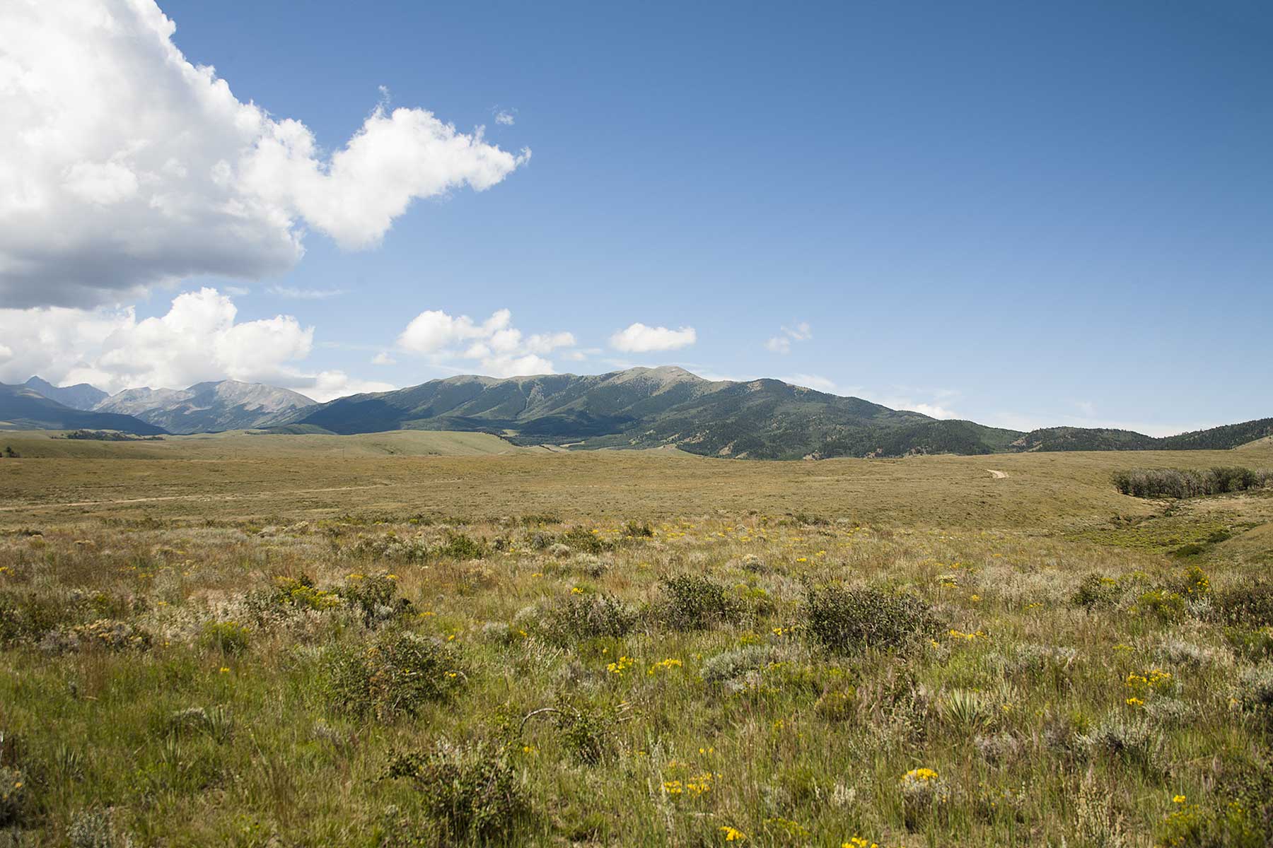
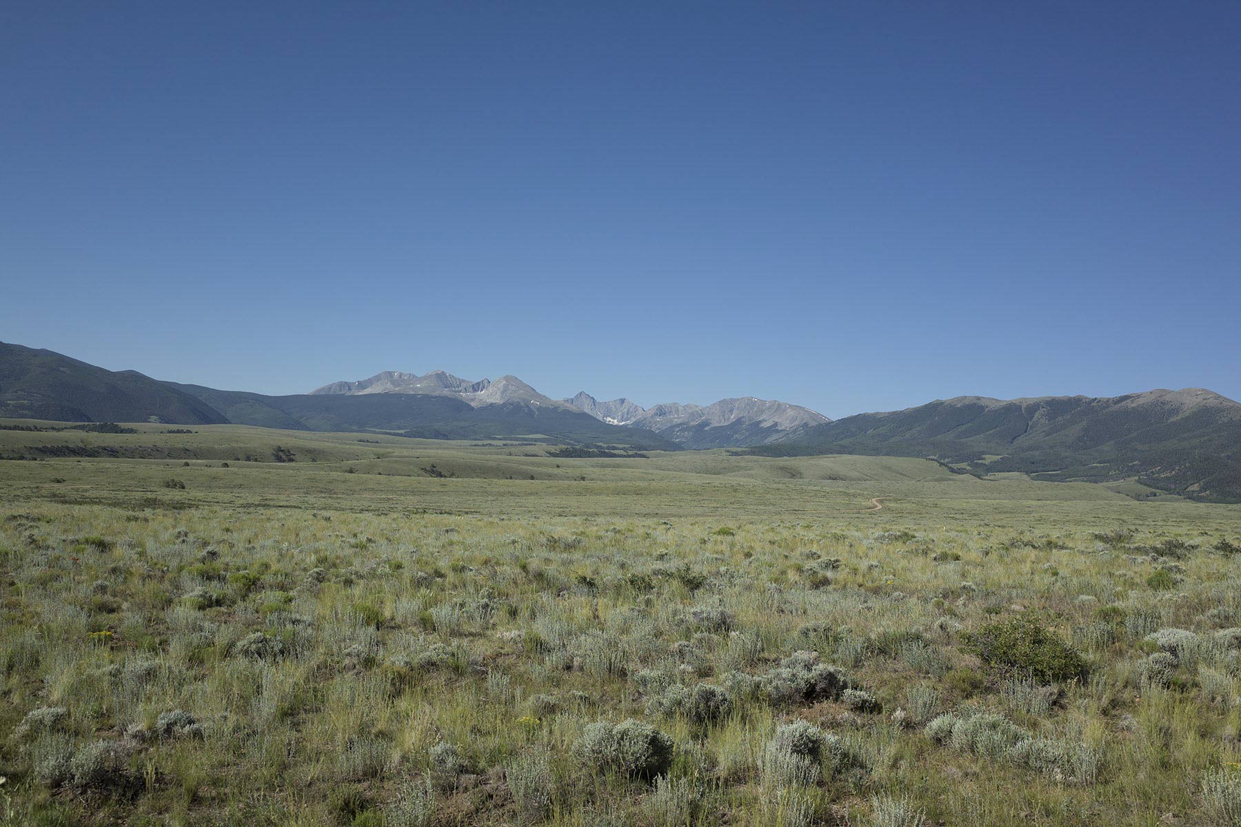
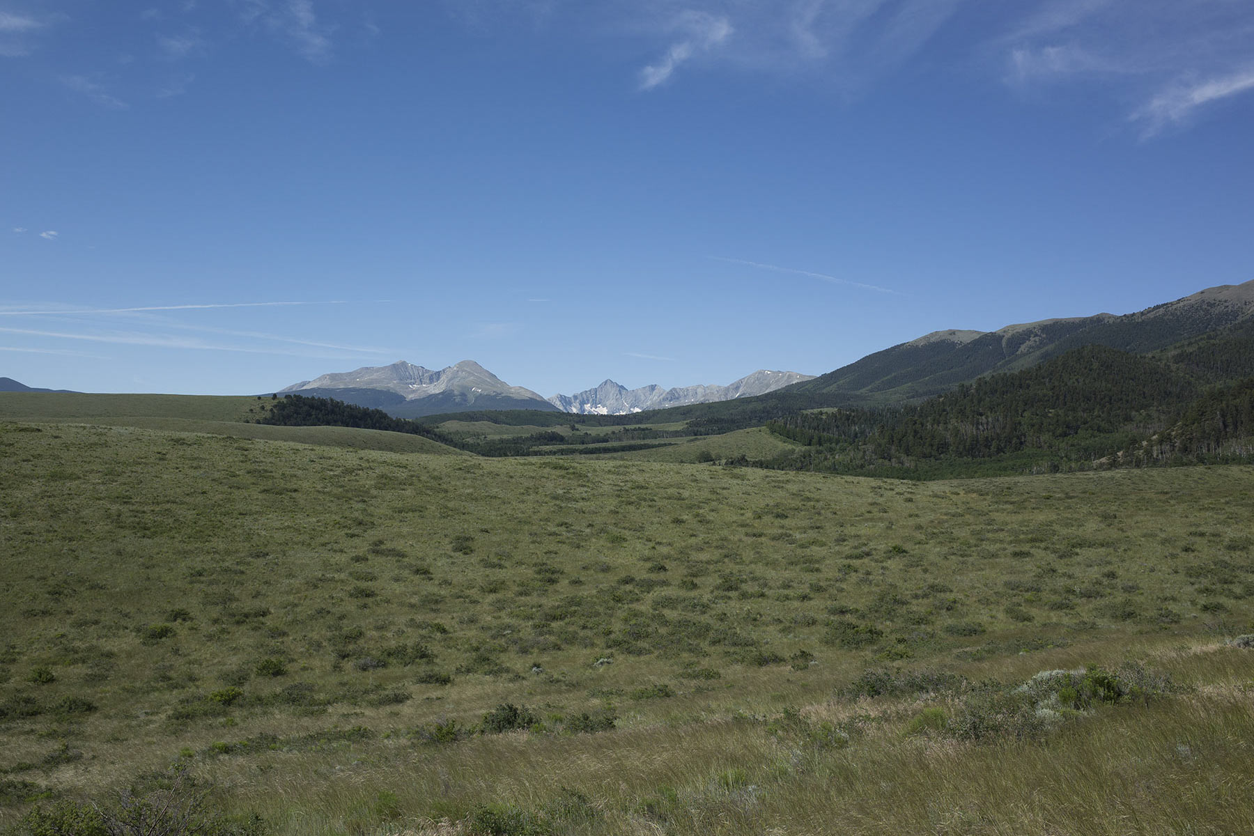
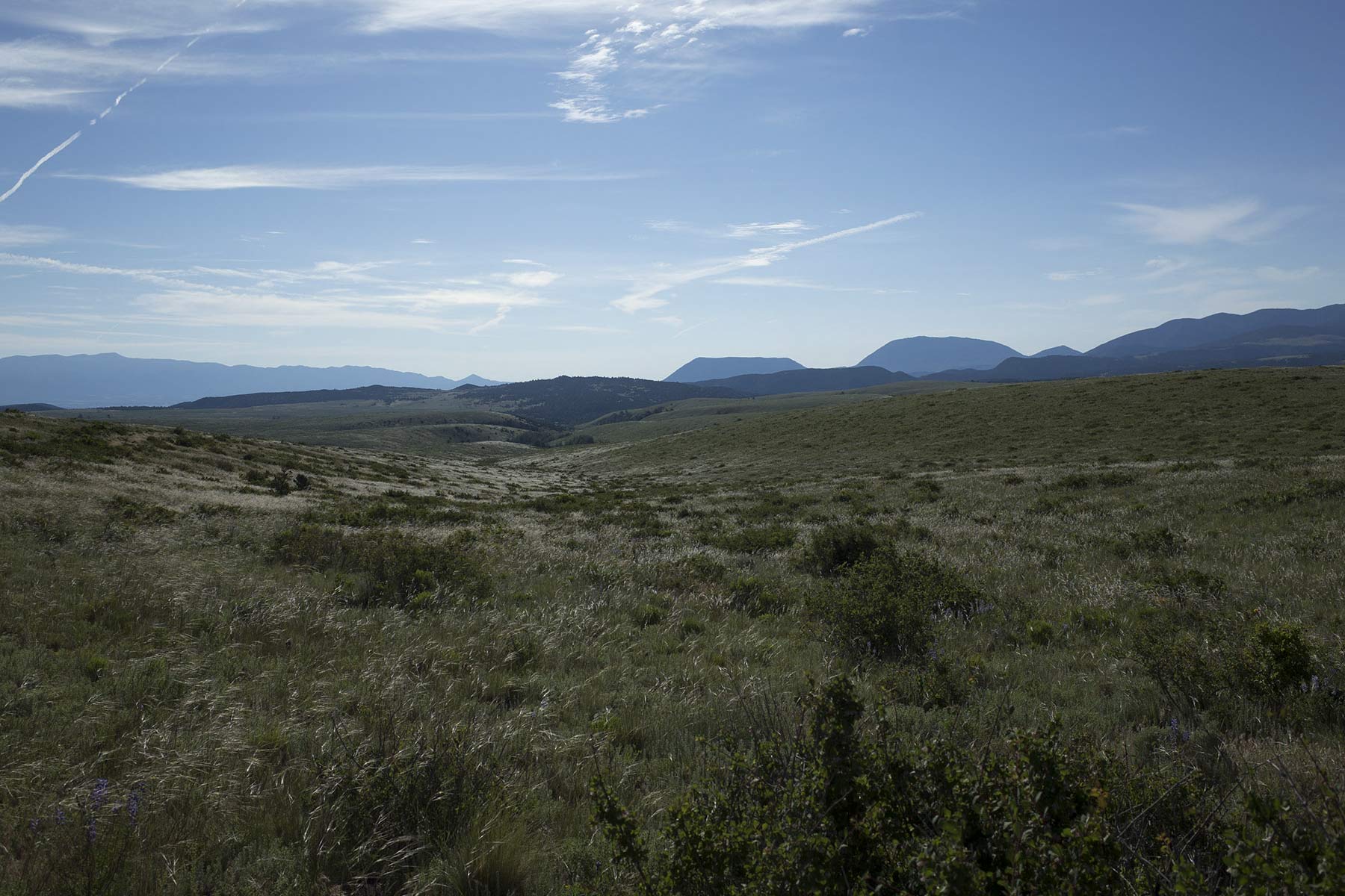
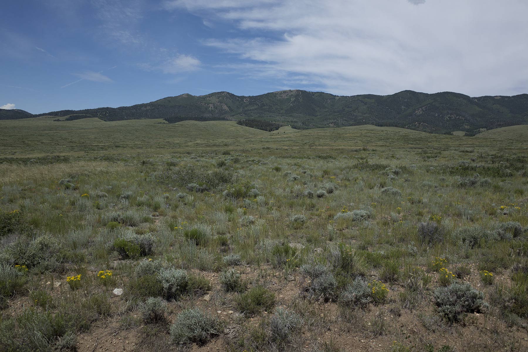
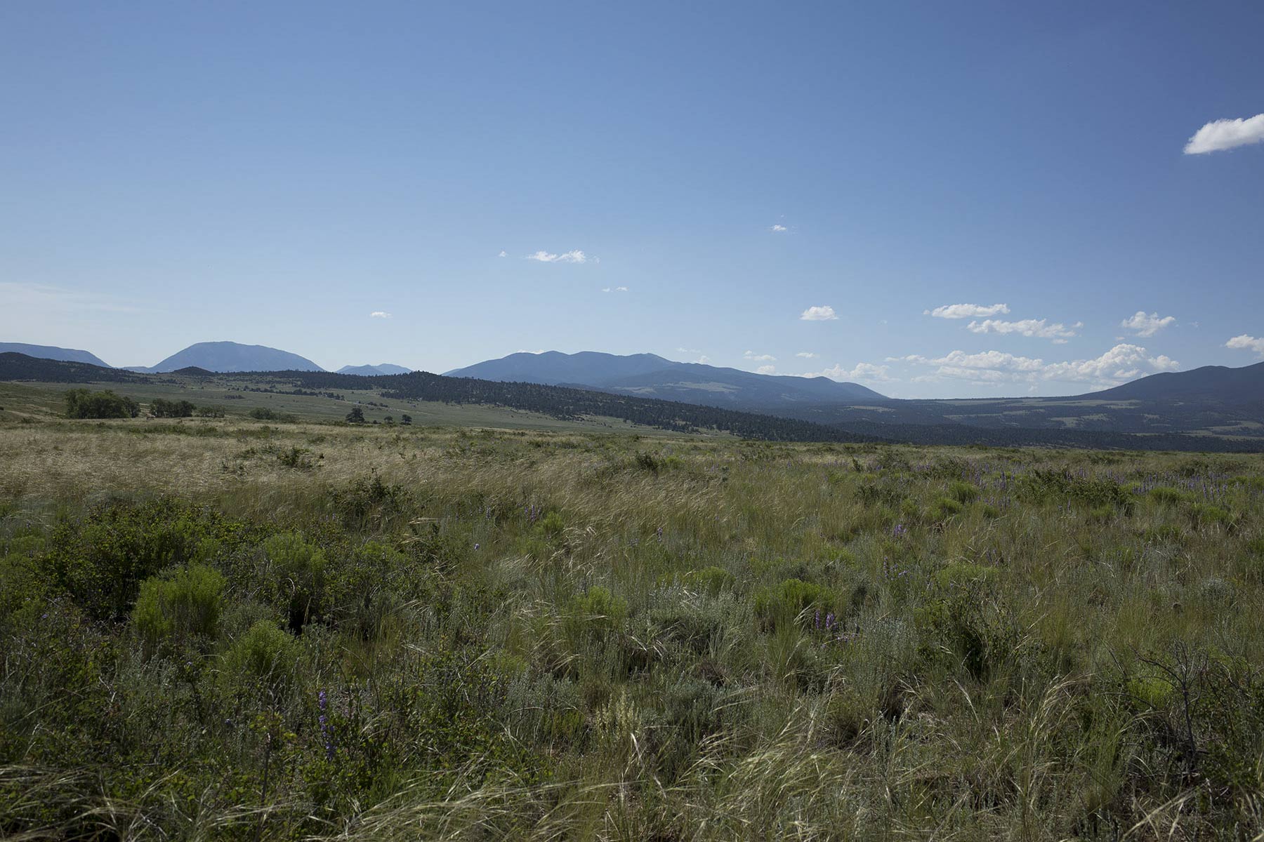
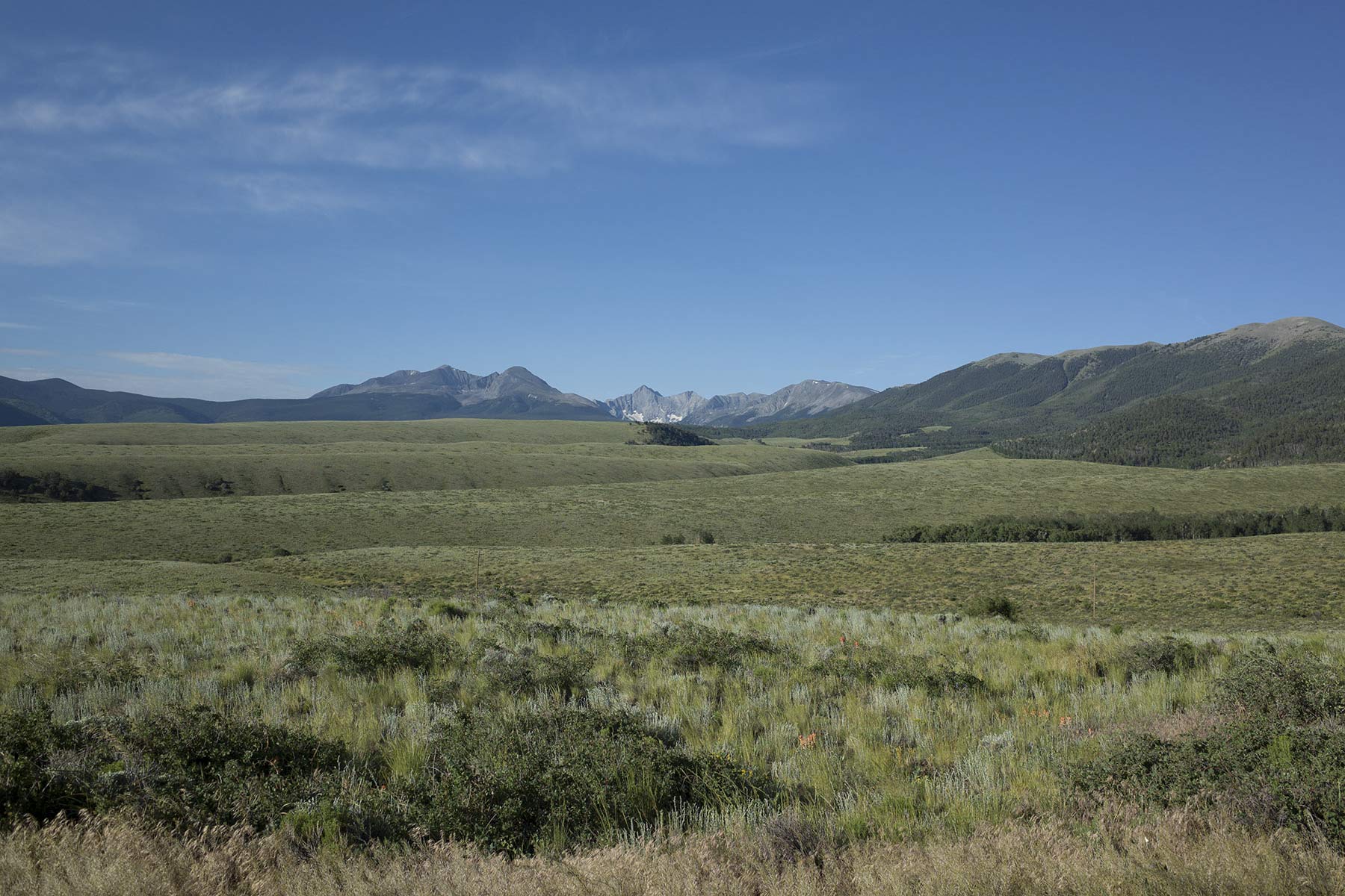
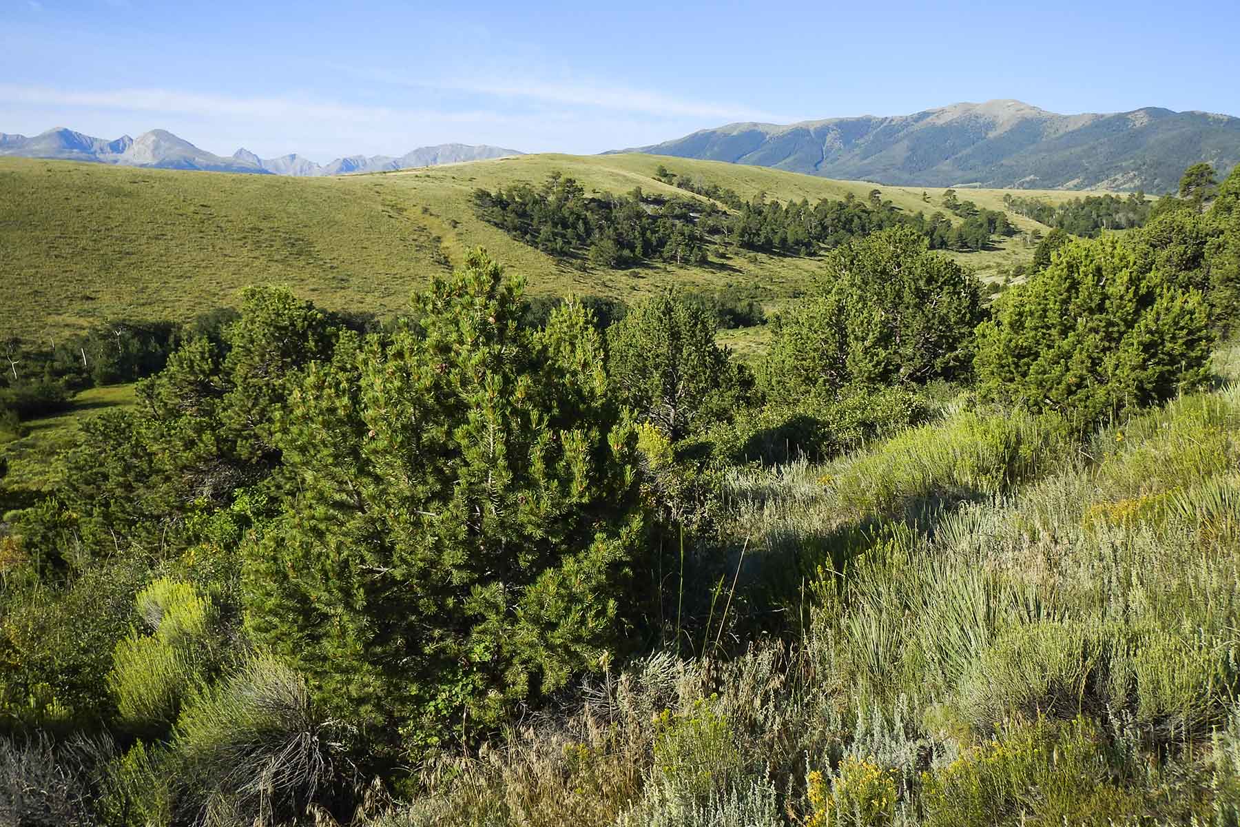
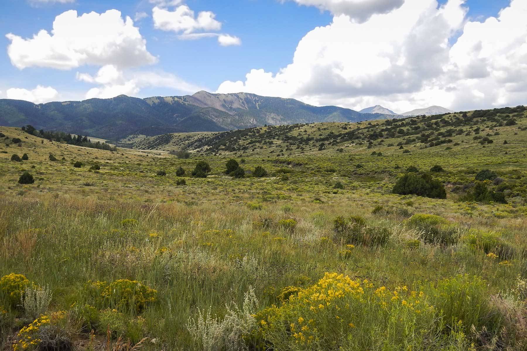
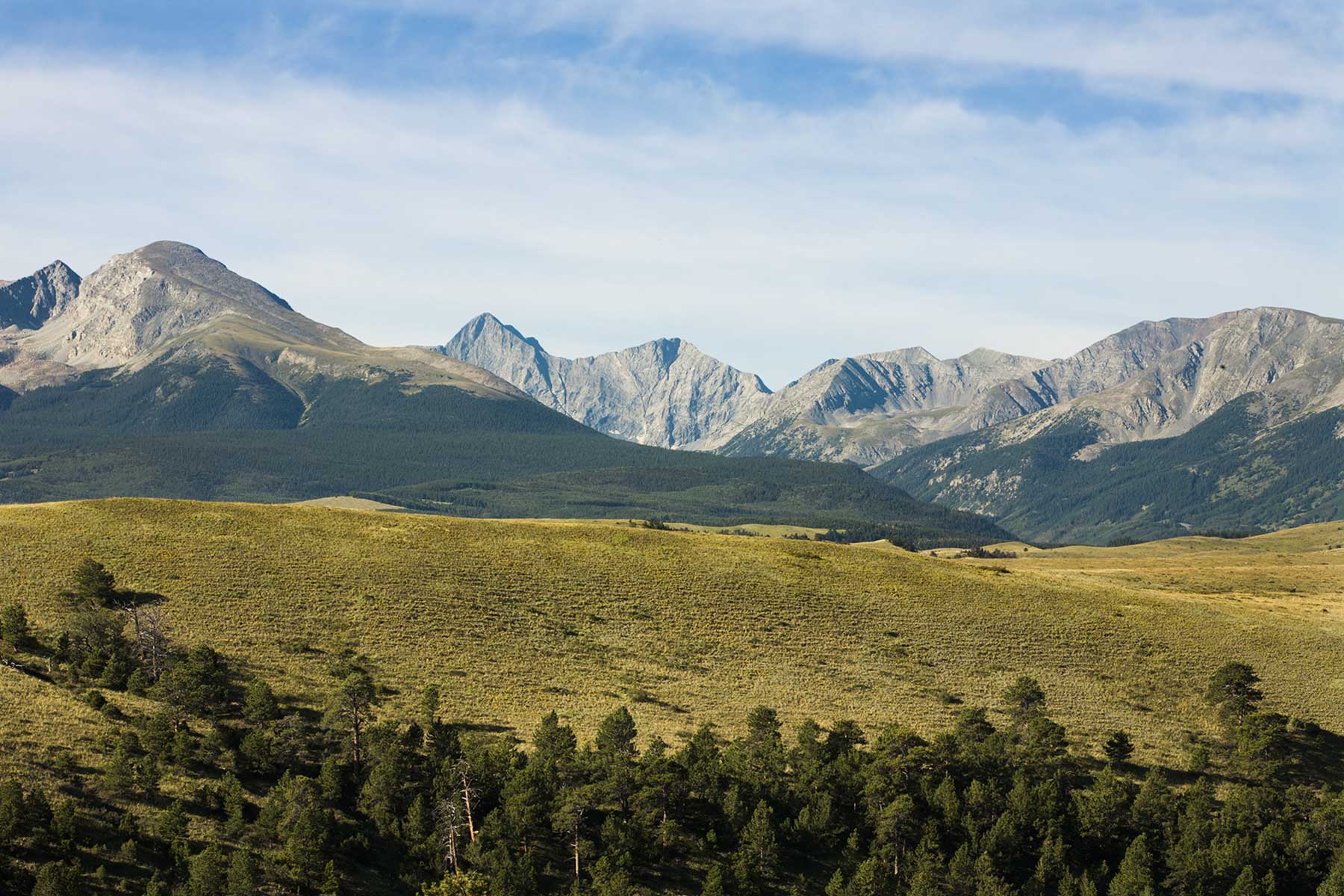
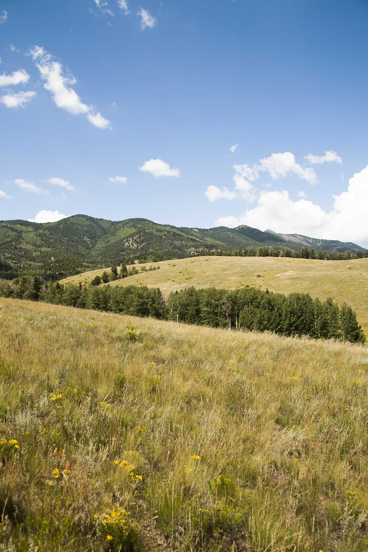
The combination of undulating topography and tremendous views of the jagged peaks of the Blanca Peak massif, Sheep Mountains, Sangre de Christo Range and Wet Mountains give the Mosca Pass Ranch its expansive character. Indeed, one can sit amongst the wildflowers and native grasses from nearly any point on the ranch and gaze out upon the many surrounding peaks and mountain ranges.
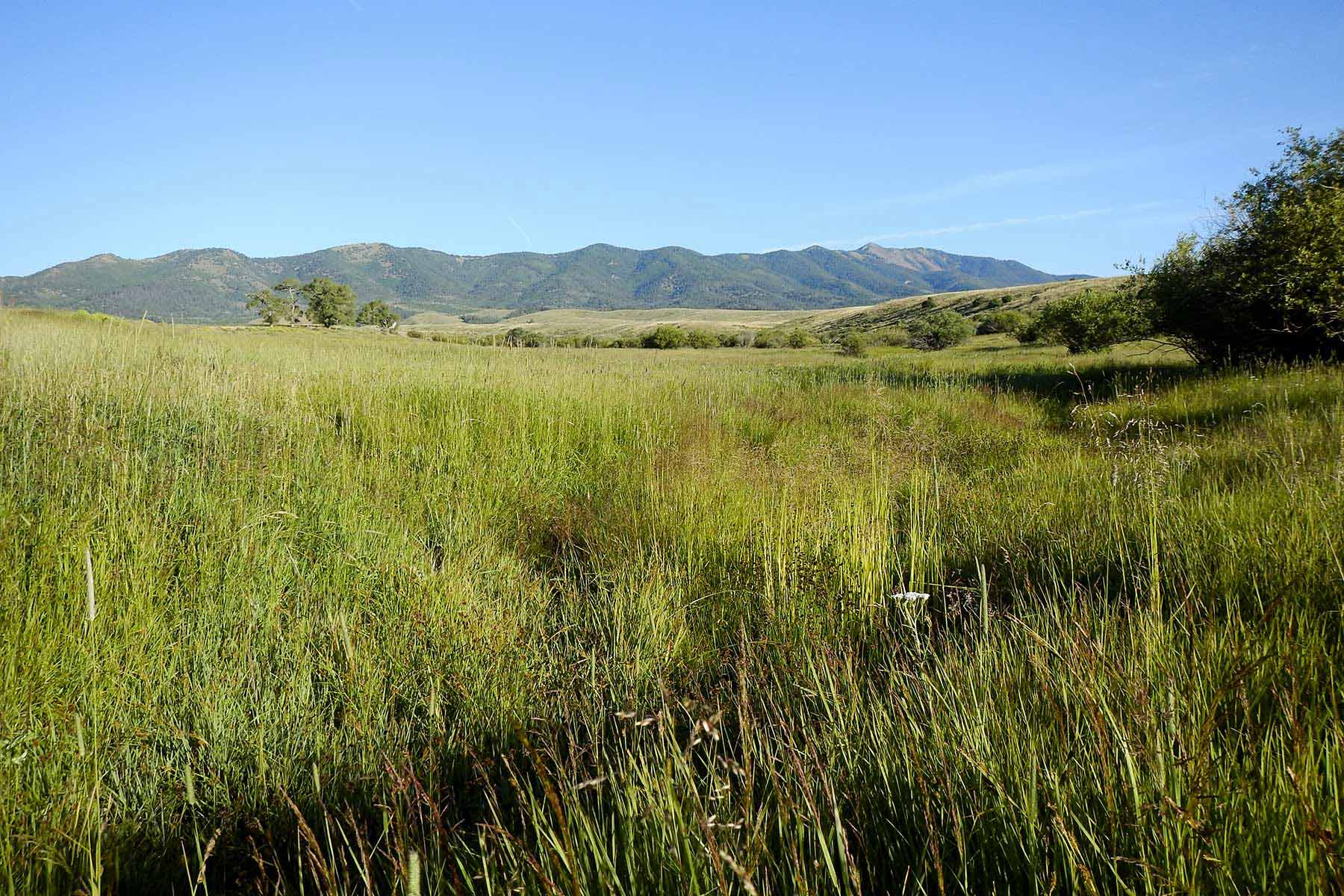
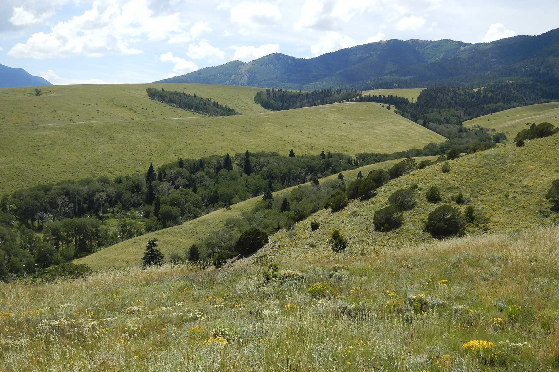
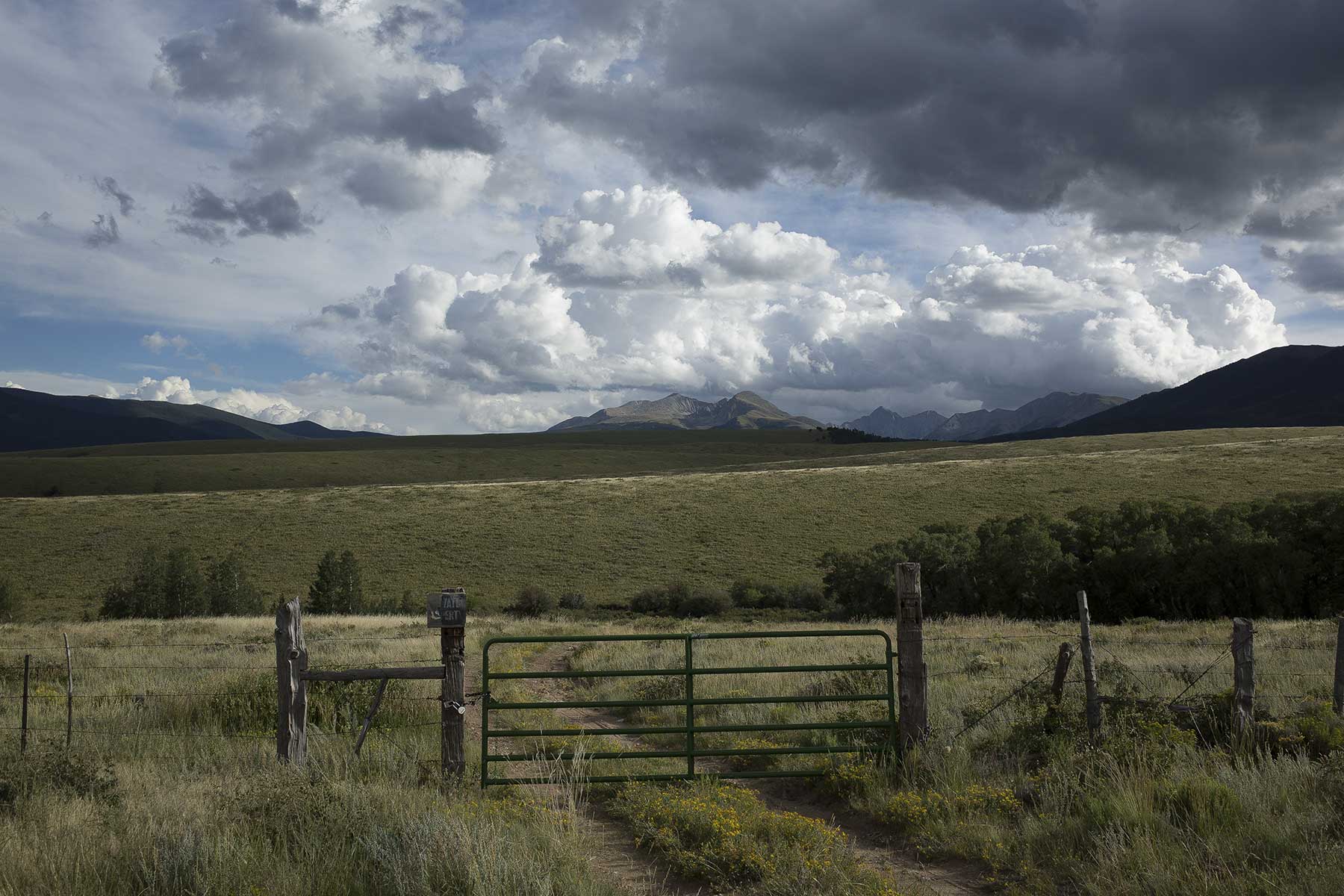
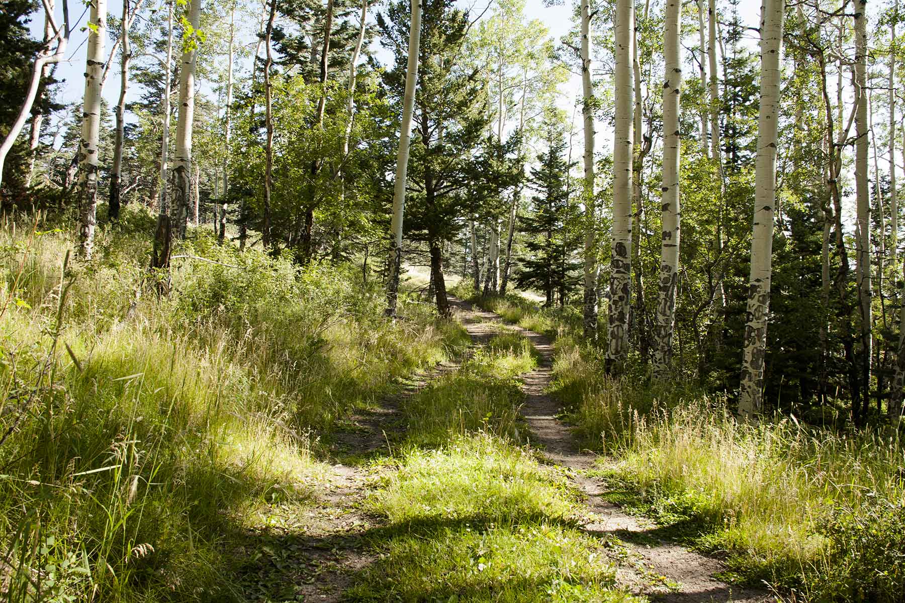
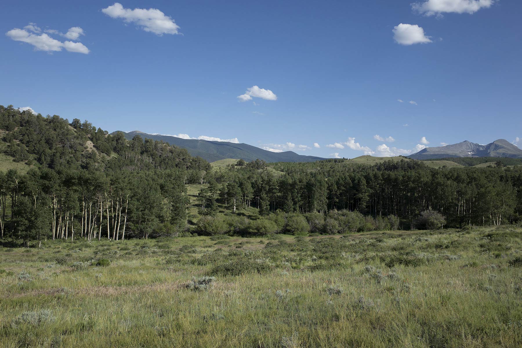
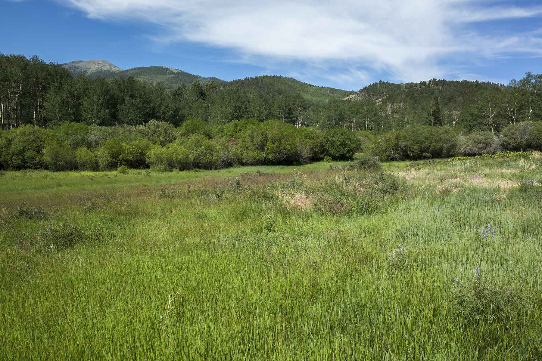
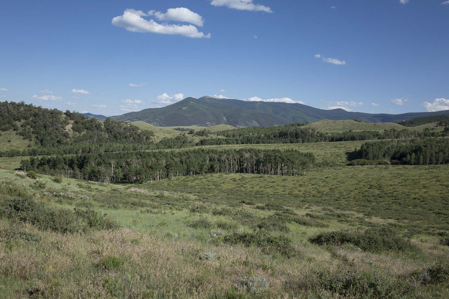
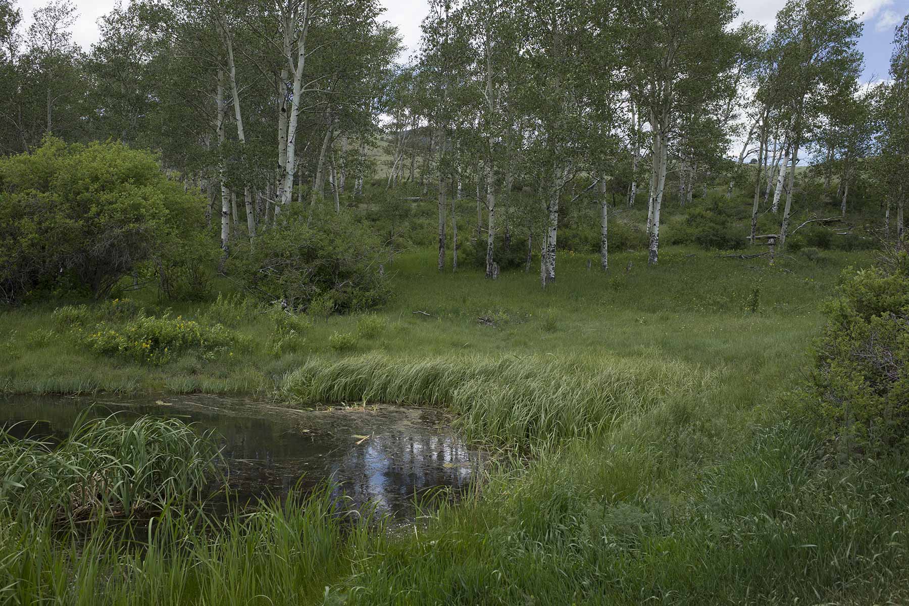
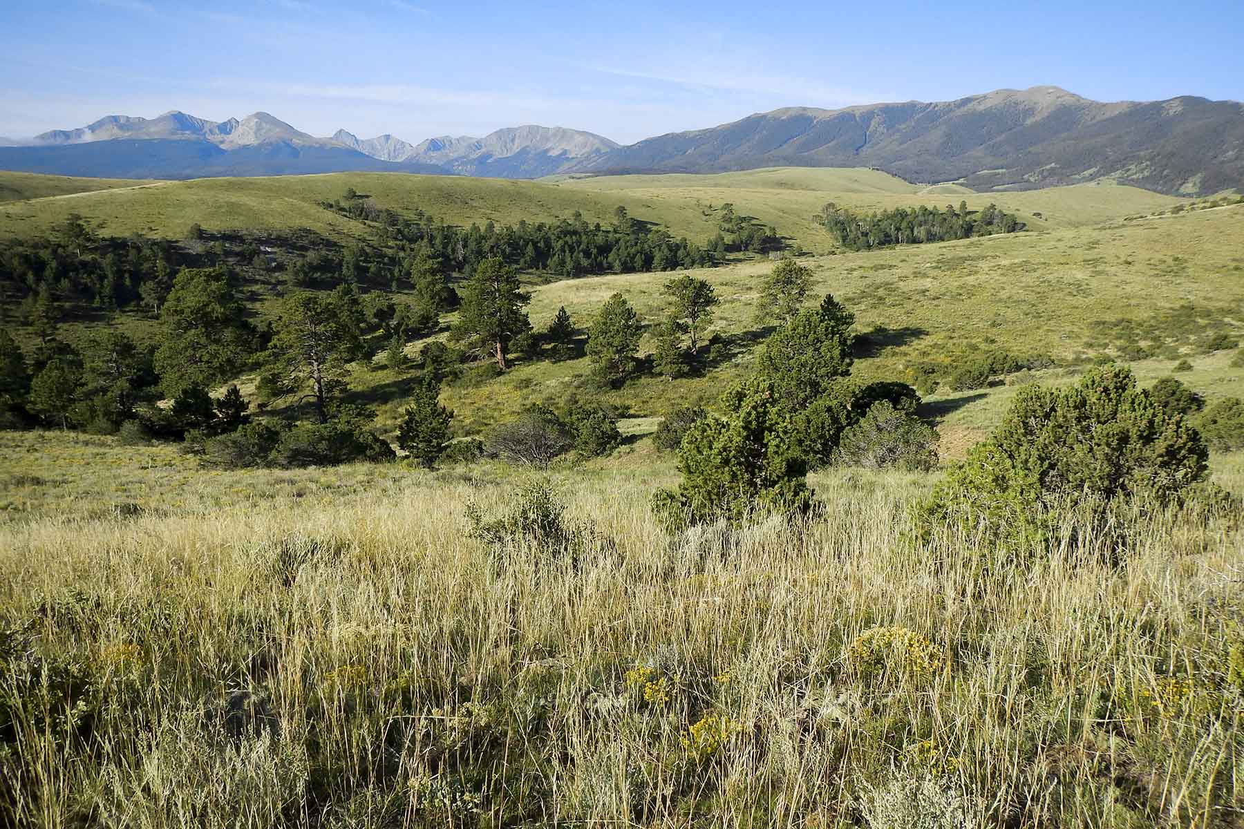
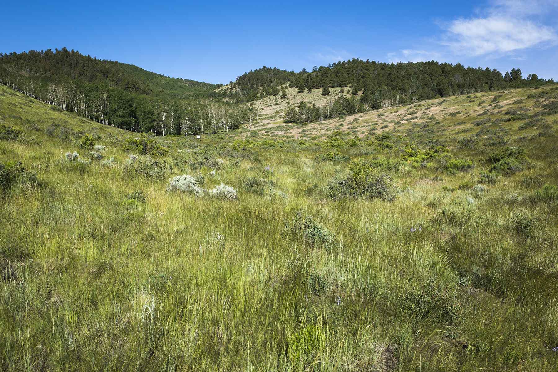
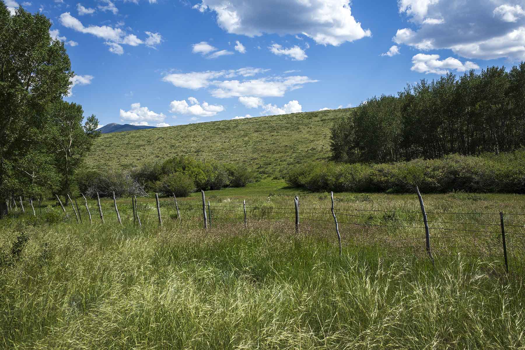
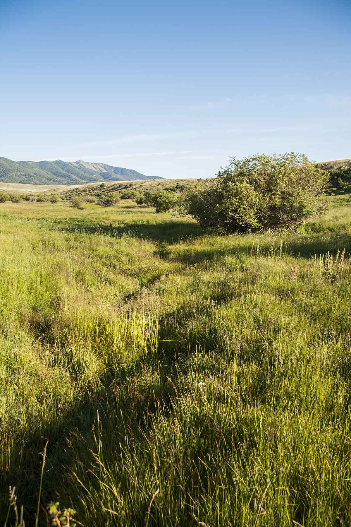
The Mosca Pass Ranch name is derived from the historic Mosca Pass Trail, the trailhead which is located on a ridge one-half mile to the west of the property. Sited along the base of the eastern slope of the Sangre De Christo Range, the ranch is bound by national forest and smaller landholdings to the west and by large ranches to the north, south and east. The balance of the ranch is rolling upland pasture with large aspen and pine-lined draws that run west to east. A number of these draws serve as drainages for small creeks, all of which are fed by mountain runoff and a number of springs.
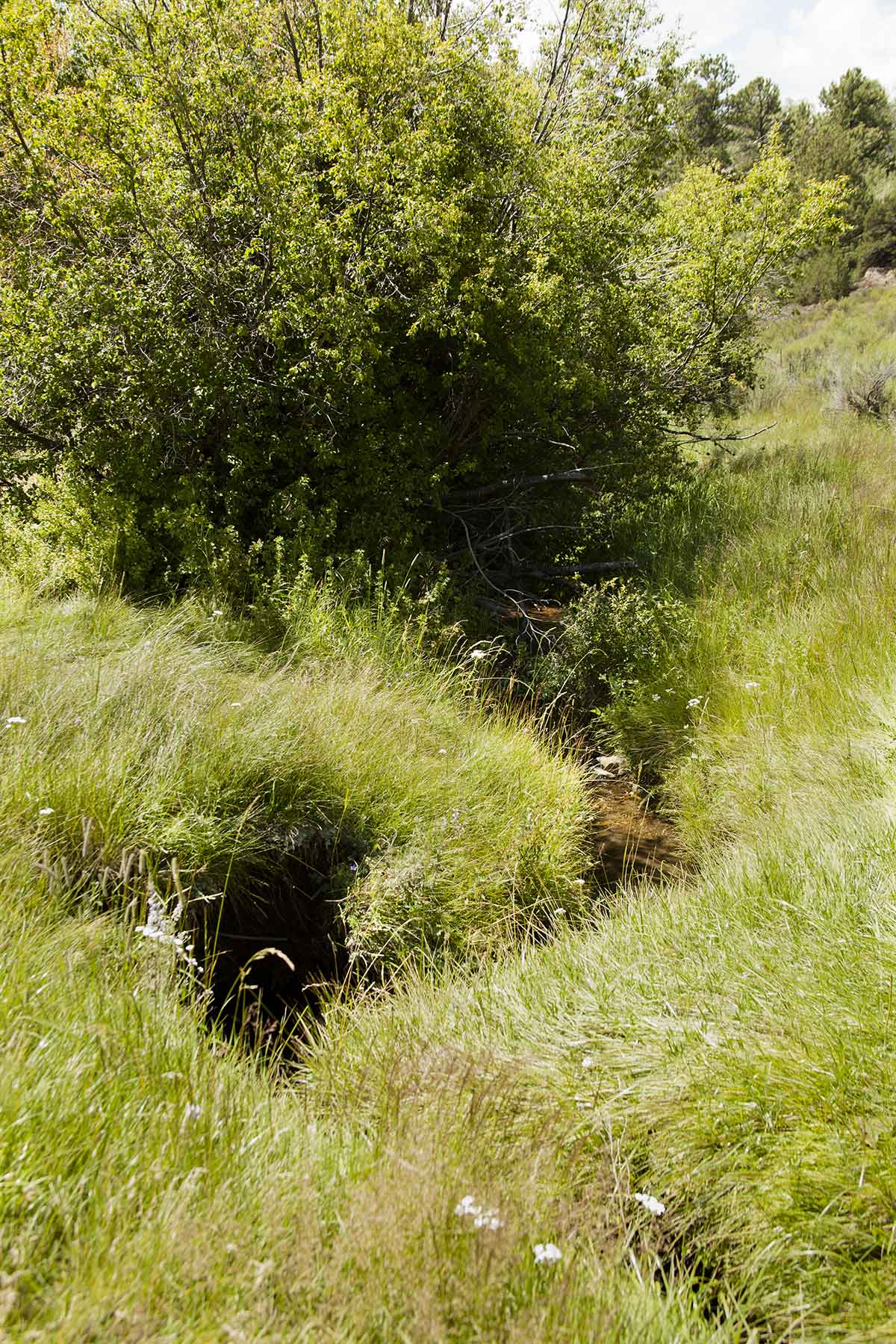
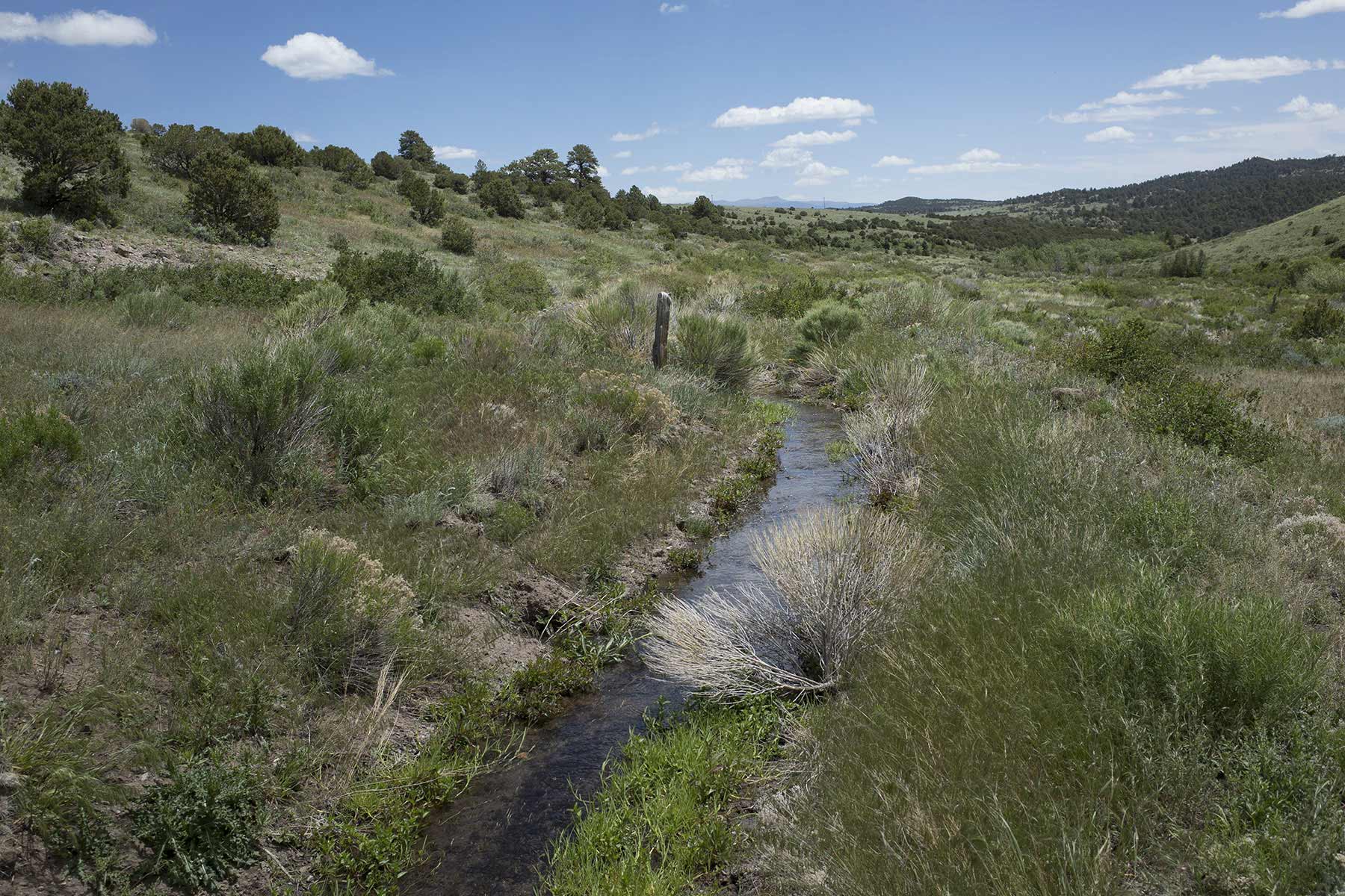
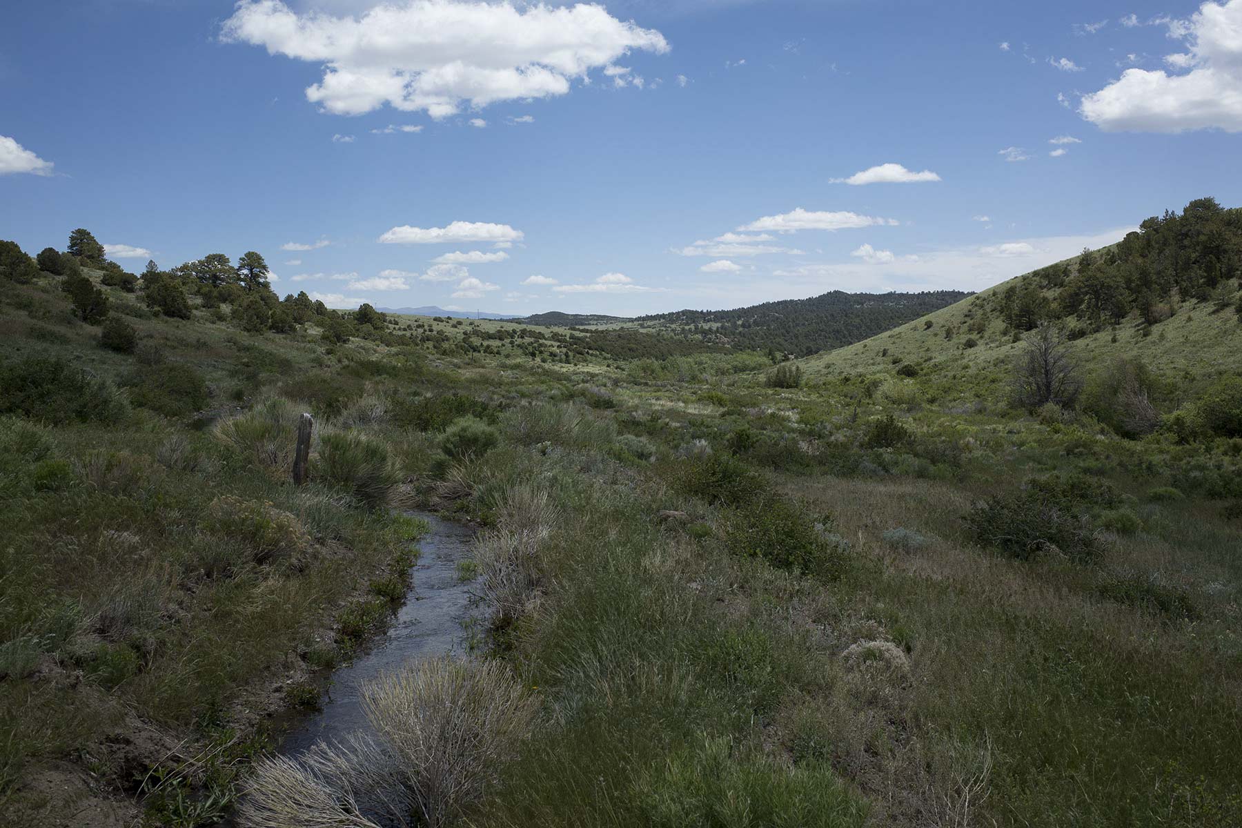
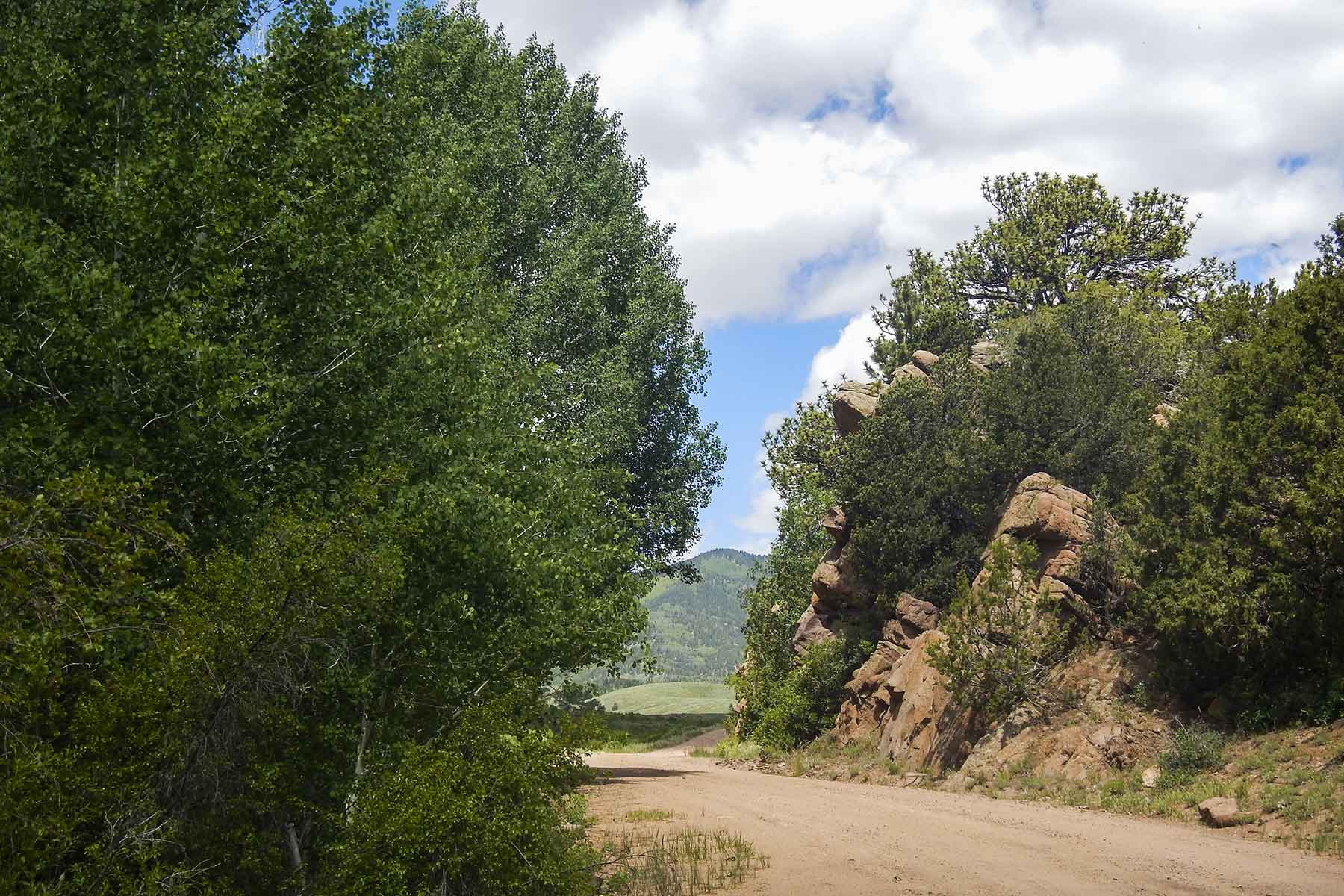
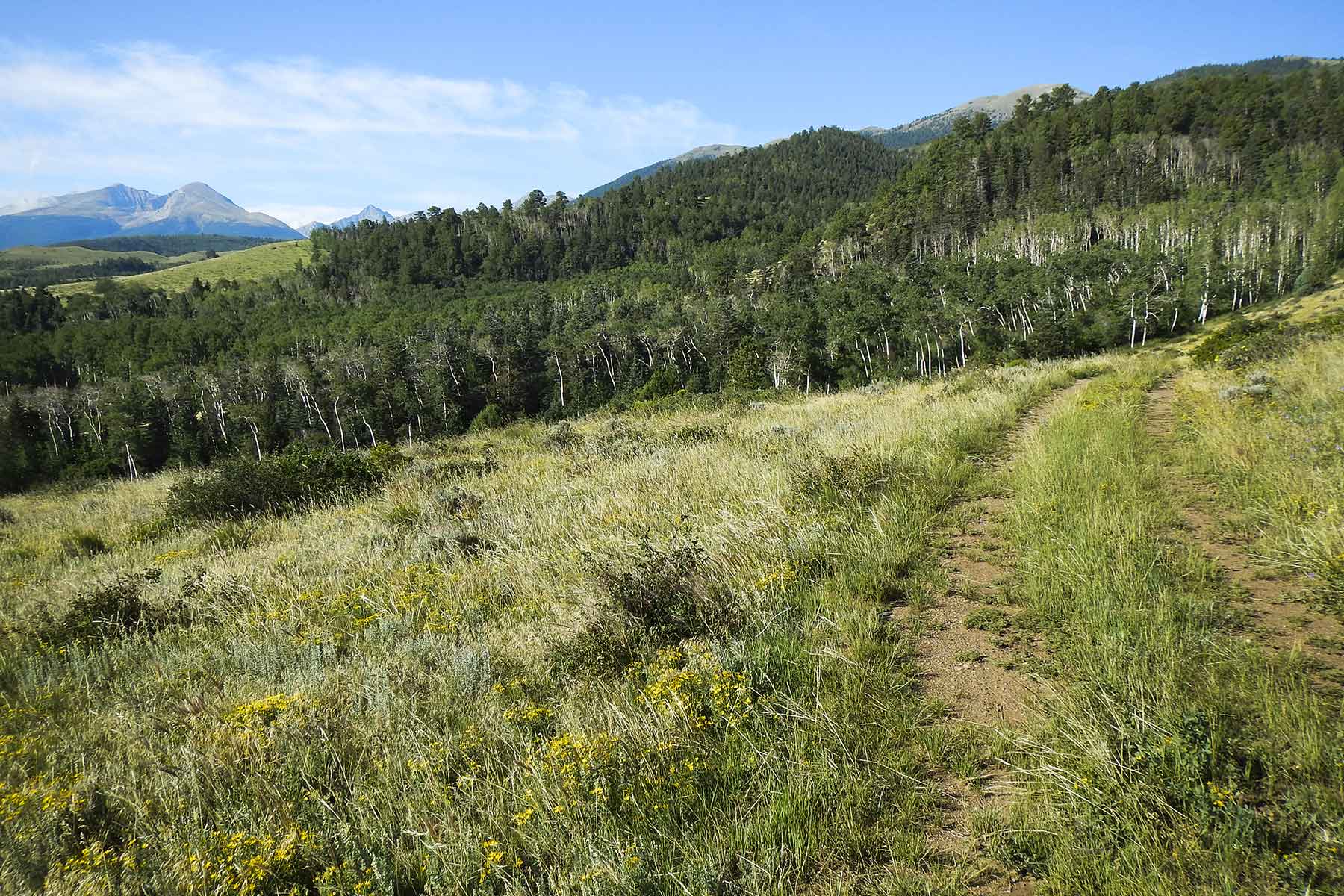
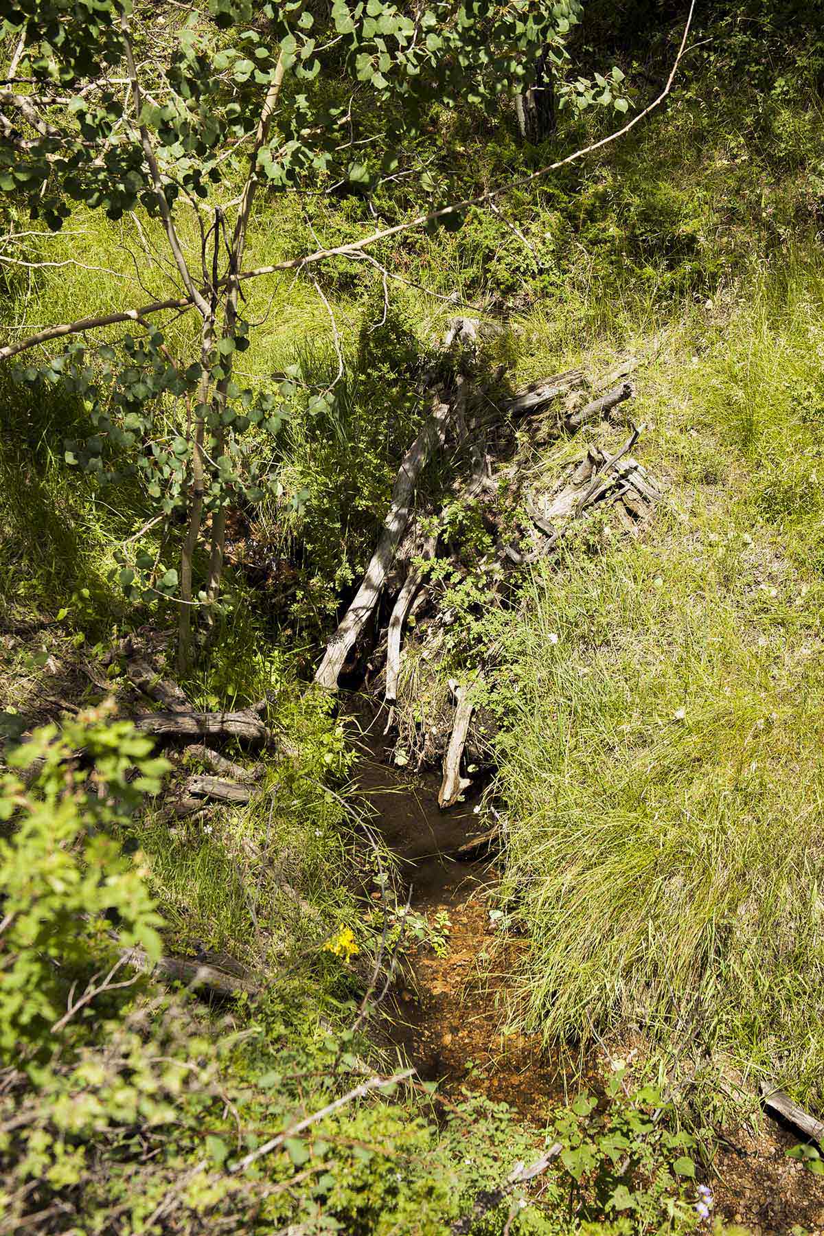
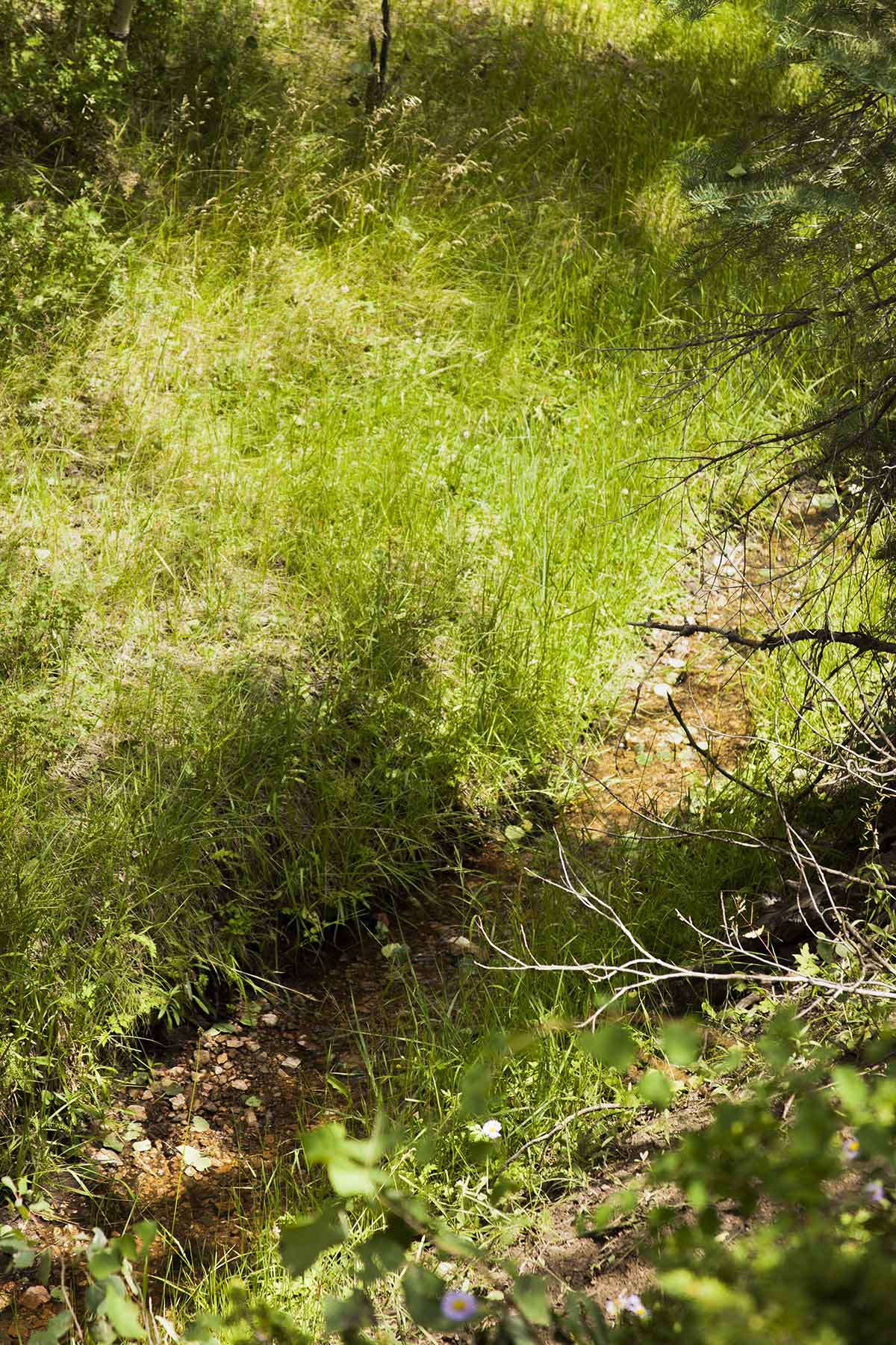
Access to the ranch is via the Mosca Pass Trail, also known as County Road 581, which enters the property from the southeast through May Creek Canyon. Following the road north through the canyon, elevation rises gradually from 8,530 to 8,800 feet before breaking out into open grasslands. The canyon portion of the ranch is defined by towering ponderosa pines, jagged cliff walls, and the lush May Creek riparian corridor. The head of May Creek is located at the confluence of North May Creek and South May Creek, which sits near the top of May Creek Canyon. Following a gentle gradient and paralleling the road, May Creek winds through deep stands of willows and ponderosa pines as it flows through the canyon.
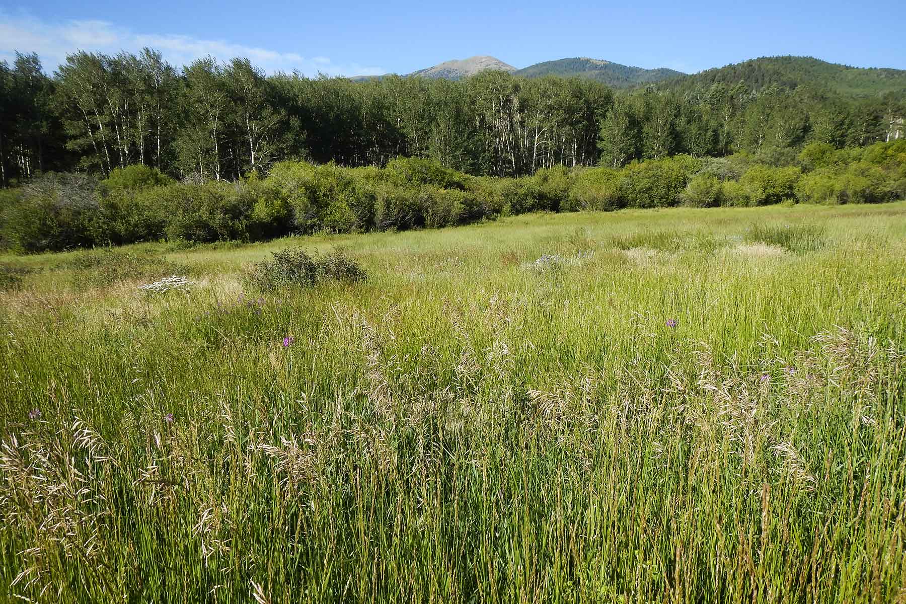
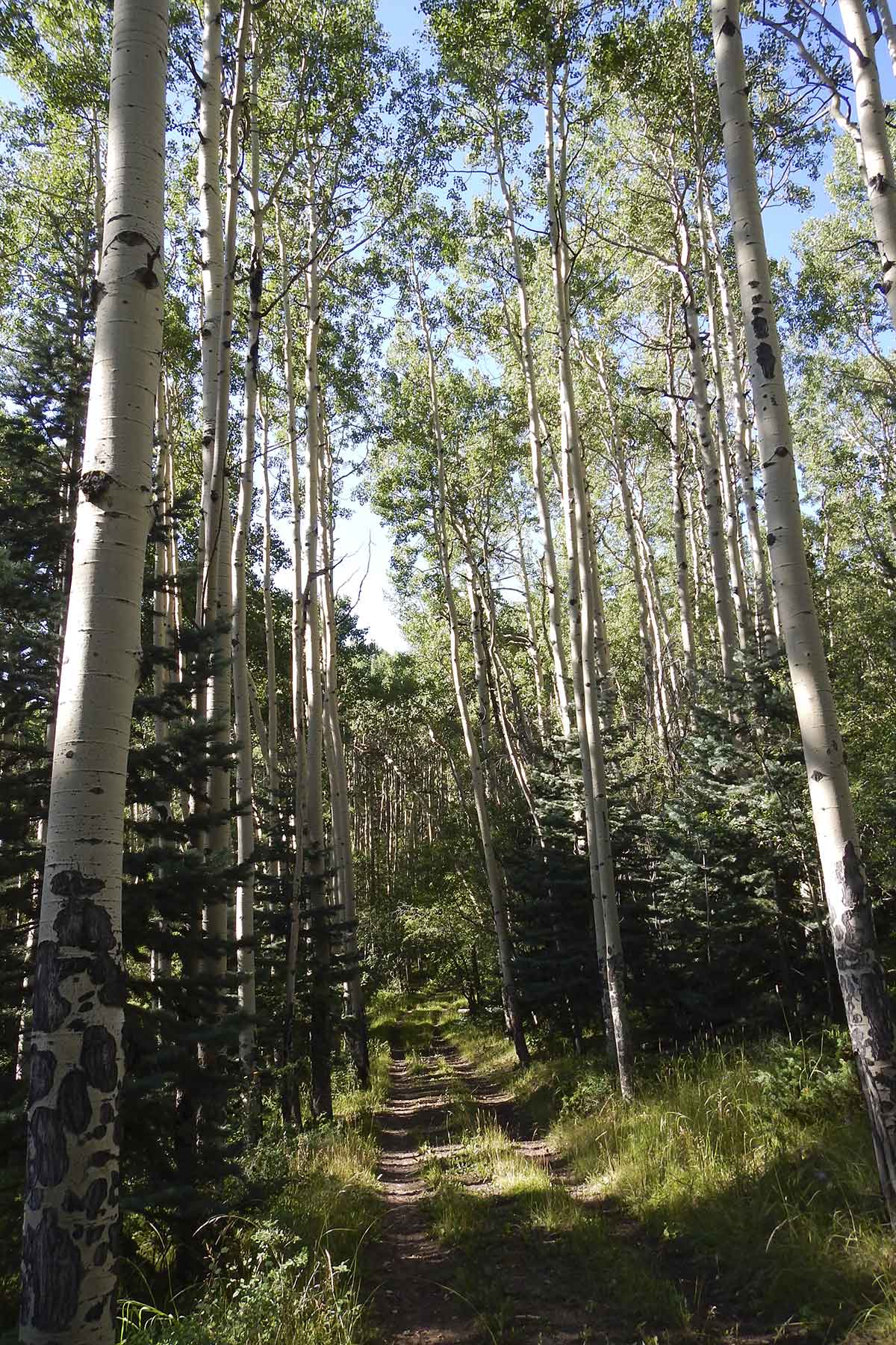
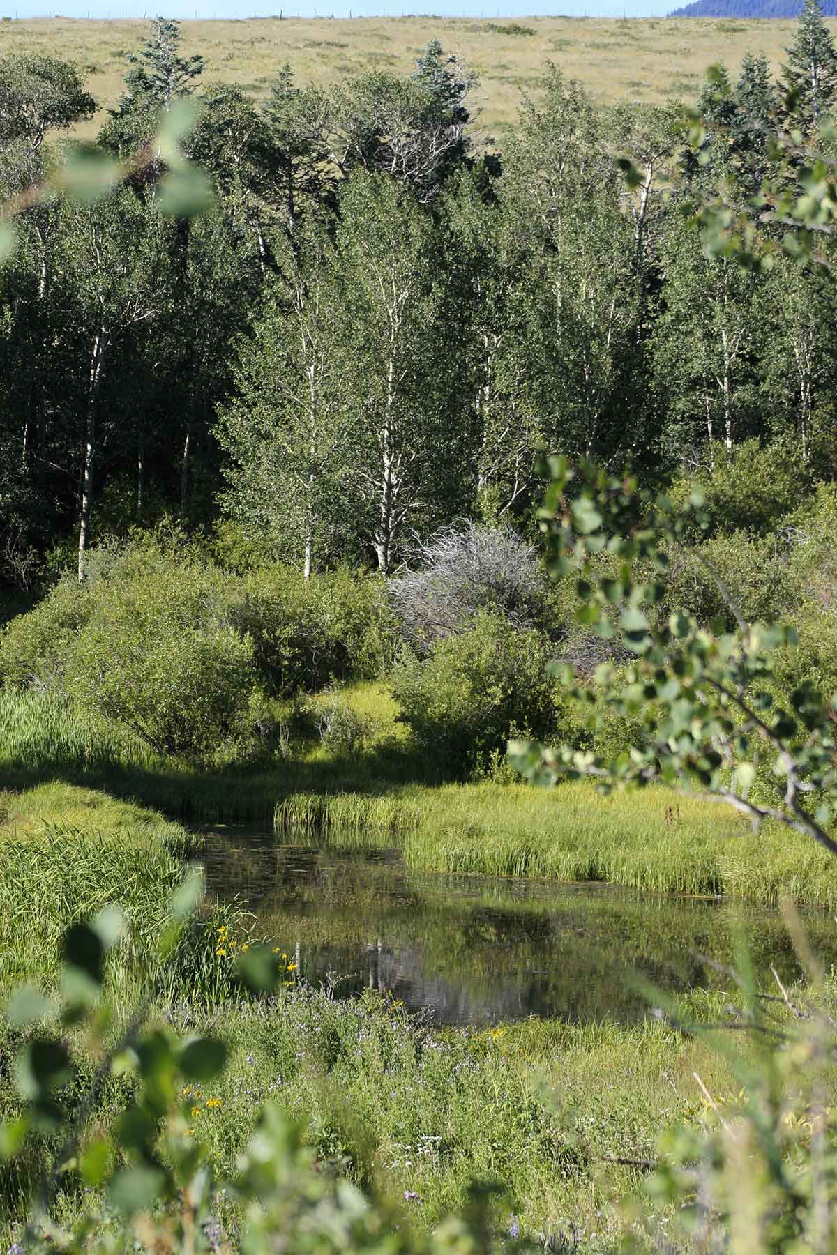
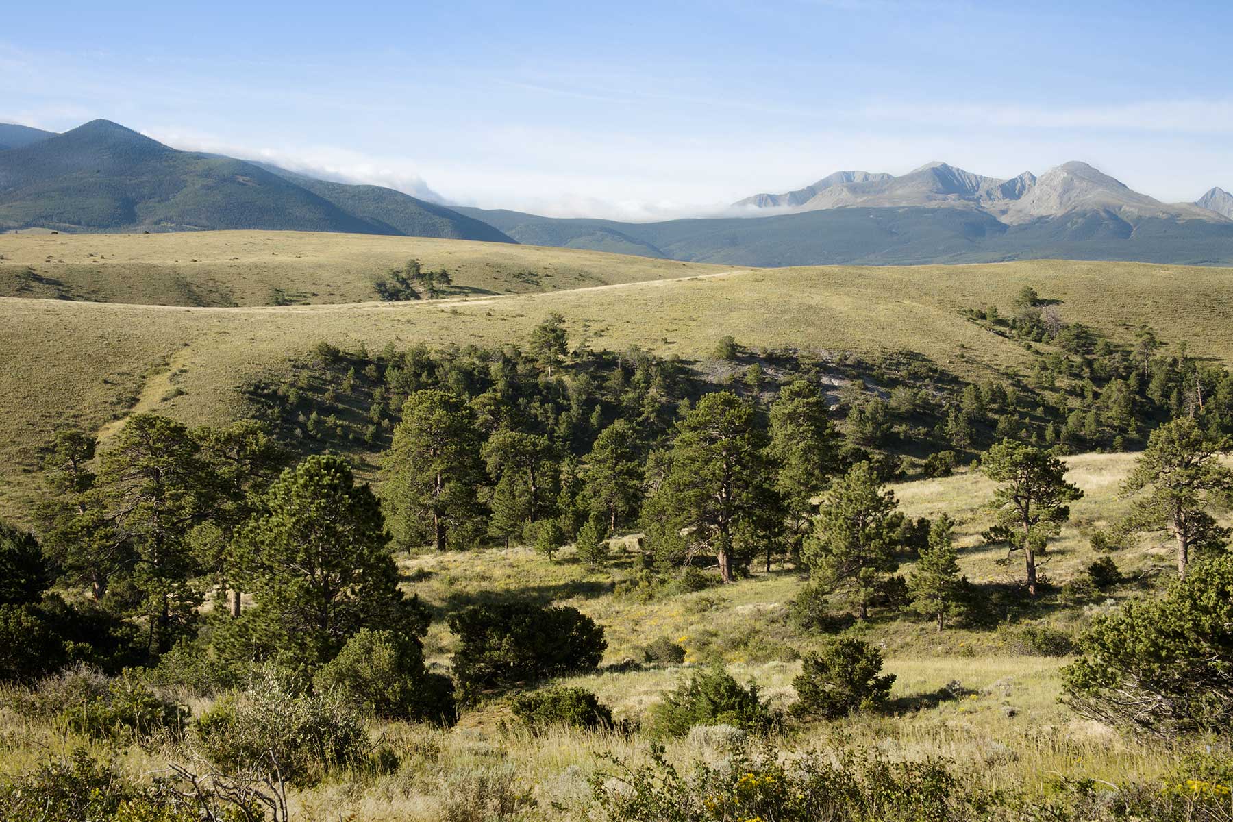
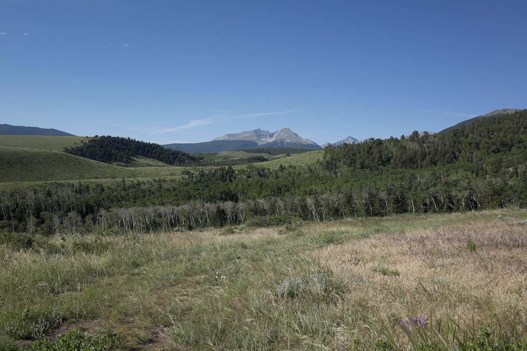
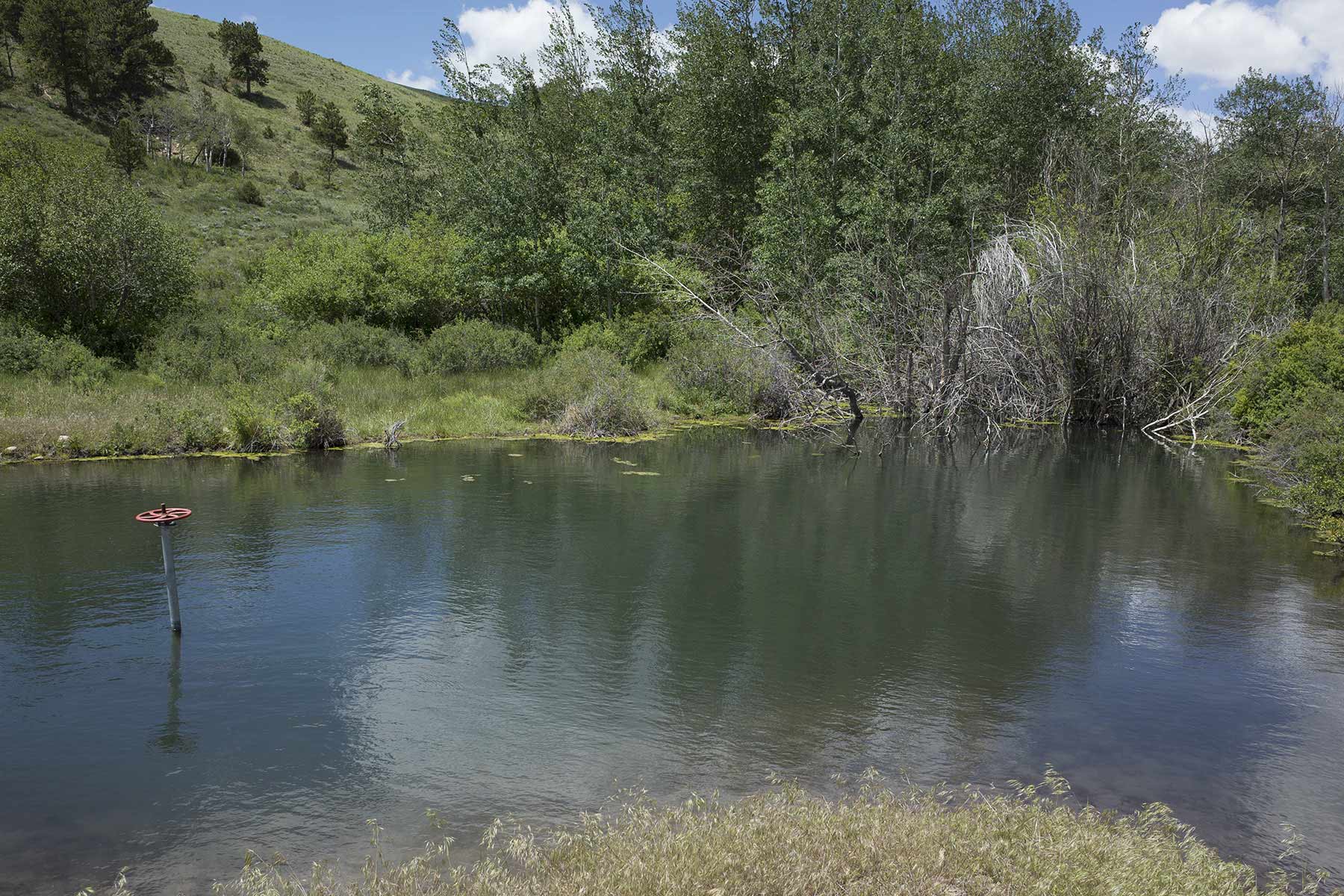
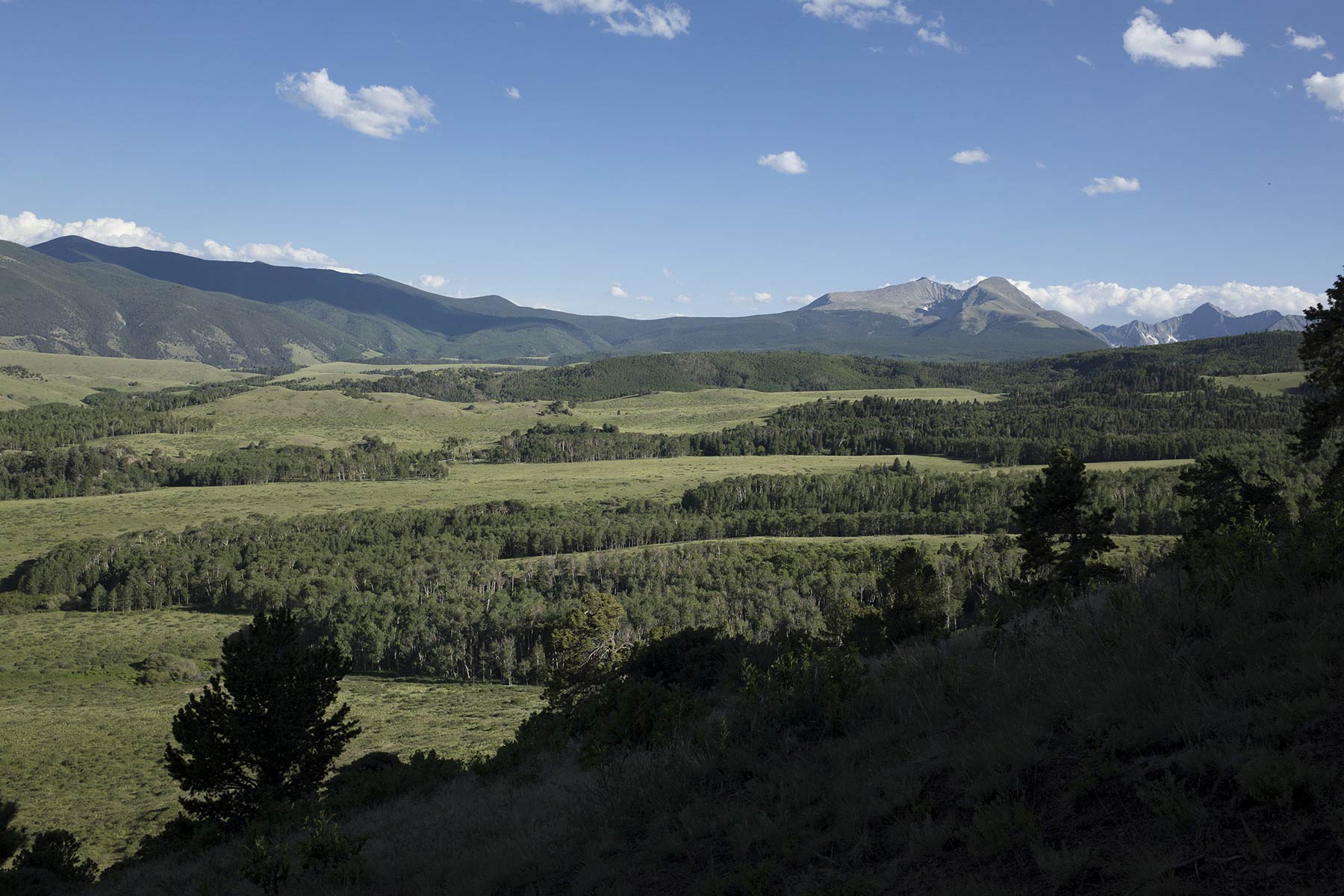
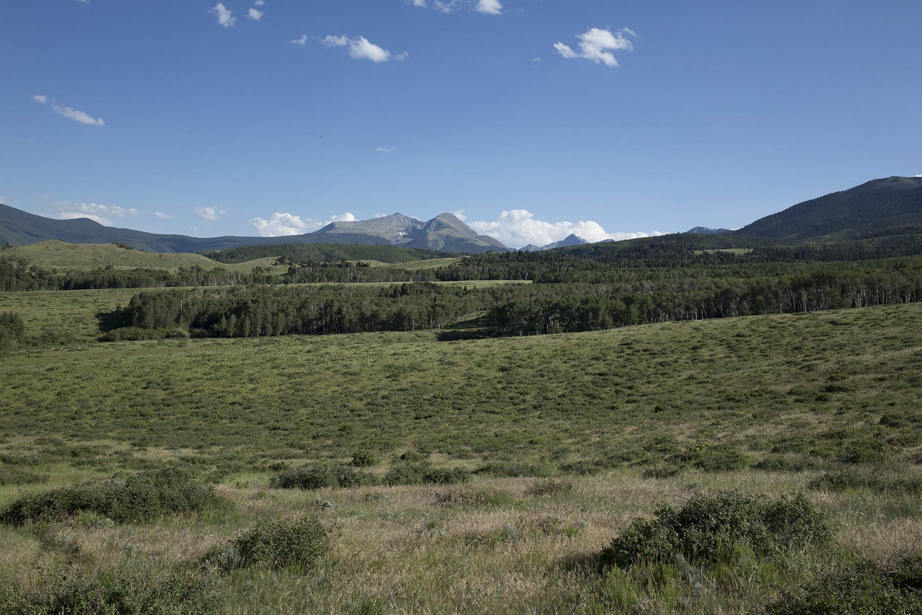
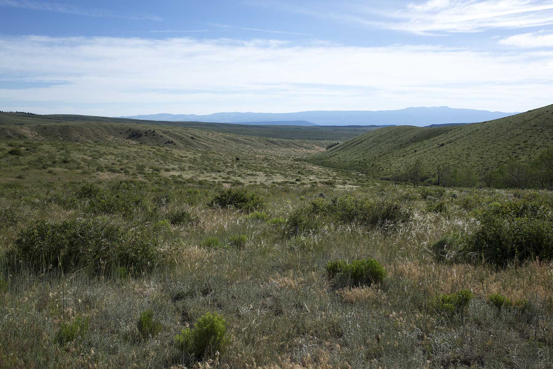
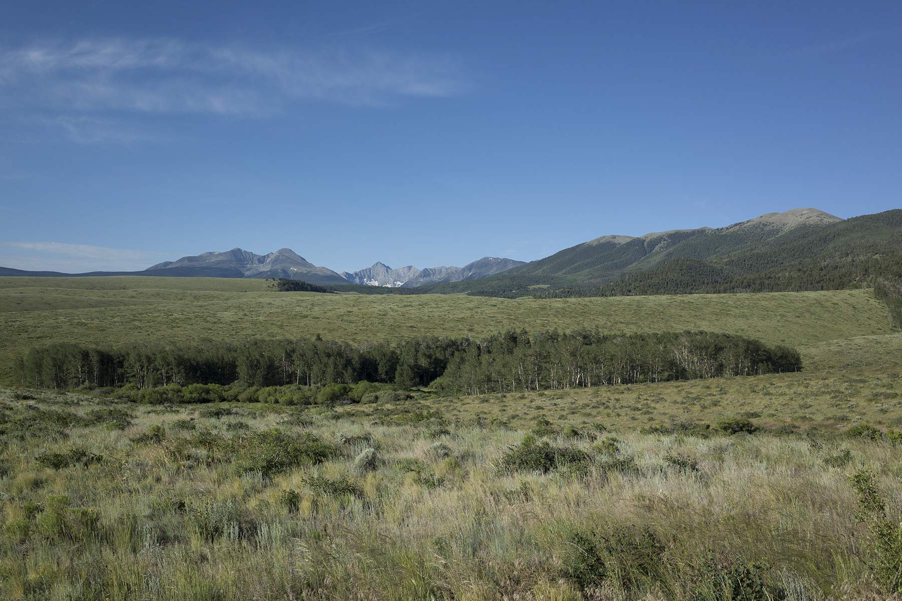
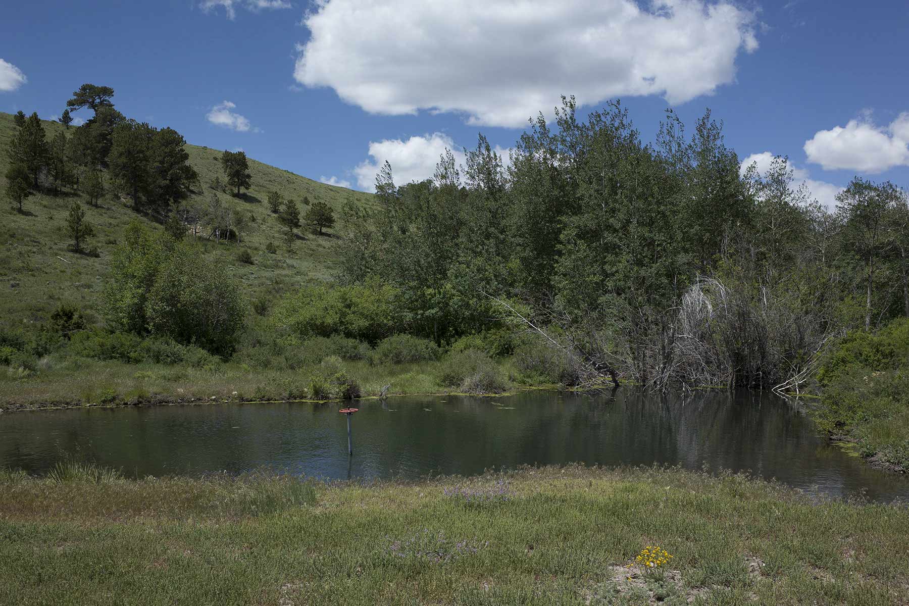
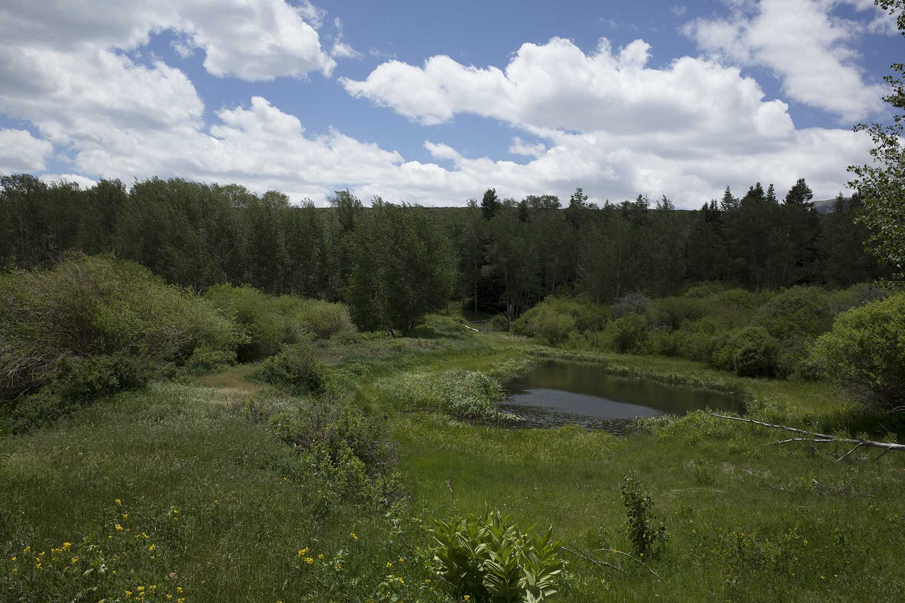
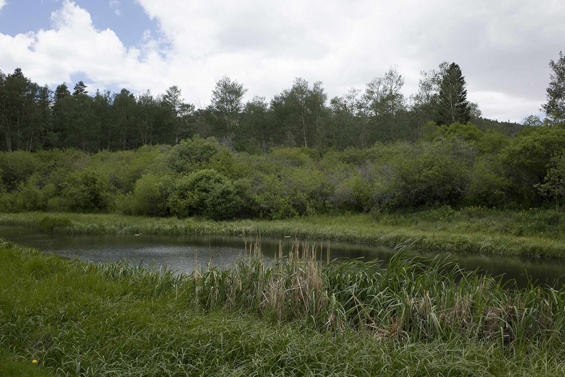
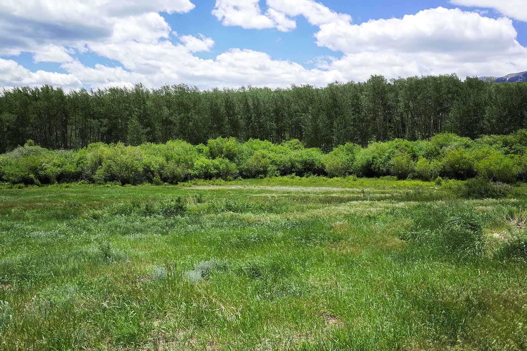
Aspen Creek and Potato Creek merge to the west of May Creek Canyon before joining May Creek near the midway point of the canyon. May Creek continues south beyond this confluence and through the canyon before meeting with the Huerfano River less than a mile from the property. At an elevation of 8,530 feet, the canyon is the lowest point on the ranch. The lands above the canyon rims are more arid and forested with old growth pinon pine and Ponderosas. This terrain gains elevation to the west, forking into two large valleys that parallel each other as they run east to west. The slopes of these valleys are interspersed with stands of aspen and pines, and the bottoms are lined with the lush grass and willows of Aspen and Potato creeks. Fed by numerous springs, these creeks originate amongst the large aspen and pine groves dominating the southwestern corner of the ranch. The riparian zones surrounding Aspen and Potato creeks are lush and the ponds along Potato Creek harbor a self-sustaining population of brown trout. Elevations here vary from 9,000 feet at the bottom of the drainages to heights of 9,400 feet along the mountain slopes of the San Isabel National Forest. At its southwestern-most corner the ranch jogs to the west, running nearly one mile up Sheep Ridge and reaching an elevation of close to 10,000 feet. Here, the ranch is comprised of large aspen and pine forests interspersed with meadows, and shares two-and-one-half miles of border with national forest. The south and southeastern portions of the ranch are bordered by a large cattle and hunting ranch.
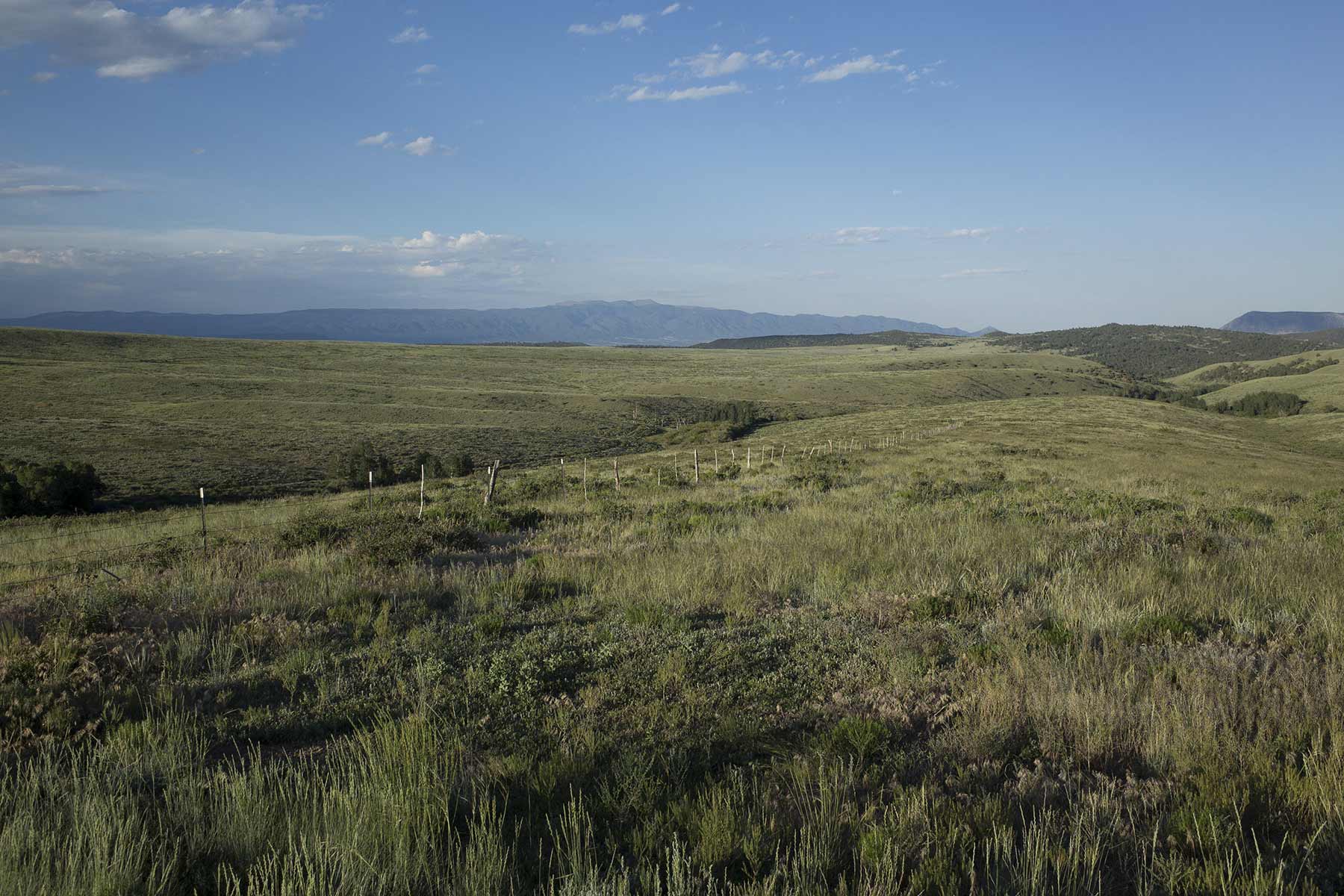
Heading north from the Mosca Pass Trail to the central portion of the property the topography continues as rolling native grasslands interspersed with bowls, open ridges and large drainages ranging in elevation from 8,900 to 9,200 feet. The undulating geography, high protein grasses and sage are favored by the ranch’s mule deer and pronghorn herds. The ranch is bordered here by small private holdings to the west and a section of leased state land to the east. Mosca Pass Ranch currently controls the agricultural and recreational leases to the state land, thus controlling access. North May Creek and the South May Creek flow through here, running from west to east before dropping southeast to their juncture in the canyon. South May Creek is intermittent in its upper reaches, but provides a good source of water throughout the majority of the summer season. It flows through a broad and well-grassed drainage that is interspersed with stands of old-growth cottonwood trees and lined with tall grasses and willows. North May Creek is a perennial stream that flows through a timbered draw and into the grasslands and state leased section before emptying into the canyon.
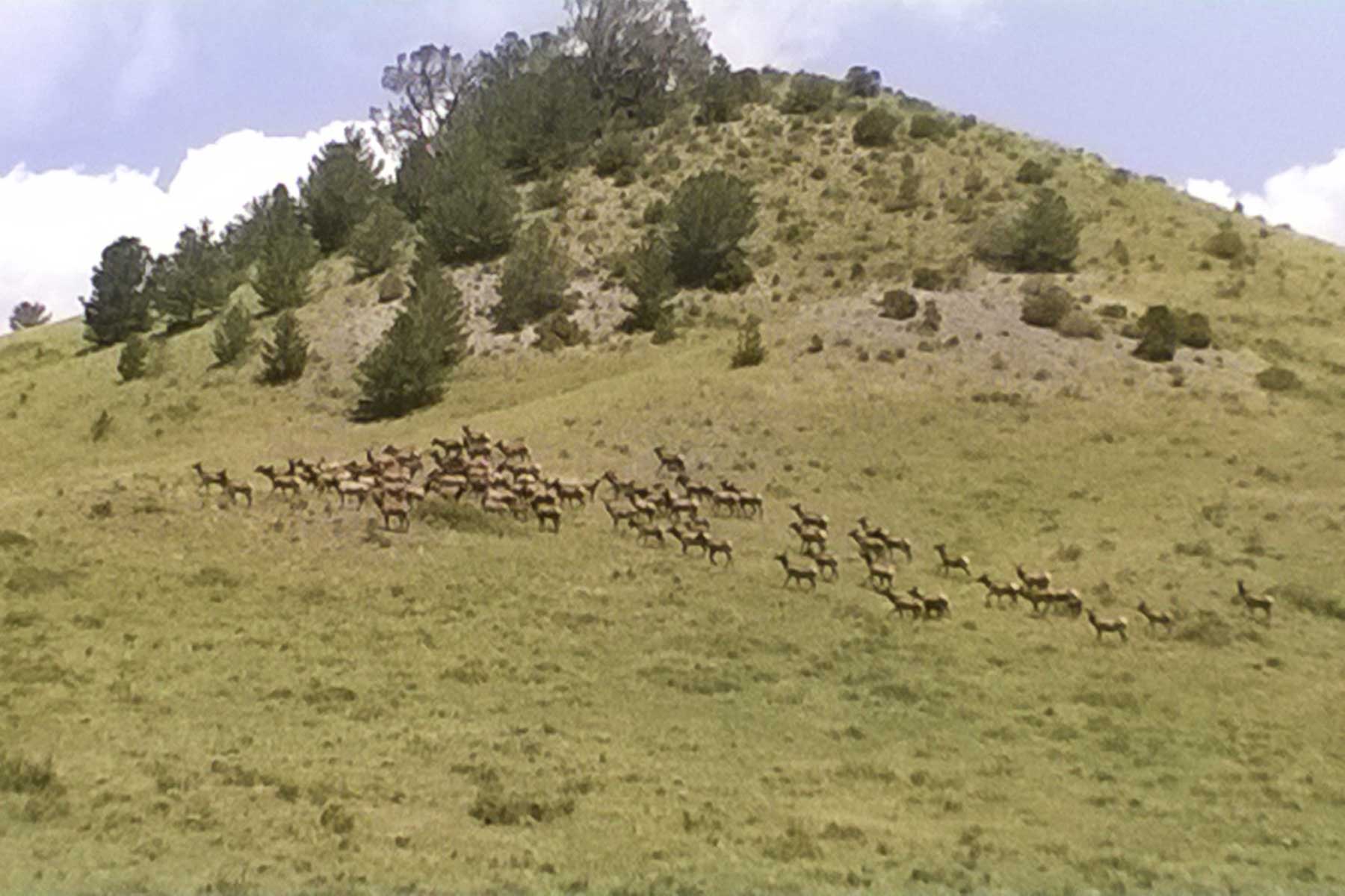
Pantleon Creek flows through a broad valley at the north end of the ranch. The north ridge of this valley runs east to west at an elevation of 9,300 feet, and its south-facing slopes are cut with smaller draws and ridges, all of which hold large pockets of juniper. To the west, the bottom of the valley holds a large stand of aspen that drops down from the national forest and follows the creek east for nearly a mile before opening into grasslands. A large herd of elk frequents this forest, utilizing the cover and water throughout the year. The ranch shares its northern border with a cattle ranch and its northeastern boundary with the Wolf Springs Ranch, a large hunting ranch that is enrolled in Colorado’s Ranching for Wildlife program. Also sharing the northeastern boundary is a 160-acre block of BLM land that is currently leased by the Mosca Pass Ranch. An additional 560 acres of landlocked BLM lands are located at the north-central portion of the ranch. There is no public access to these lands and they are also leased by the ranch. Access to the northern portion of the ranch is via County Road 584 – a one mile spur off of the Mosca Pass Trail that runs along the eastern boundary of the property and provides access for private neighboring landowners. From the northernmost ridge above Pantleon Creek one can look back across the entirety of the ranch to the south and beyond to Blanca Peak.
Broker's Comments
Mosca Pass offers the outstanding opportunity to acquire an expansive and undeveloped Colorado mountain ranch that lies in a contiguous block. Few properties on the market can claim over three miles of border with national forest and close proximity to a national park. Blessed with conservation opportunities and tremendous panoramic views, the ranch’s scenery is complimented by its wildlife, solitude and operating potential.
Locale
Location
Mosca Pass Ranch is located along the base of the eastern slope of the Sangre De Christo Range in Huerfano County, Colorado and 15 miles west of the mountain community of Gardner (pop 680). Year-round access is provided via the Mosca Pass Trail, a maintained county road. Great Sand Dunes National Park is less than three miles to the west and the community of Westcliffe (pop 570) and the jet-accessible Silver West Airport are 26 miles to the north. Walsenberg (pop 2,980) and the I-25 corridor are 26 miles to the east. The City of Pueblo and the FBO services of the Pueblo Airport are located 85 miles to the northeast of the ranch. Colorado Springs is a two-hour drive to the north. The Colorado Springs Airport provides commercial air service by Alaska Airlines, Allegiant, American Airlines, Delta and United, with direct flights to Atlanta, Chicago, Dallas, Houston, Los Angeles, Minneapolis, Salt Lake City, Seattle and Washington. Denver and the Denver International Airport are a three-hour drive to the north.
Locale
The Sangre de Cristo Range in south central Colorado is defined by towering peaks and a rich cultural history. At the southern end of the range is the Blanca Peak complex, a massif comprised of several peaks ranging from 13,580 feet (Twin Peaks) to 14,345 feet (Blanca Peak). The complex serves as a pivot point where the range veers east before continuing south to New Mexico. Blanca Peak is the eighth highest peak in the contiguous United States. It is one of the Navajo people’s four sacred peaks and is known as the “Sacred Mountain of the East”.
Located 11 miles to the north of Blanca Peak is the historic Mosca Pass. Now known as Mosca Pass Trail, the pass derives its name from Luis de Moscosco Alvarado, the Spanish explorer and conquistador who likely explored the area in the 1540s. Running through a low point or notch in the range, Mosca Pass has long served as a thoroughfare for travelers seeking westward passage to the San Luis Valley and beyond. Mosca Pass was utilized by American Indians for centuries. More contemporary accounts indicate that it was traveled by a number of notable mountain men including Antoine Roubidoux, George Fredrick Ruxton, as well as John Charles Fremont “The Pathfinder.” Once called Robidoux’s Pass, the trail was made into a wagon route and operated as a toll road for a short time by settlers in the late 1800s. Mosca Pass currently serves as a hiking trail that begins in the San Isabel National Forest and descends into the Great Sand Dunes National Park and the San Luis Valley.
Great Sand Dunes National Park dominates the foothills along the western slope of the Sangre de Cristo range. The park was granted national monument status in 1932 and expanded into a national park and reserve between 2000 and 2004. Home to towering sand dunes and some of the oldest known archeological sites in the United States, the 150,000 acre park rises into high mountain peaks and provides sanctuary to a wide array of wildlife.
To the east of the Sangre de Cristo Range and Mosca Pass is the Huerfano River Valley. This large valley is ringed by the Wet Mountains to the north, the Sangre De Christo’s to the west and the Blanca Peak Complex and Sheep Mountains along its southern flank. The San Isabel National Forest runs throughout these mountains, nearly encompassing the valley. The Huerfano River Valley opens east, following the Huerfano River into the great plains. Fed by numerous creeks and small streams, the Huerfano River flows east before veering north to its confluence with the Arkansas River. Settlers began arriving in the valley in the 1850s and as evidenced by the number of branches throughout the valley, their agricultural traditions continue to this day.
The nearest services are located 15 miles east of the ranch at Gardner. This small community is located in the valley nearly halfway between the Wet Mountains and the Sangre de Cristo’s. Gardner is home to several large ranches and numerous smaller agricultural holdings. It was originally founded at the confluence of Muddy Creek and the Huerfano River along a stagecoach line that ran between the towns of Westcliffe to the north and Walsenburg to the south. Gardner grew as other settlements in the valley faded and the establishment of State Highway 69 along the old stage route cemented its prominence in the valley. The Wildflower Café and Grocery is a local landmark noted for its hospitality and excellent meals. The towns of Westcliffe and Walsenberg are each located within 30 minutes of Gardner and each provide a greater variety of dining and shopping options.
Climate
Mosca Pass Ranch features an attractive mountain climate with good eastern and southern exposure, and averages nearly 300 days of bluebird skies. Average annual precipitation is 13 inches and the annual snowfall averages 58 inches with greater accumulations at higher elevations. Summer days bring high temperatures in the 70s and 80s with cool evenings and nights. Winter temperatures will be in the 20s or 30s with the occasional cold snap. The spring and fall seasons bring moderate daytime temperatures in the 50s and 60s.
Property Details
Acreage (Deeded & Leased)
Deeded Acres: 5,056±
State Leased Acres: 640±
BLM Leased Acres: 720±
Total Leased Acres: 1,360±
Total Acres: 6,416±
Lowest Elevation: 8,530
Highest Elevation: 10,000
Additional Information
Water Resources
Water resources are abundant with miles of creeks, ponds and springs located throughout the property. Mosca Pass Ranch enjoys irrigation rights as well as 10 adjudicated springs. Riparian corridors have been well maintained and the ranch’s numerous water resources are good candidates for further development and augmentation.
The South and North Forks of May Creek each flow through the ranch for nearly two miles before joining flows and forming May Creek. An additional .75 miles of North May Creek runs through the state-leased section before returning to the ranch. Aspen and Potato Creeks are derived from springs and seasonal runoff and each flows through the ranch for over two miles before merging and then joining May Creek. Two spring-fed ponds are located on Potato Creek and their waters sustain a healthy population of wild brown trout. May Creek flows through the property for one mile before continuing south to the Huerfano River. Pantleon Creek flows through the northern third of the ranch for 1.25 miles with an additional .75 miles on the BLM lease. From the ranch, Pantleon Creek drops into a steep canyon before continuing east to the Huerfano River.
Mineral Rights
Seller will convey one half of all of its mineral rights as part of this offering. Seller believes but will not warrant that it owns substantial oil and gas and other mineral rights.
Taxes
Property taxes are approximately $2,064.00 annually.
Recreational Amenities
Wildlife Resources
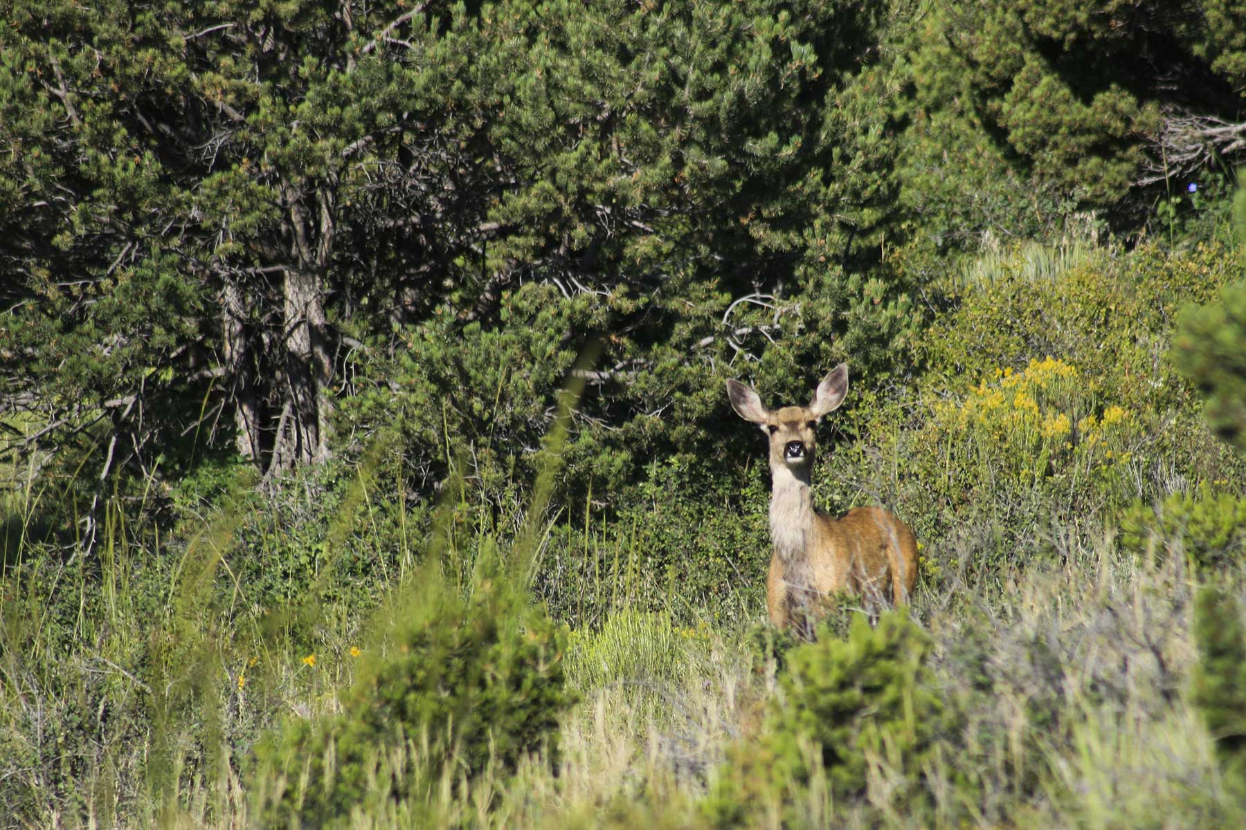
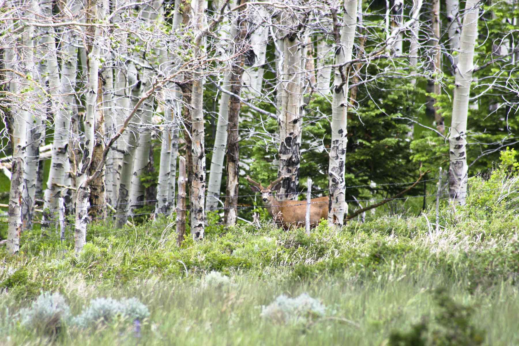
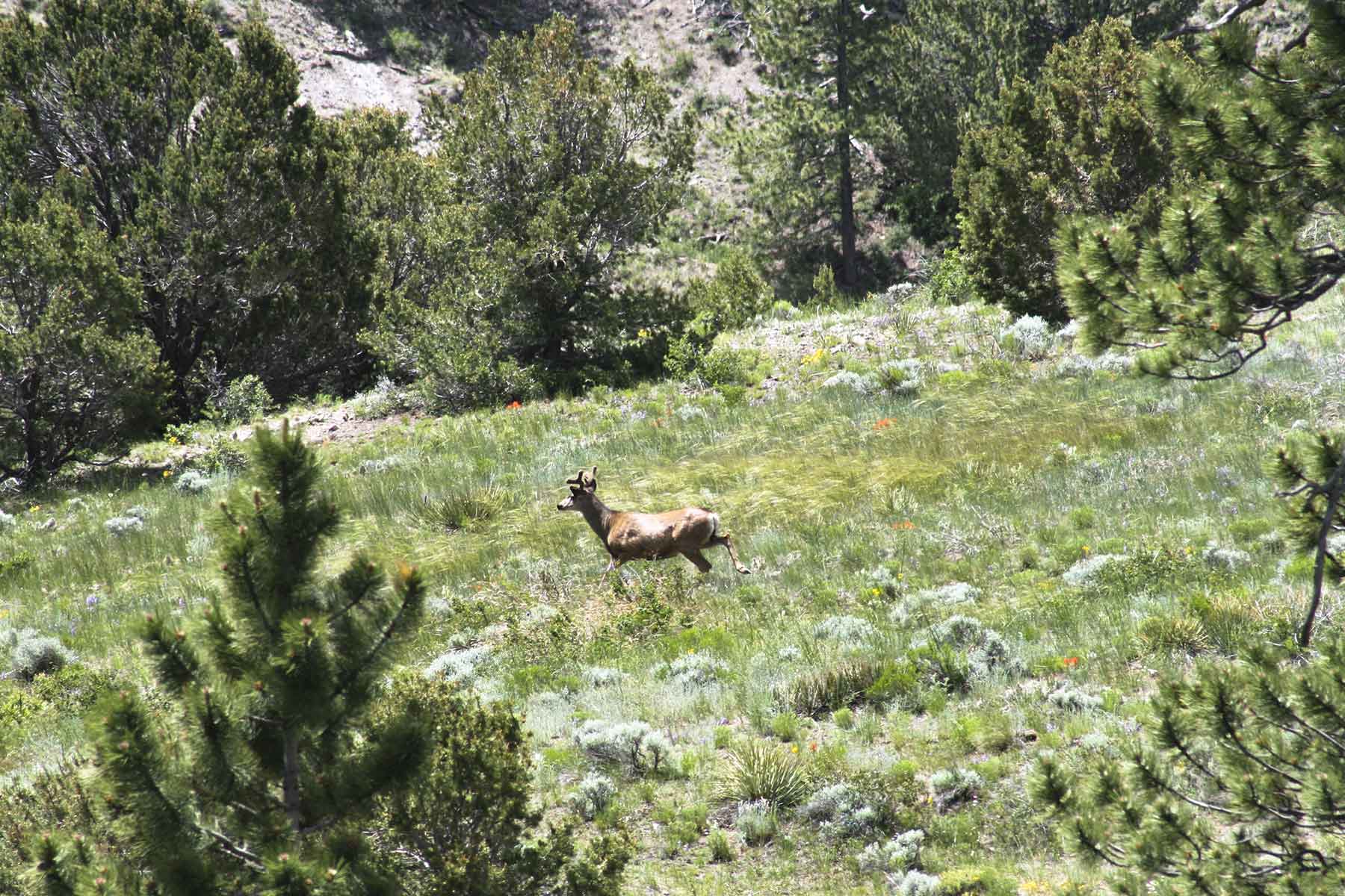
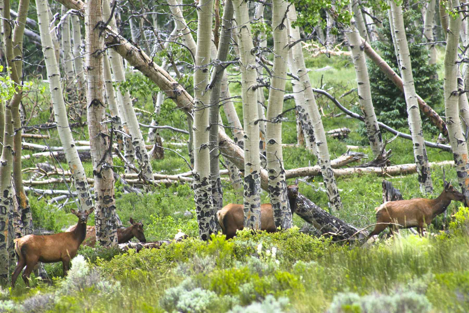
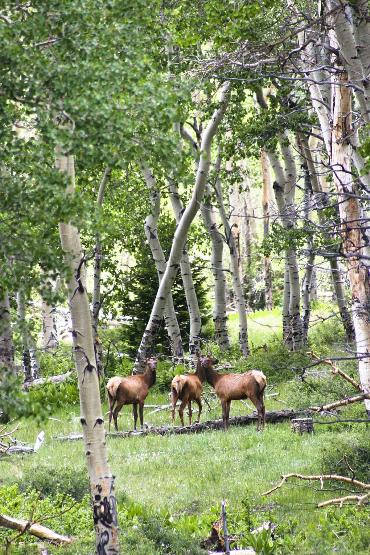
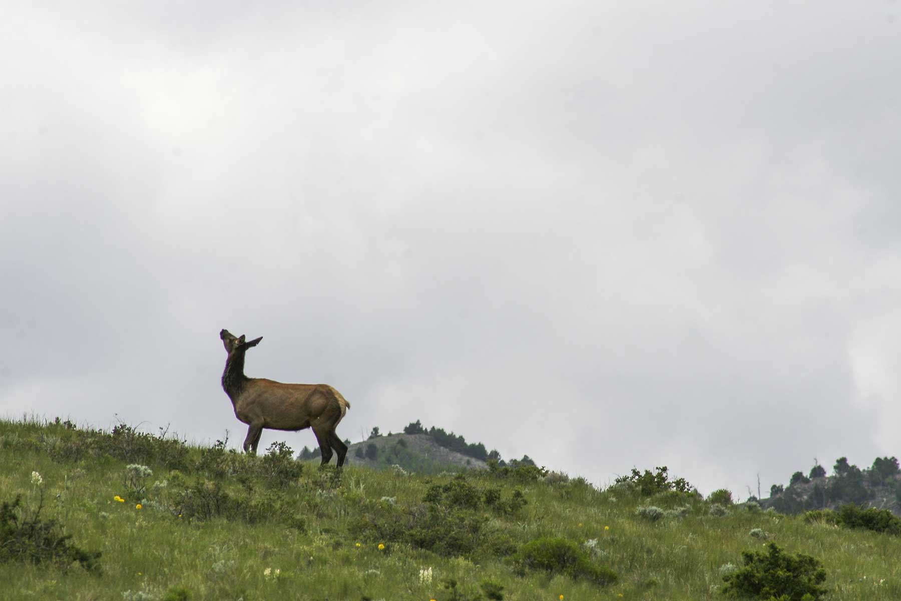
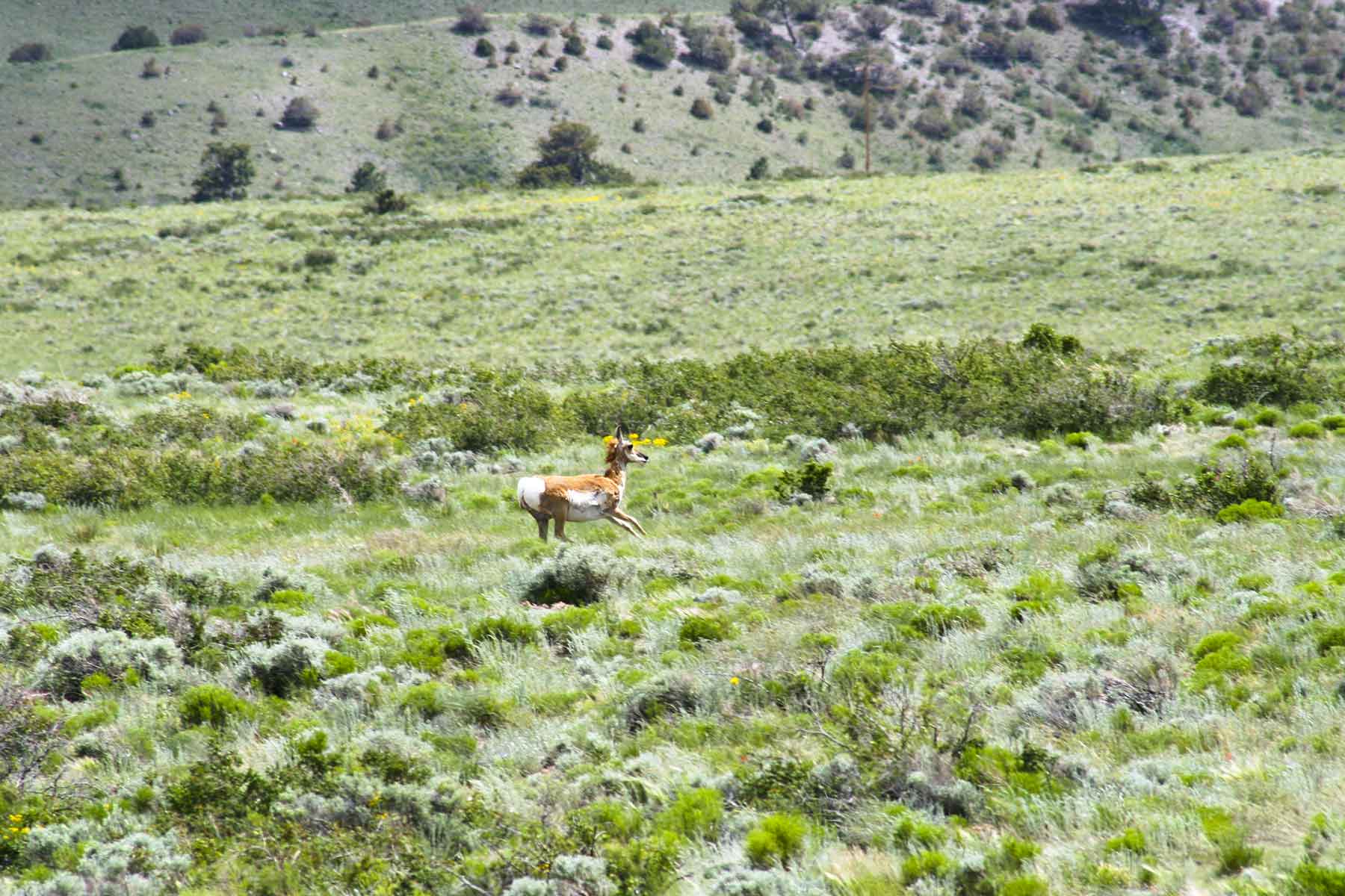
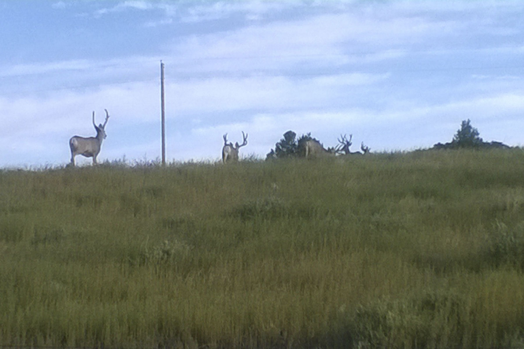
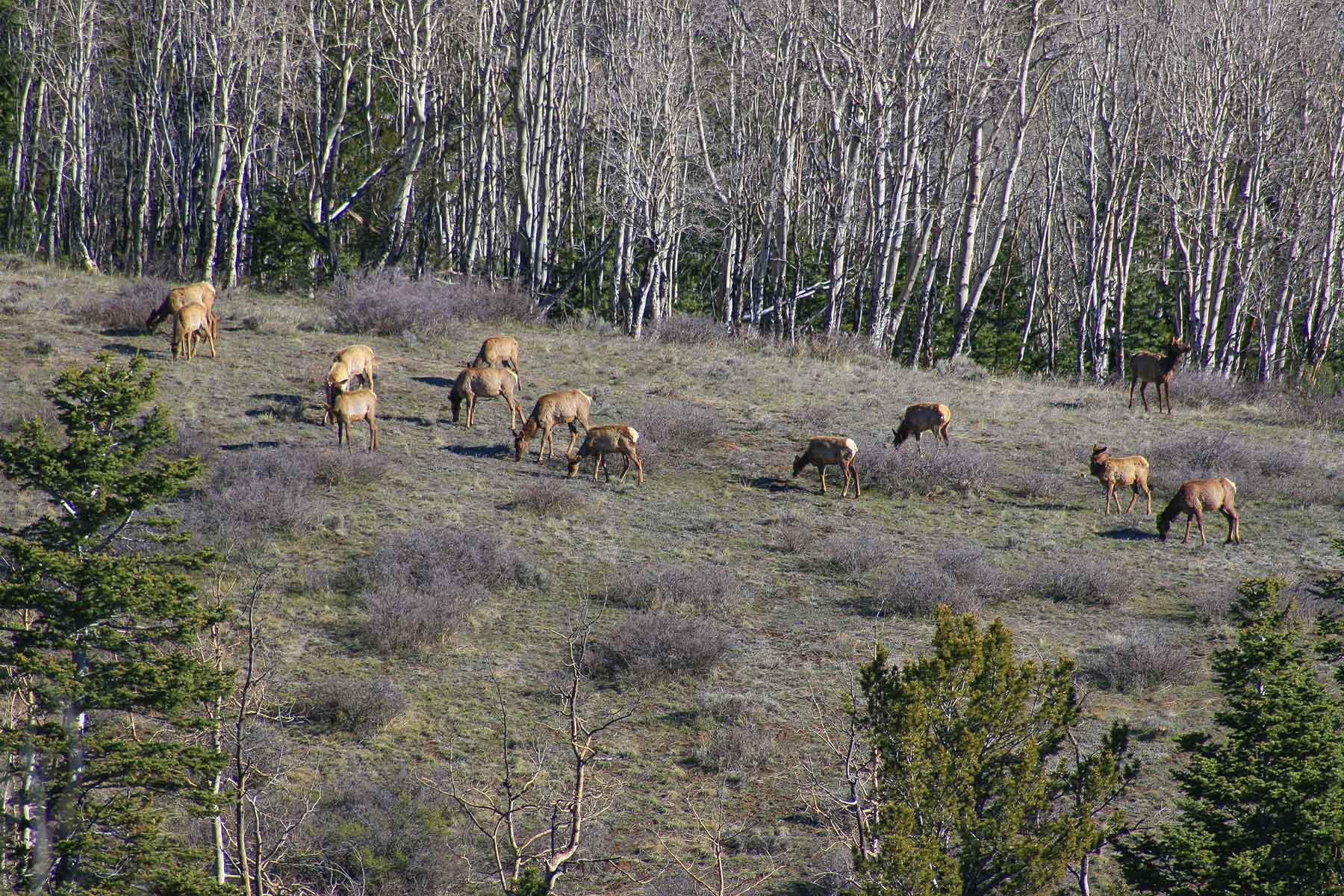
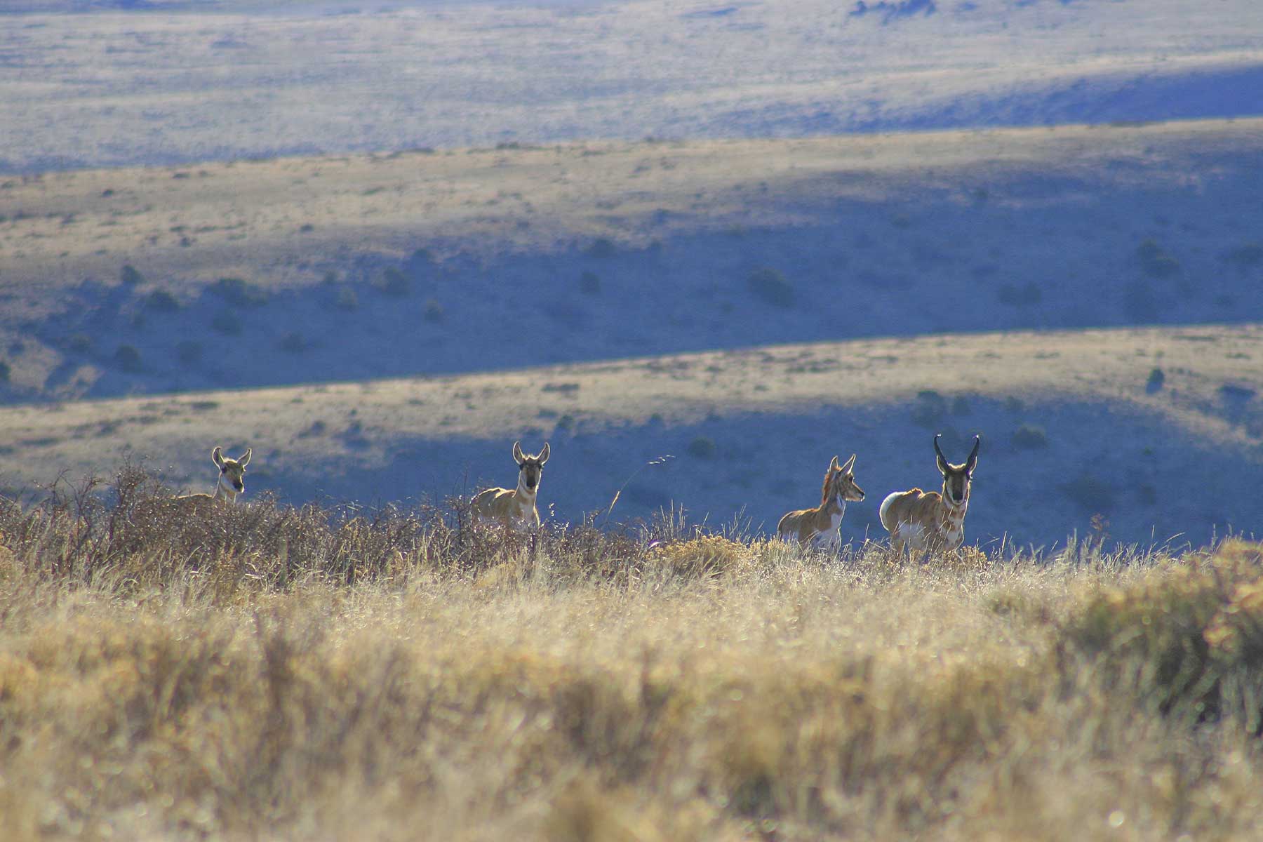
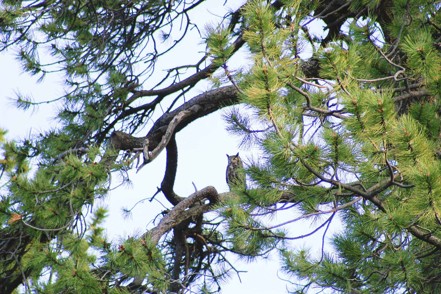
Mosca Pass Ranch is a large block of undisturbed habitat that is home to significant populations of wildlife including elk, deer, antelope, black bear, mountain lion, bobcat, the occasional moose and many smaller mammals. Turkey, eagles, smaller raptors and a number of songbirds can also be observed throughout the property. Mule deer are found throughout the ranch with trophy-sized bucks frequently spotted. The pronghorn antelope herds prefer the central and northern portions of the property and are constantly moving between Mosca and its neighbor to the east.
The ranch is a valuable resource for the local elk herds. The southern portion of the ranch is a spring calving ground for a number of cow elk and the entirety of the property serves as a crucial wintering area for several large herds. Though it sits between two large hunting ranches and national forest lands, current ownership has not permitted hunting on Mosca Pass Ranch since 2011. As such, in recent years the ranch is utilized by deer and elk as a safe-haven during the hunting seasons.
Mosca Pass Ranch is located in Colorado Game Management Unit 861 which is known for quality mule deer and elk hunting. The adjacent Wolf Springs Ranch is enrolled in Colorado’s Ranching For Wildlife Program and regarded as a trophy deer and elk hunting property. Though not currently enrolled in any hunting programs, Mosca Pass would meet the requirements needed to participate in Colorado’s private landowner license preference program. Upon enrollment in this program the ranch would likely qualify for a number of private land owner elk and deer tags each year and would be capable of supporting a hunting operation. The combination of its size, proximity to a national park and shared borders with national forest and large trophy hunting properties make Mosca Pass Ranch an ideal candidate for anyone seeking a quality hunting property.
Two small spring-fed ponds along Potato Creek hold wild, breeding populations of brown trout. The crystal clear waters of these ponds provide the opportunity to sight cast for cruising trout as well as the potential for enhancement and creation of additional water features.
General Operations
General Operations
Mosca Pass Ranch was historically operated as a hunting and summer grazing operation prior to passing its legacy on to the current owners, who are ardent conservationists. During their tenure the ranch has been operated more as a wildlife reserve than an operating ranch with the deer, elk and pronghorn herds managing the grasses. The rangeland and grasses have benefitted from a three-year period of rest.
Though it hasn’t been grazed in several years, Mosca Pass Ranch has run 165 cow/calf pairs or 250 yearlings through the grazing season. The ranch currently maintains the agricultural leases on 720 acres of adjacent BLM lands and 640 acres of adjacent state lands. The state lease provides for 208 animal unit months of grazing and the BLM grazing lease allows for 55 animal unit months. The majority of the perimeter fences are in working condition and the only interior fencing is located on the southern portion of the property. With a wide variety of grasses and good water resources, the ranch represents an excellent opportunity to acquire a large and easily accessible parcel of productive rangeland.