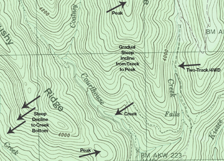
Understanding Contour Lines and Spacing
Contour lines help inform access and usability, assisting in management planning. Contour lines provide a three-dimensional view of the land by indicating the steepness of the terrain. Tighter lines signify steeper terrain. Widely spaced lines depict gentler terrain.
Recognizing Key Topographic Features
Contour lines can also illustrate the shape of the terrain. Groups of concentric circles can indicate a peak on a mountain. “Index lines” are used every fifth contour line, and are thicker and list the elevation. The elevation change between one contour line is always the same within the same map.
Calculate Distance and Access
Help plan routes for gathering cattle, hiking and hunting. Access across gentle terrain will change significantly if the equal distance is applied to steep terrain with draws and water crossings.
Topographic Maps Matter When Evaluating Land
Today’s maps are created with a large amount of data built in to help a user access all sorts of knowledge before setting boots on the ground. Water flows, vegetation, wells, fence lines, buildings and trails are just a few of the features available in our digital maps provided with a listing.