
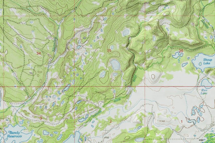
As leading experts in the ranch brokerage field, we at Hall and Hall know the importance of a good set of maps. Not only can maps show the location and shape of a property, but they can also provide key information about the topography of the area. Topographic maps provide this information through the use of contour lines and other physical (natural and man-made) features in the area.
Contour lines provide a three-dimensional view of the land by indicating the steepness of the terrain. Contour lines connect points that share the same elevation—when the lines are close together the terrain is steep, and when the lines are farther apart the terrain is more of a gentle slope.

Contour lines can also illustrate the shape of the terrain. Groups of concentric circles can indicate a peak on a mountain. “Index lines” are used every fifth contour line, and are thicker and list the elevation. The elevation change between one contour line is always the same within the same map.

Topographic maps include other helpful characteristics such as water features, vegetation, roads and railroads, cities, mines, wells, and survey control points. All of these features can be referenced to gain a better understanding of the land in a particular area.
Maps are very important tools that we use to gain a full understanding of the land, often before we have even set foot on the property. The advance of technology has innovated the mapping process and brought it into the digital world. We now have access to large amounts of data that assist in the creation of maps, as well as provide valuable information to those viewing the maps. We create these interactive maps for each one of our listings to provide our clients with detailed and relevant information about the property.
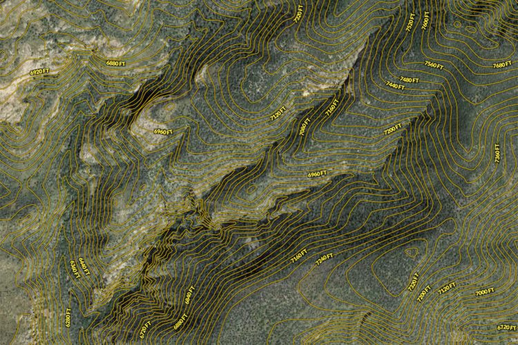
A recent innovation in interactive mapping is the use of “layers” such as water features or county lines that can be toggled on and of, allowing the user to fully customize their experience. A particularly interesting layer that is available is the contour lines layer. The contour lines layer overlays the countour lines of the terrain on the aerial satellite imagery, giving a more realistic view of the topography. Unlike using a topographic map where the user must be familiar with elements used and perhaps simultaneously refer to an aerial satellite image map, the contour lines layer allows the user to combine both options into a streamlined view.

It is interesting to speculate whether the advance of interactive mapping and endless layer options will eventually replace the traditional topographic maps that many have used for generations.
Have other questions? As the leading land experts in the industry, we are here to help!


