Home Place Ranch
Bridger, MTThe Home Place Ranch is 5,212± deeded acres, with a 1,160± acre BLM and 640± acre state lease. A modest house and cattle facilities. All within one hour of Billings, Montana.
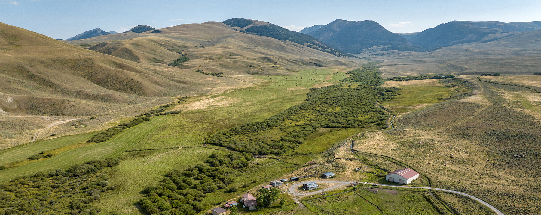
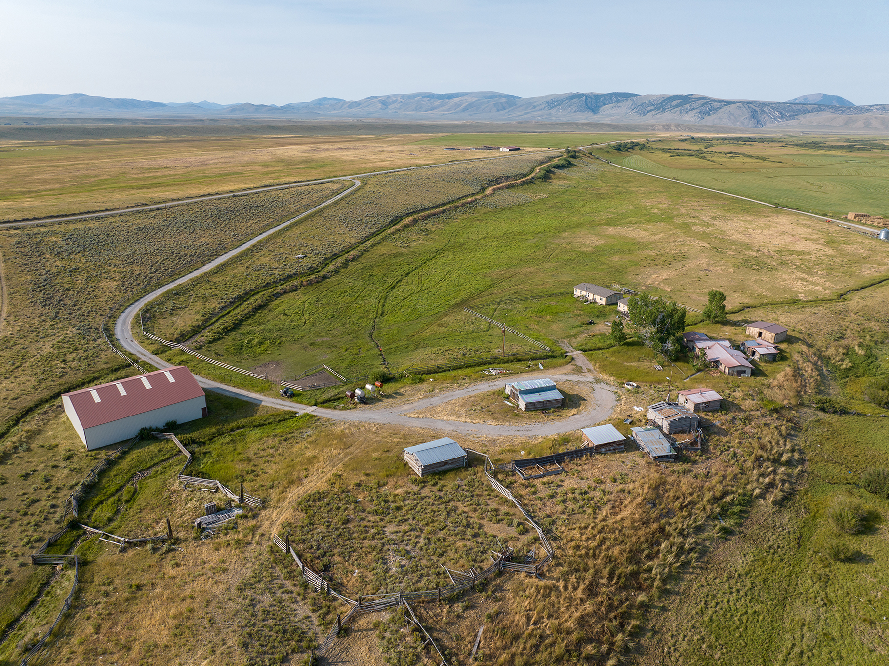
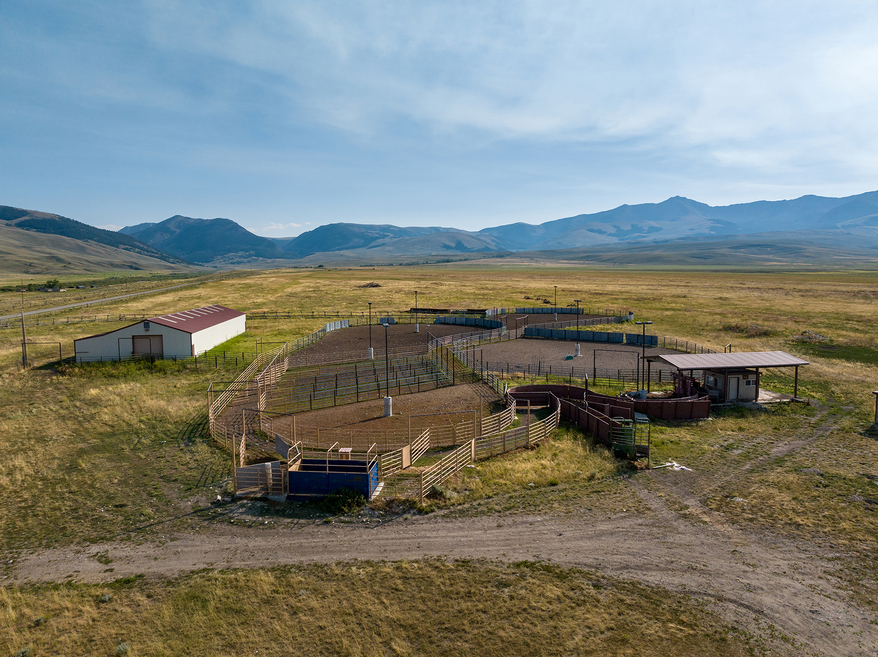
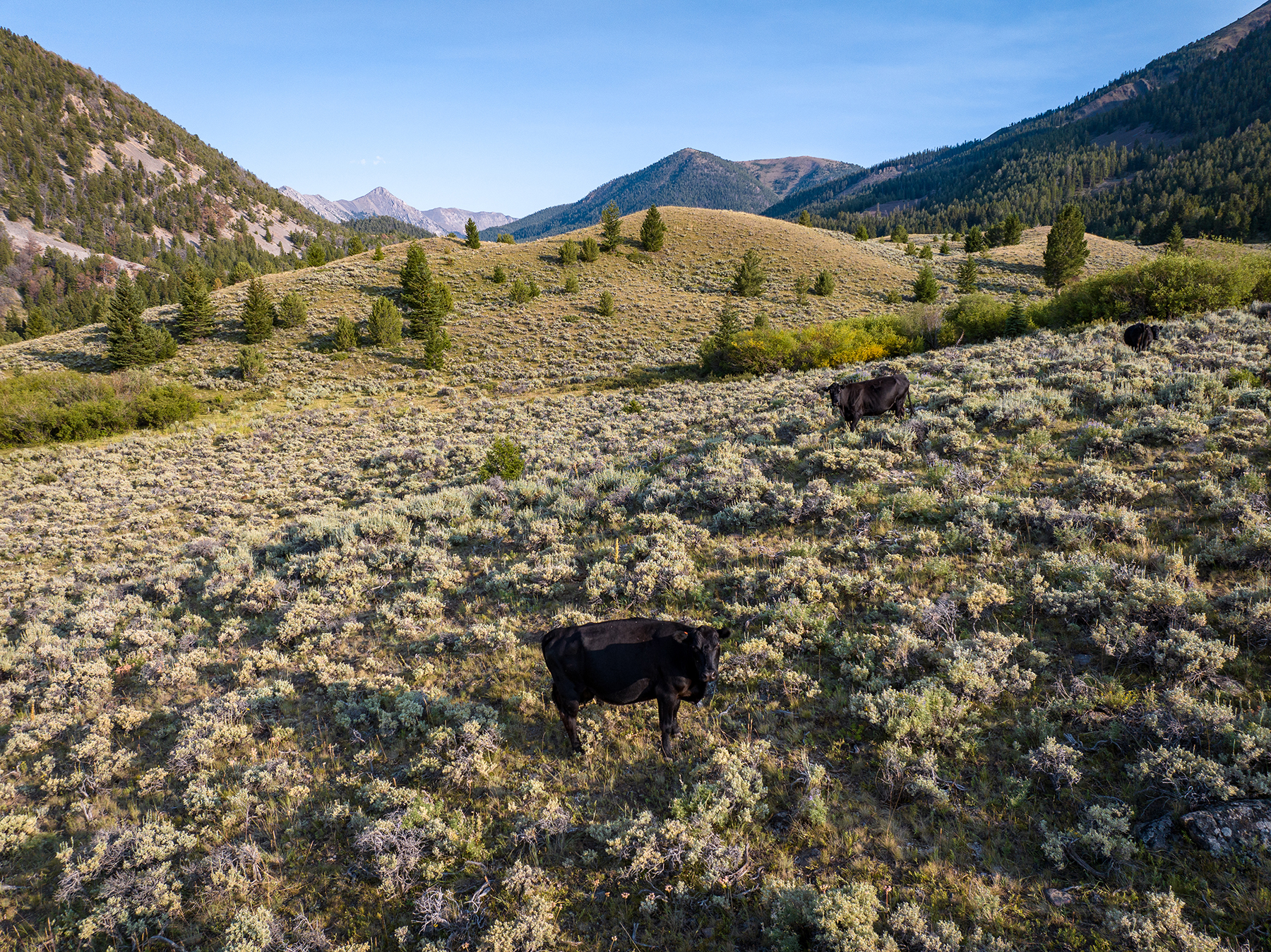
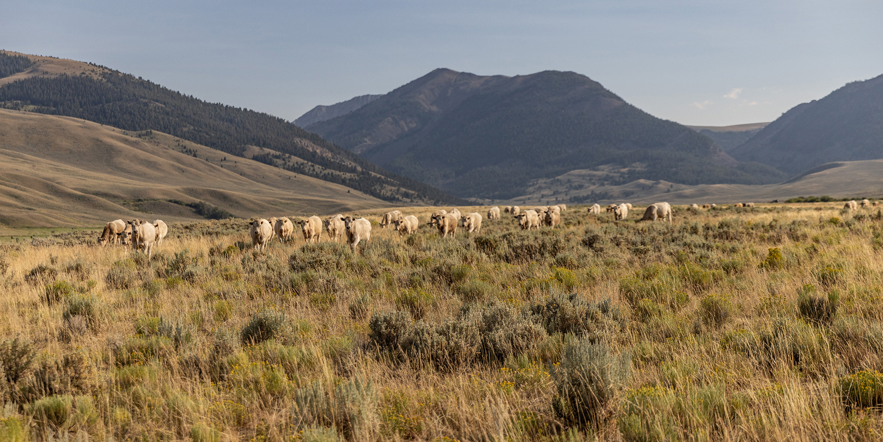
Nicholia Creek Ranch is a 3,445± deeded acre mountain ranch inclusive of expansive United States Forest Service and Bureau of Land Management (BLM) leases spread along a high-hanging remote valley of southwest Montana. Ideally, the ranch serves as an outstanding base for seasonal summer and fall grazing with irrigated meadows and vast, rolling native range. The mountain vistas are incredible, with the second-tallest peak in the state of Montana (18 Mile Peak) dominating the western horizon. Over 3.3 million acres of the Beaverhead National Forest expand from the ranch, including the 62,500-acre Italian Peaks Wilderness Study Area and its stunning lakes, which lie adjacent to the ranch. Nicholia Creek Ranch is a remote, ecologically diverse high-elevation scenic cattle ranch located in one of the more pristine and unspoiled regions of Montana.
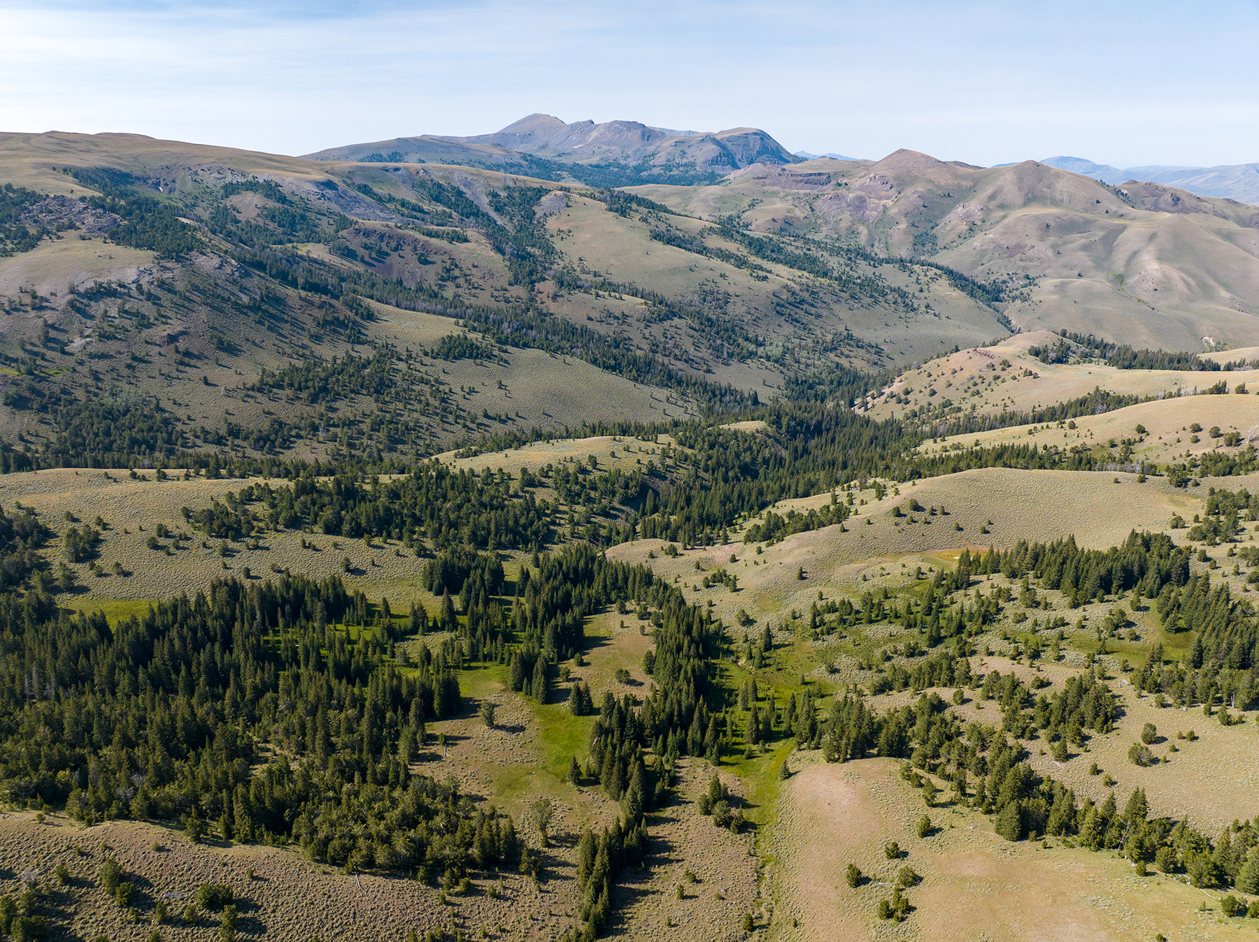
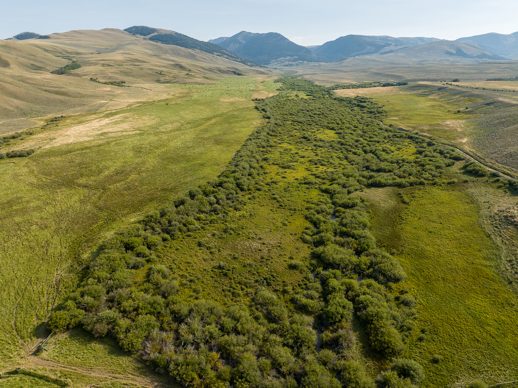
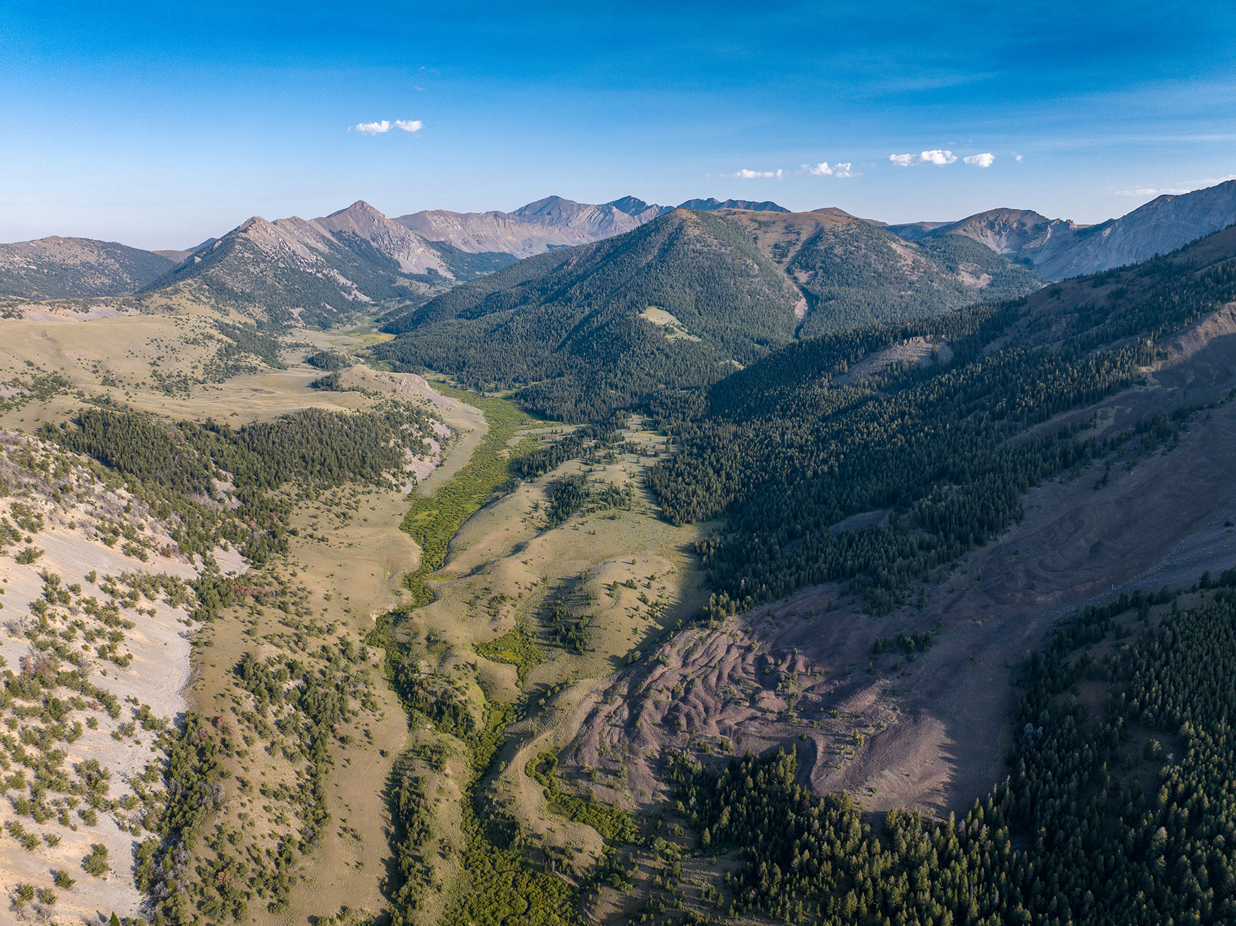
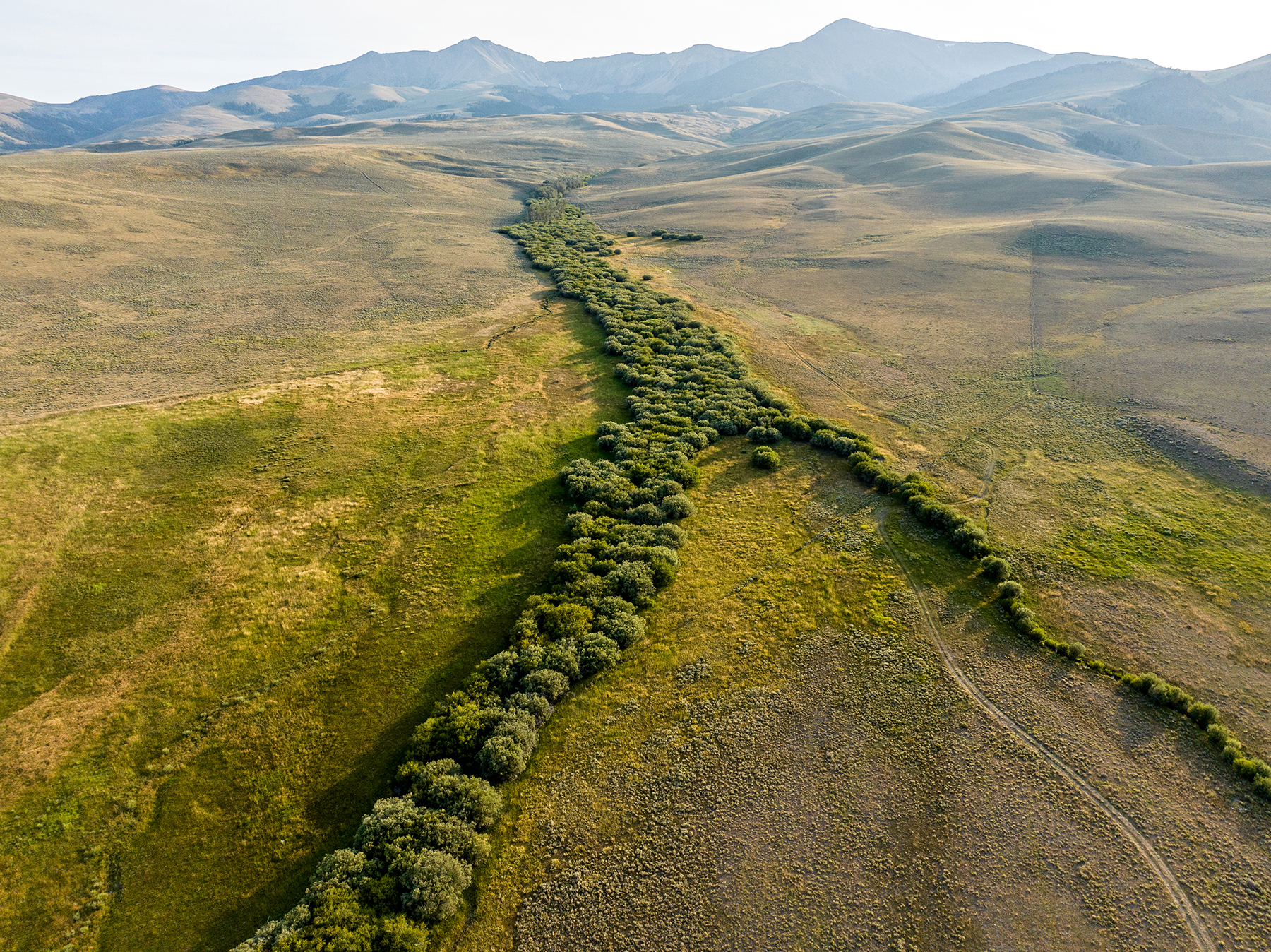
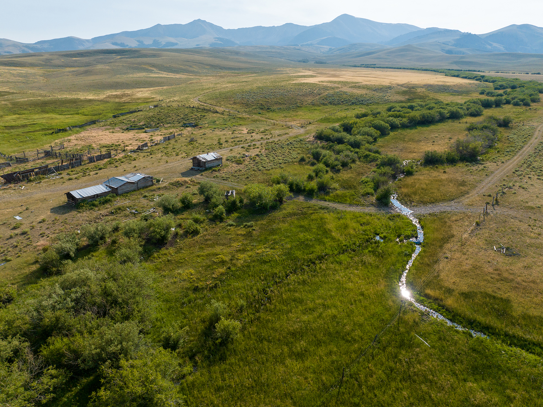
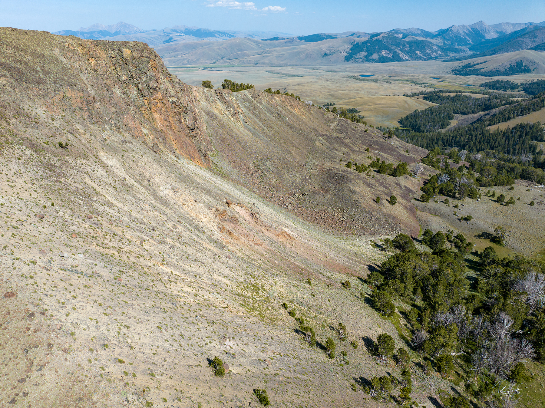
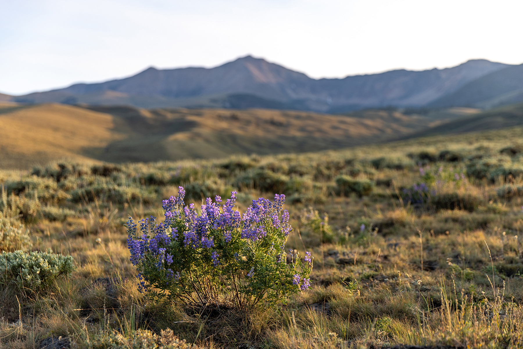
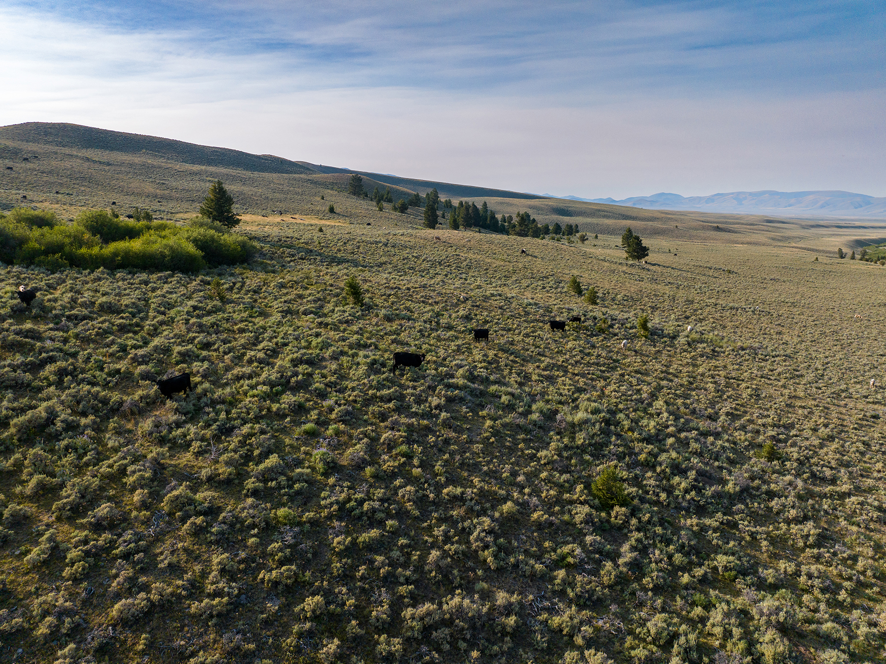
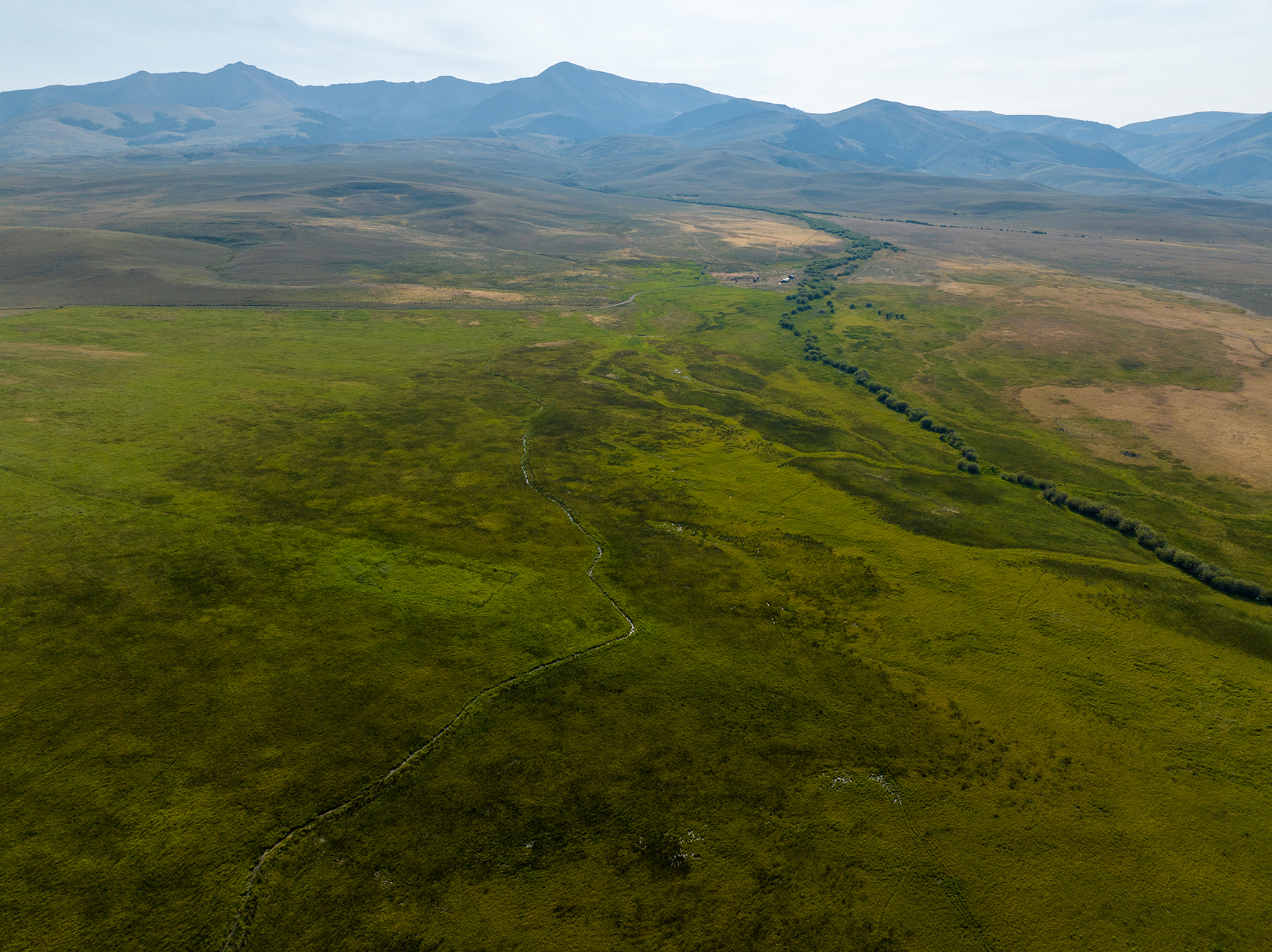
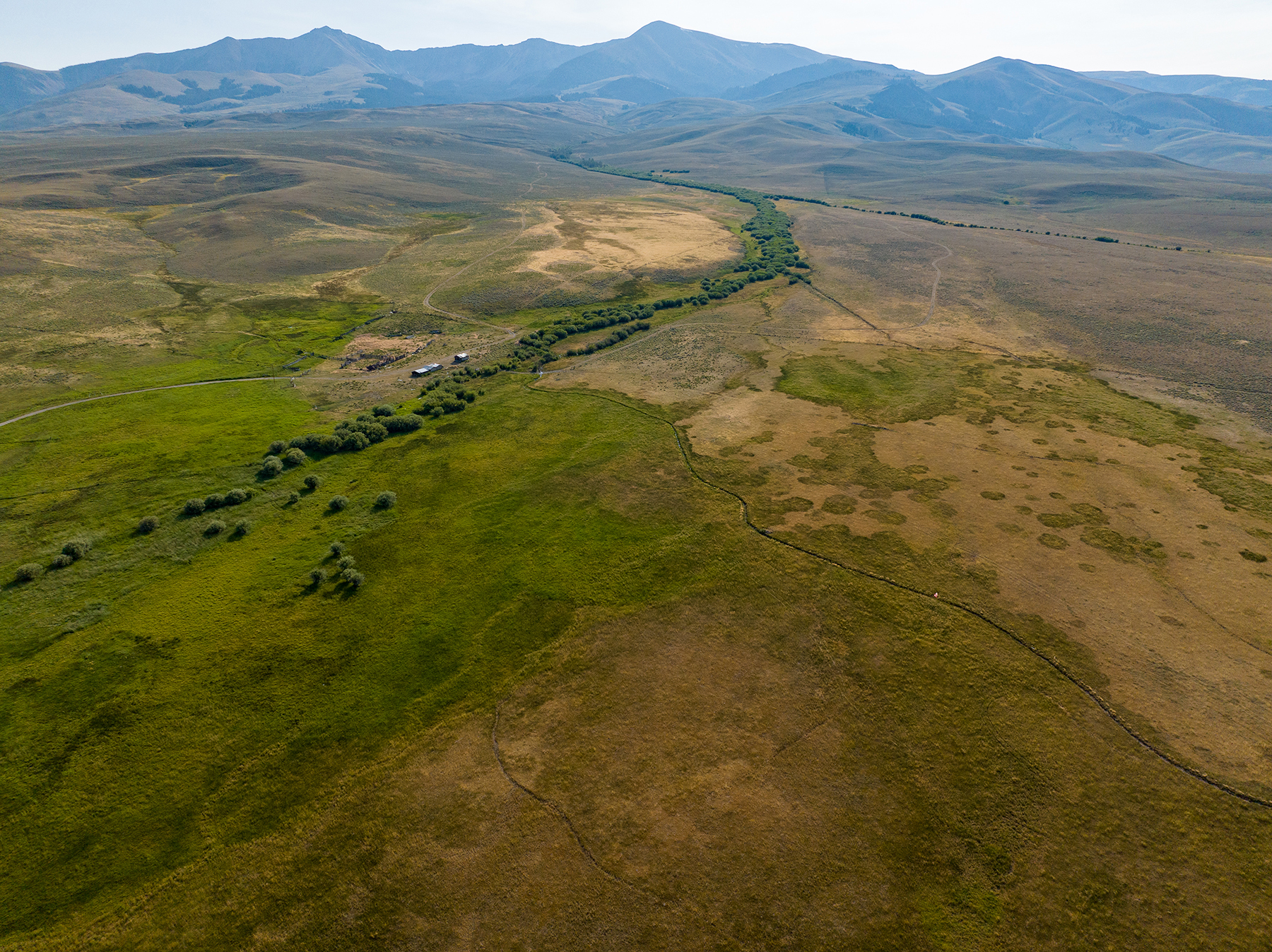
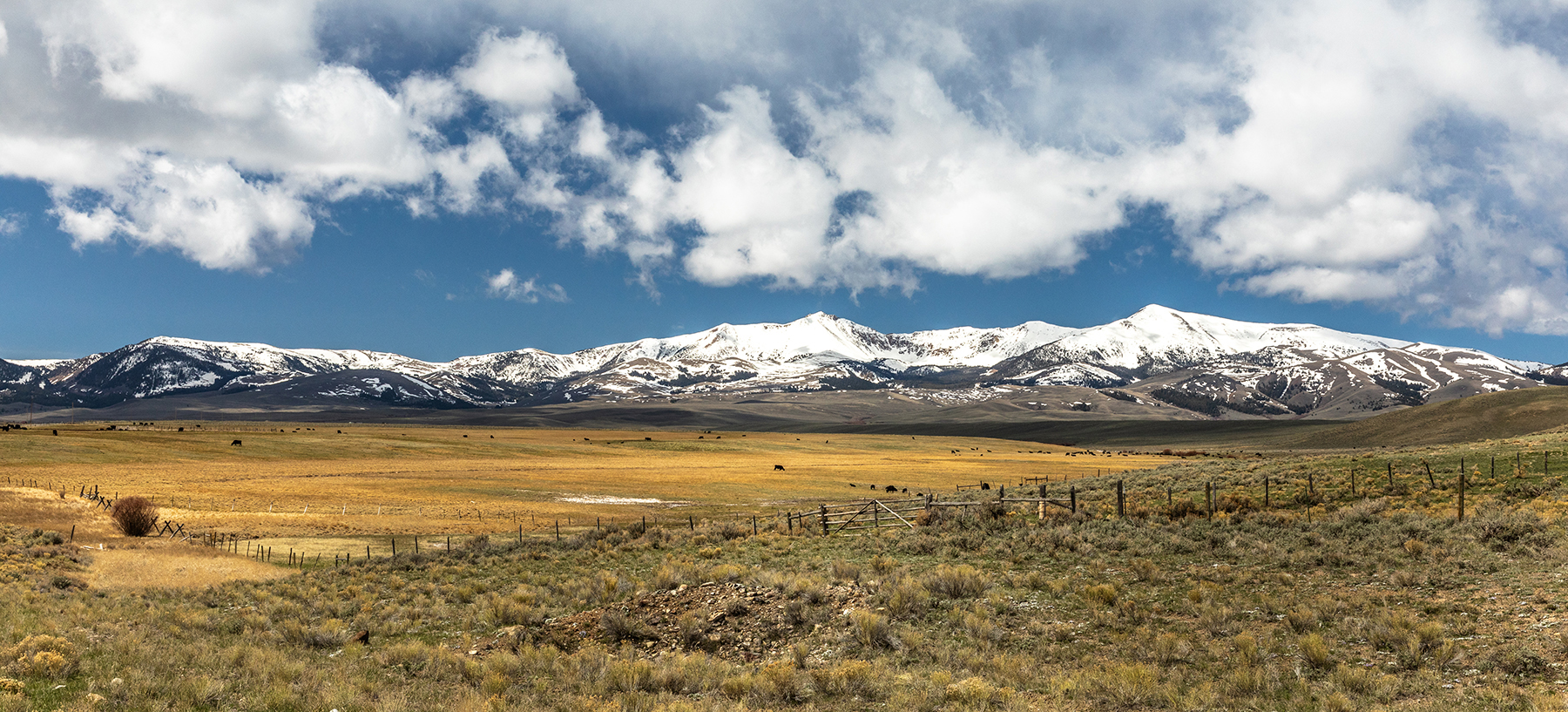
It is a beautiful drive from Dell, following Big Sheep Creek through a spectacular limestone canyon. As the canyon gives way, the landscape unfolds into a sweeping expanse of rolling rangelands, willow-lined creek bottoms, and majestic mountain peaks stretching along the western horizon, marking the path of the Continental Divide and the Idaho border. Rising above the valley, 18 Mile Peak is a sentinel along the horizon, reaching an elevation of 11,185 feet and is the highest point on the Continental Divide between Banff, Alberta, and Wyoming’s fabled Wind River Range. The immediate vicinity is a part of the Beaverhead Range, which extends for more than 175 miles north to south. The sprawling Big Sheep Creek Basin is generally rolling native range with sage-covered hills, shrubby coulees, scattered timber, and irrigated bottomlands that starkly contrast to the surrounding alpine country. Apart from a few fences, roads, and a sparse human presence, the valley remains virtually untouched, preserving its raw, unspoiled natural beauty.
The approach from the southeast through Big Sheep Canyon is spectacular, with towering limestone walls and pristine flowing waters. The drive in from the north transitions through Medicine Lodge Creek and over the High Divide, which breaks into the Big Sheep and Nicholia Creek basins. The Continental Divide is effectively the skyline to the west, also constituting the Idaho state line.
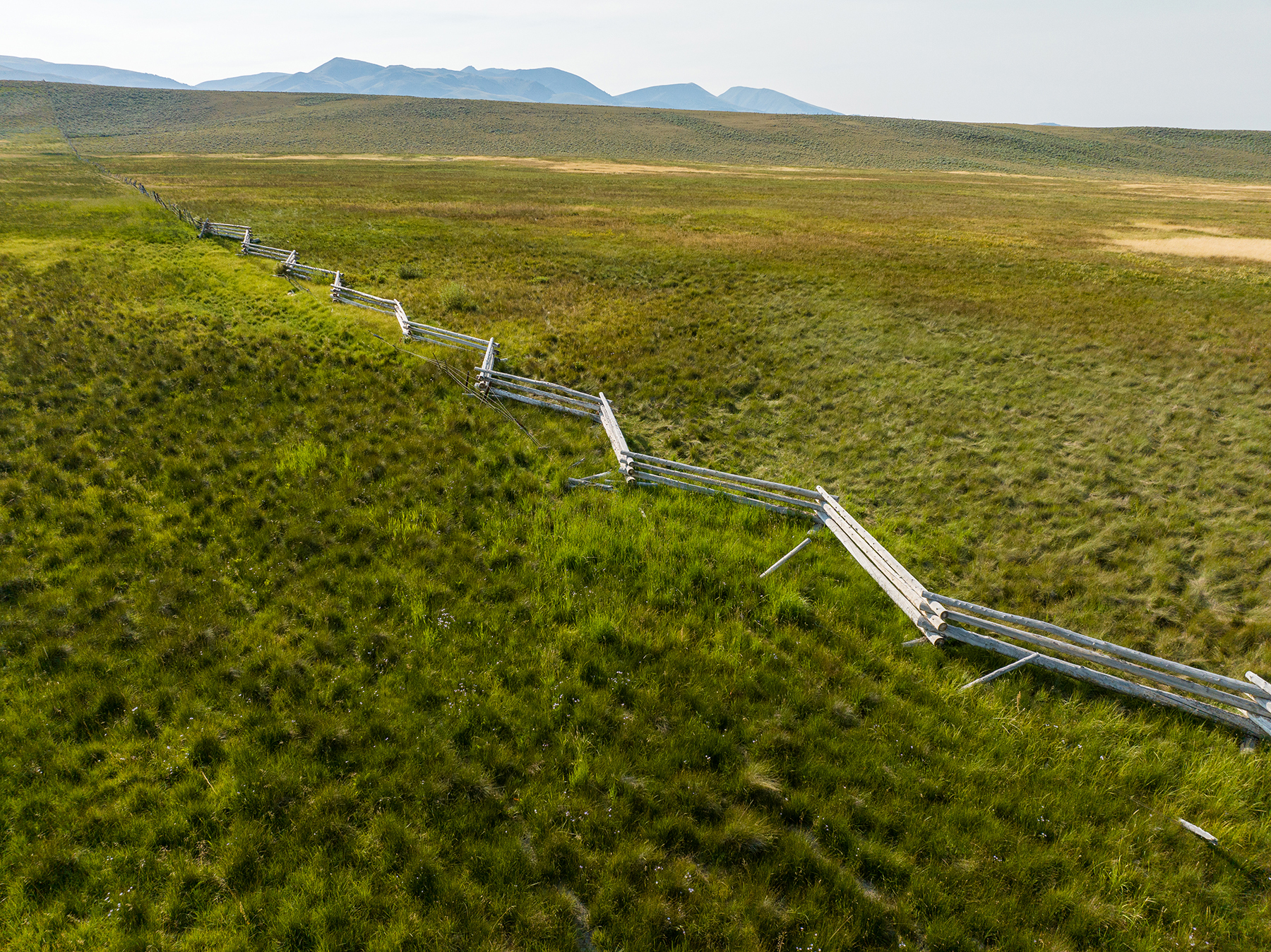
The county gravel road is maintained, but not always the first priority, and continues past the ranch to a trailhead for the National Forest and the Italian Peaks Wilderness Study Area. Traffic is minimal beyond the occasional recreationists, the neighboring ranchers, or the small number of cabin owners to the south.
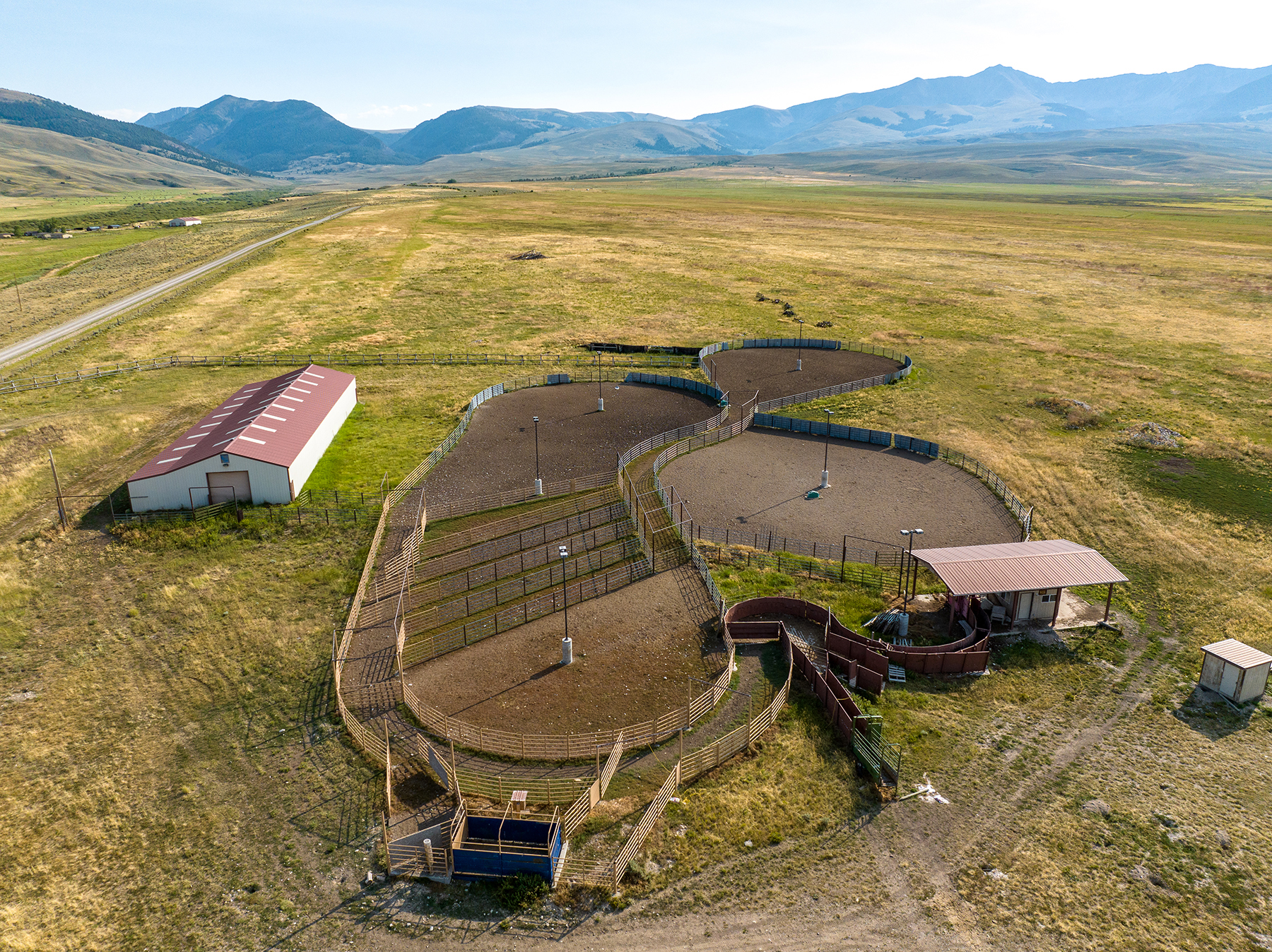
Travel becomes adventurous inside the ranch. Maintained roads turn to two-track roads, which ford the creeks and provide access to most of the ranch area in a 4-wheel drive or UTV. Although it is possible to get stuck, the ground below the soil is generally quite rocky and well-drained, providing overall traction while traveling.
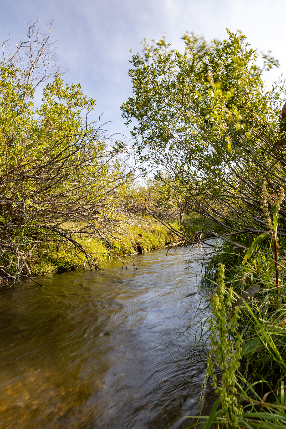
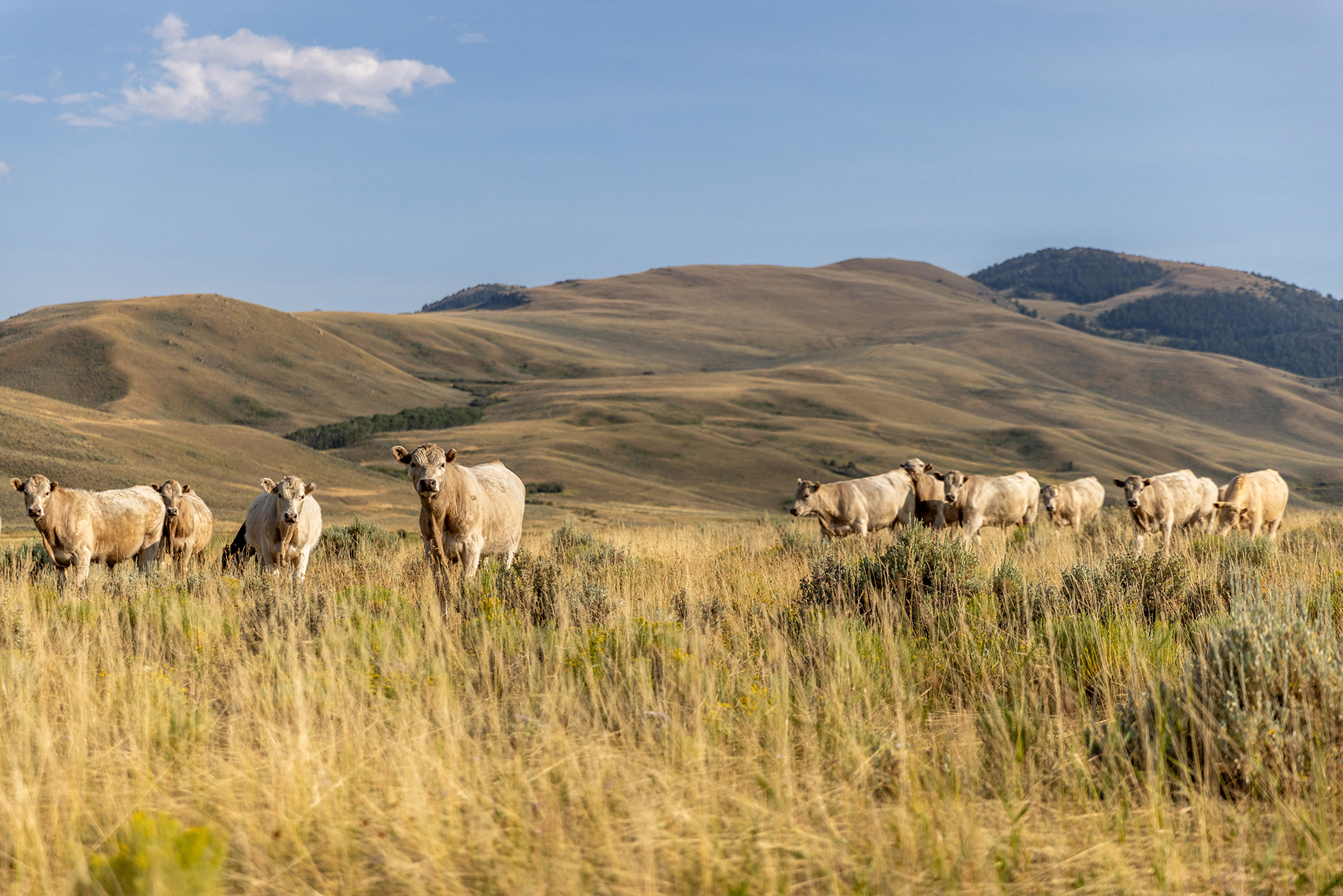
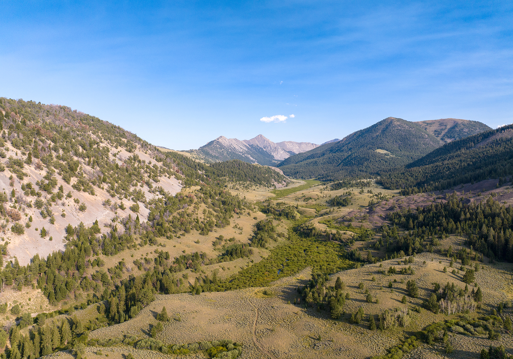
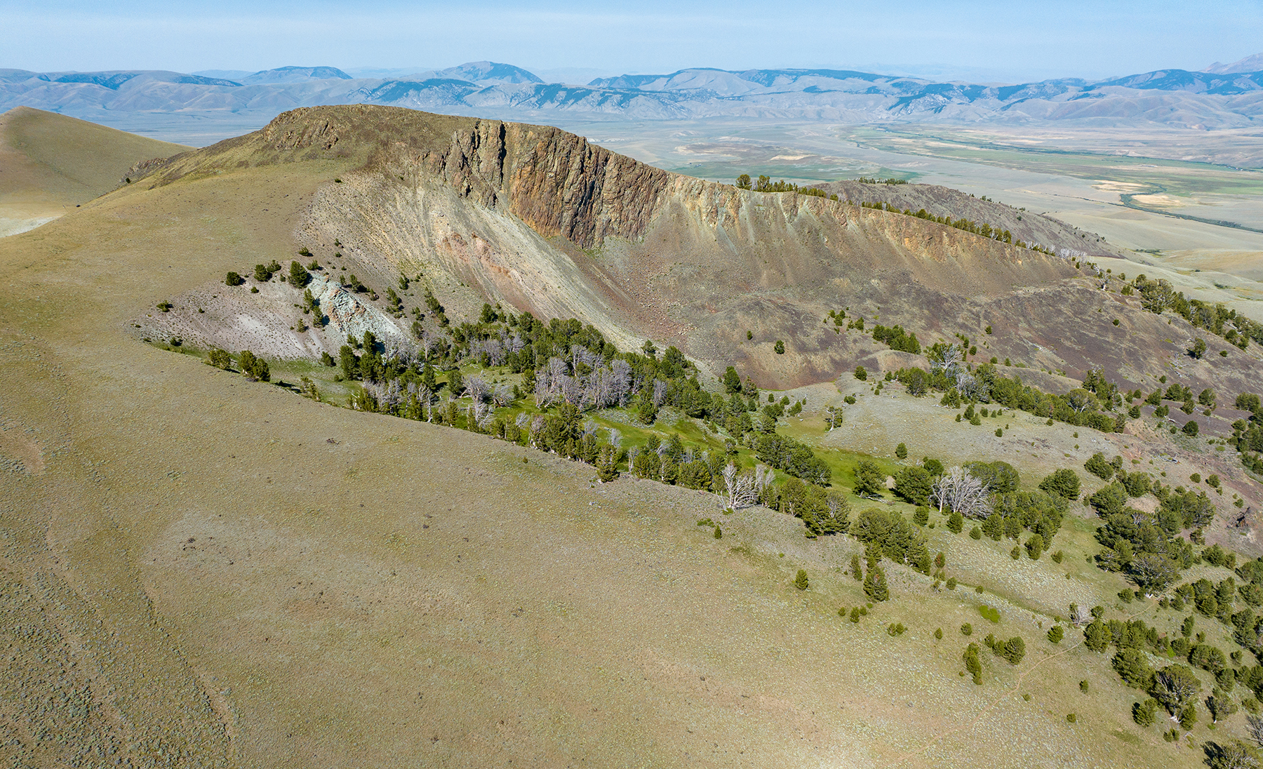
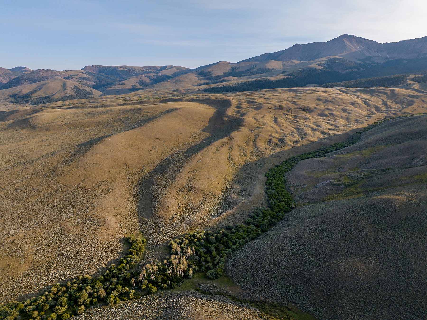
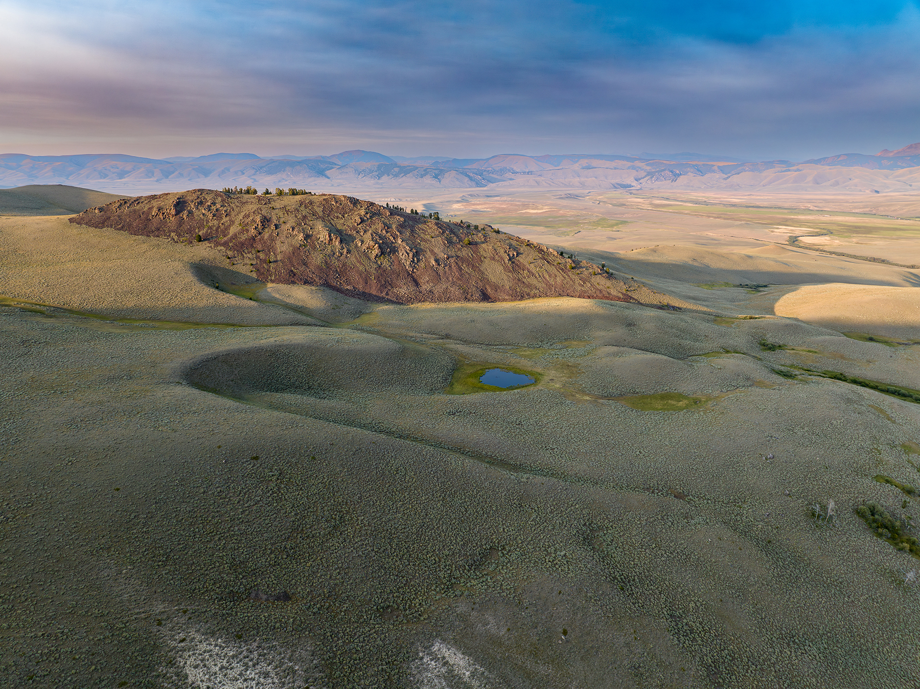
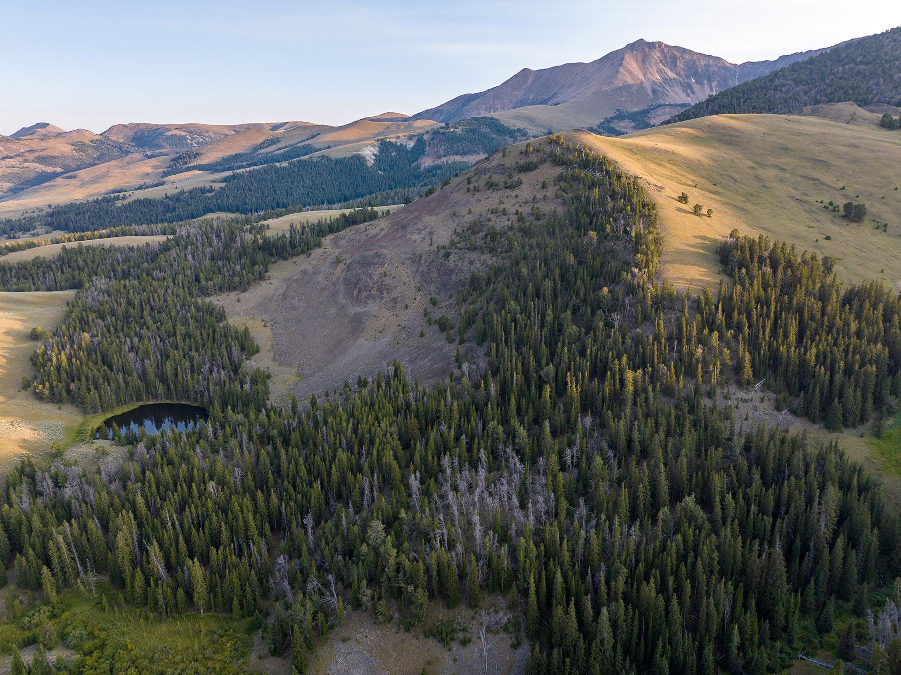
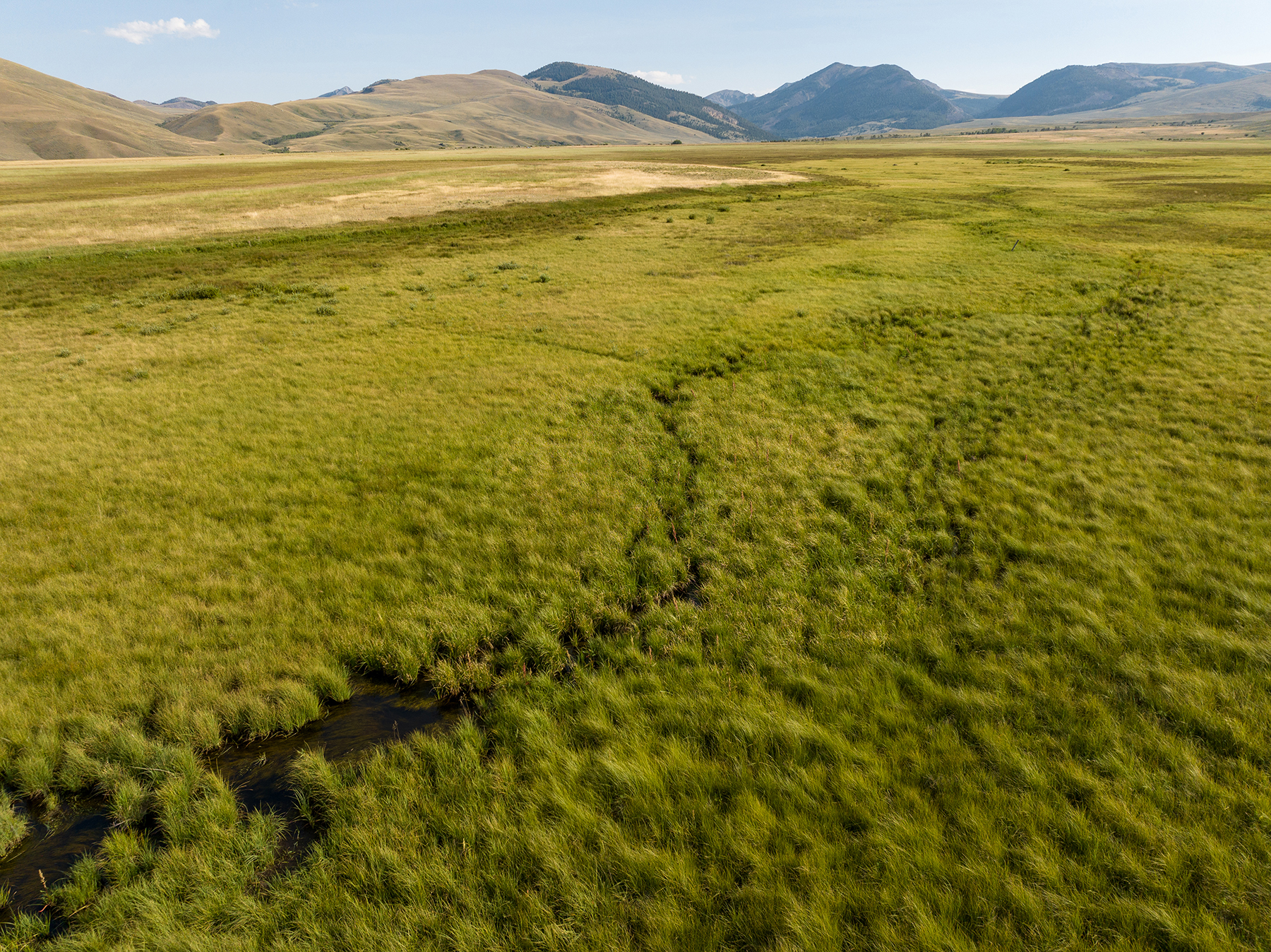
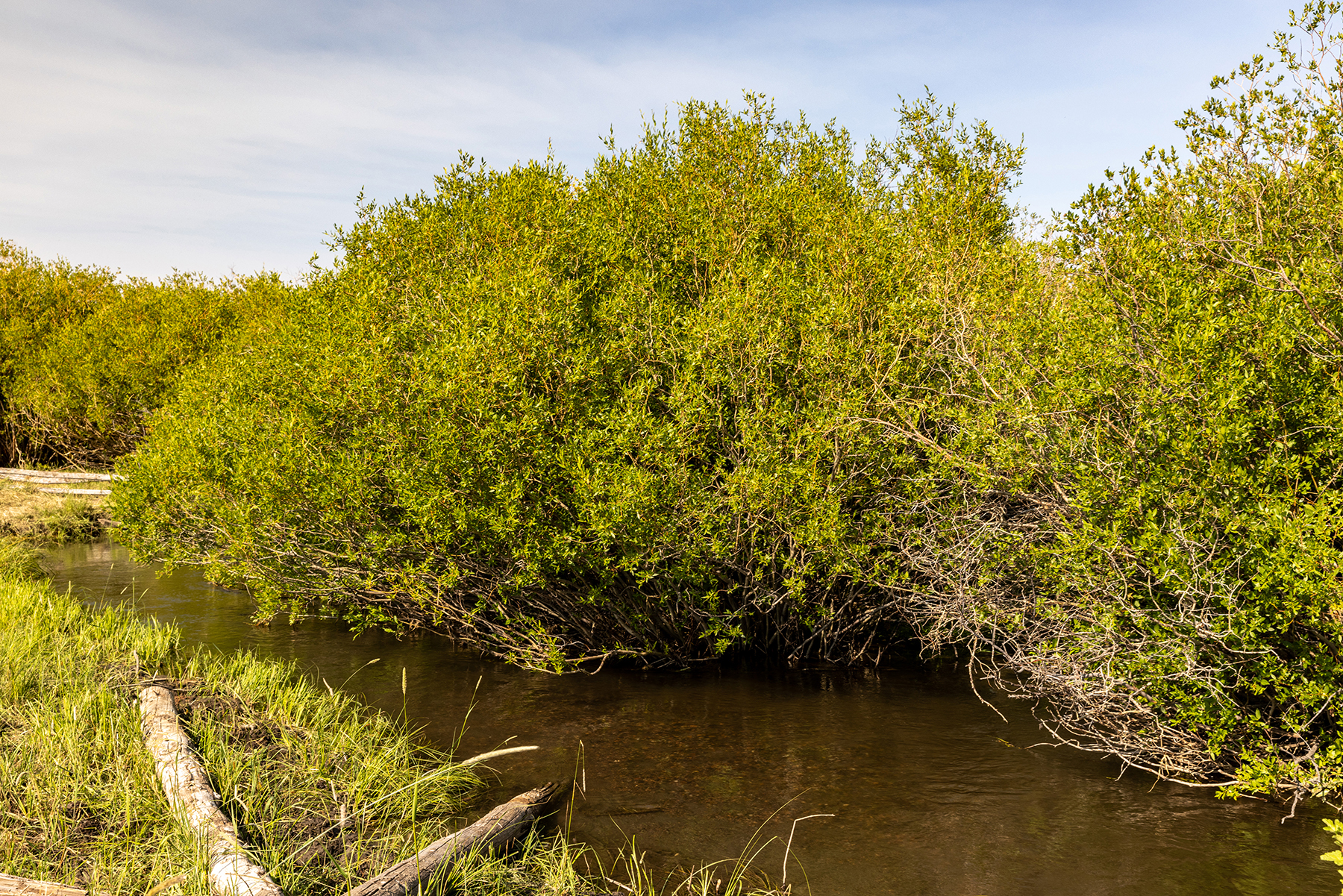
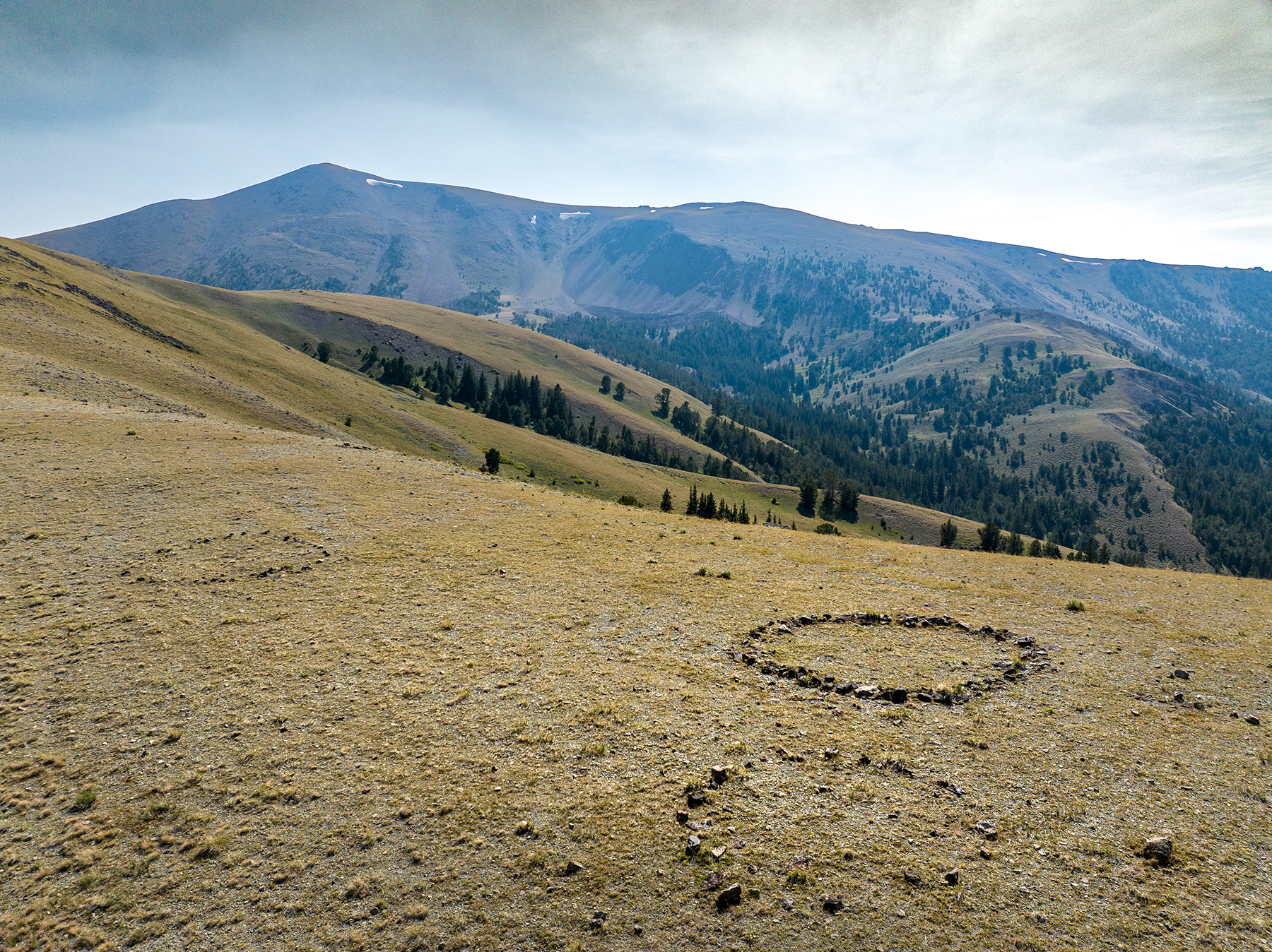
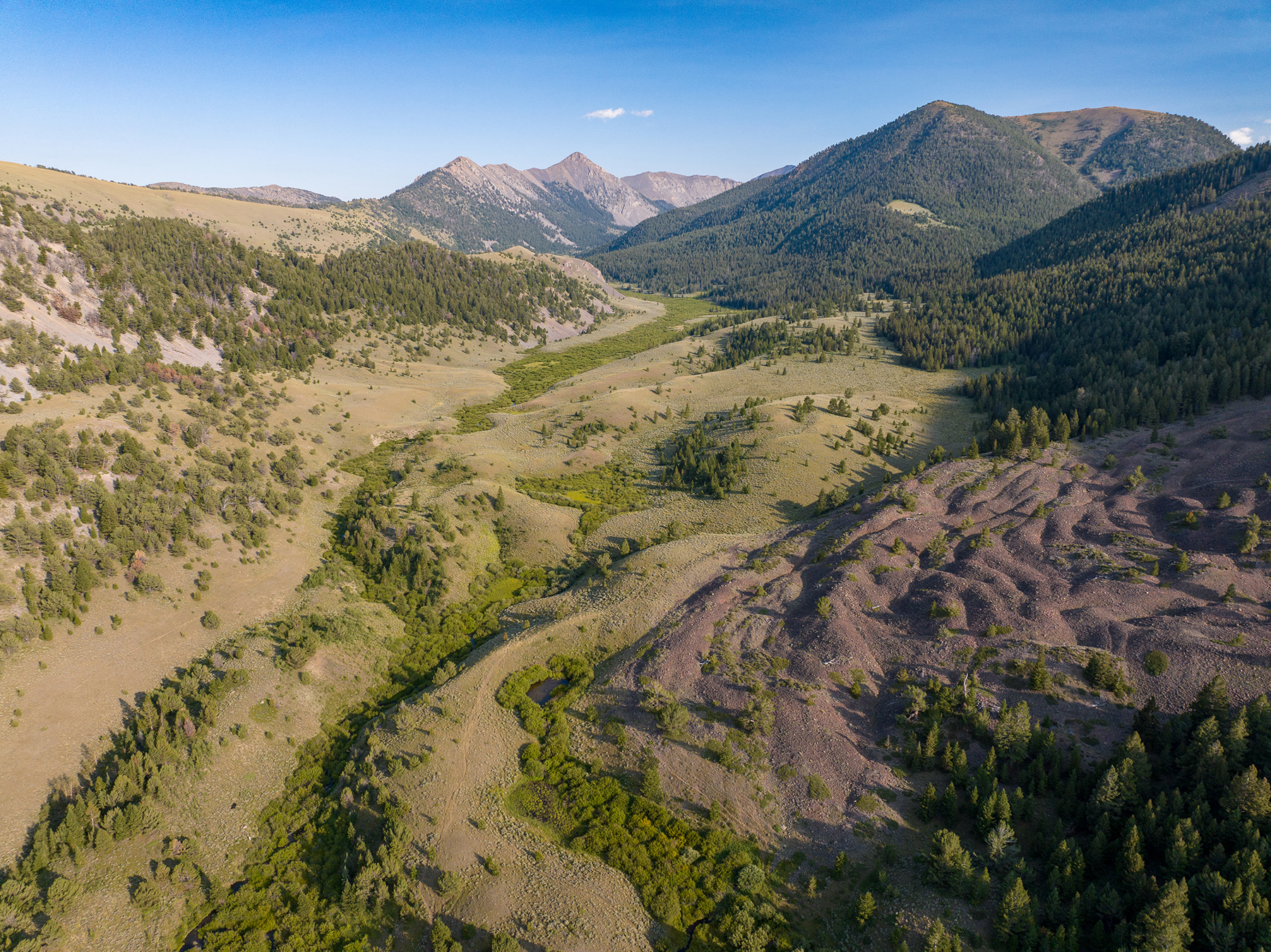
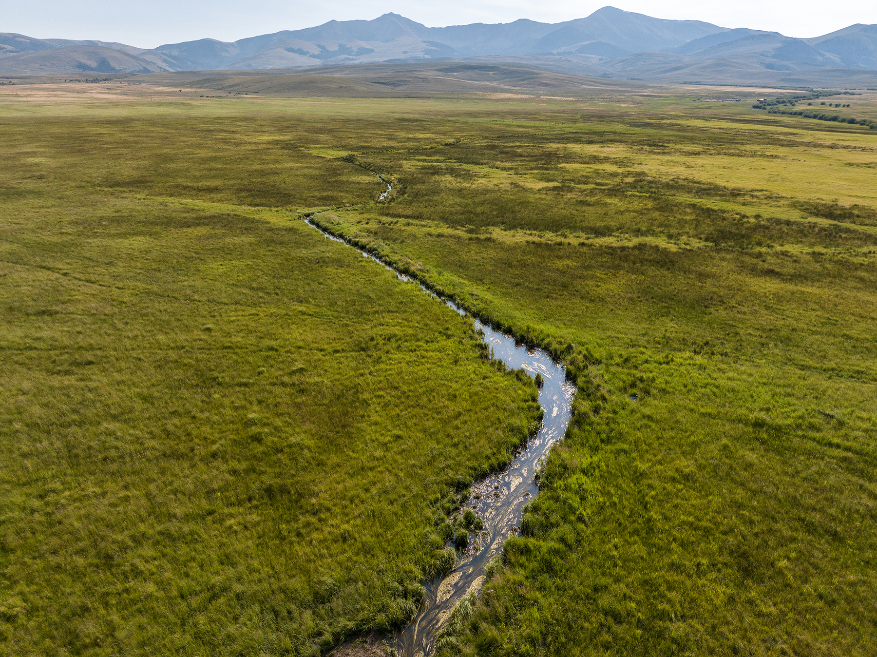
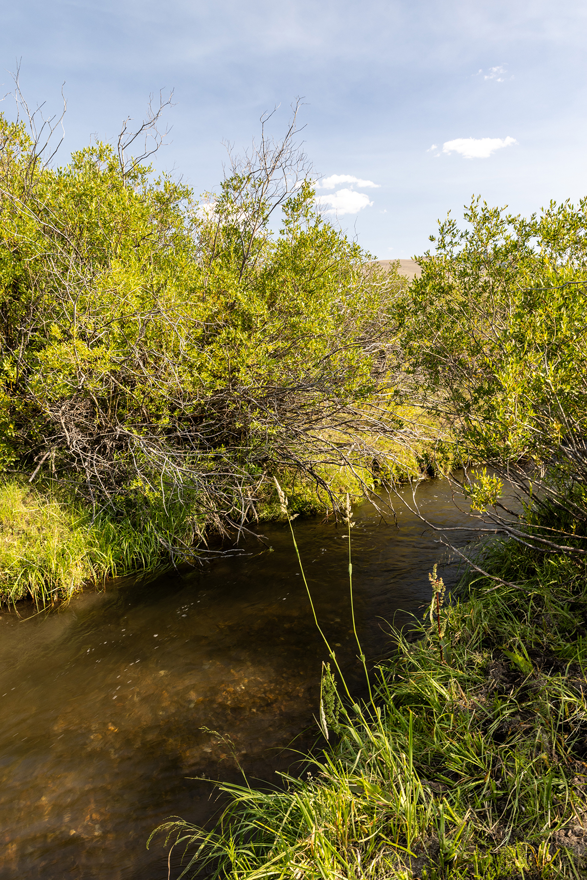
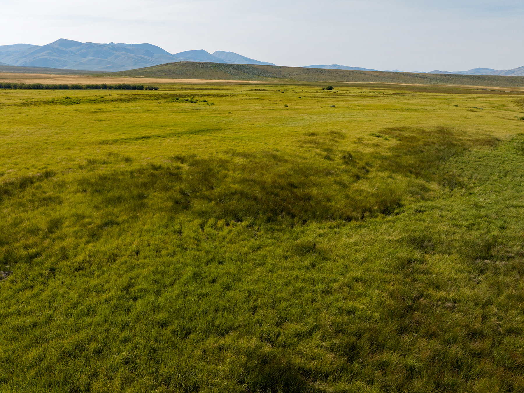
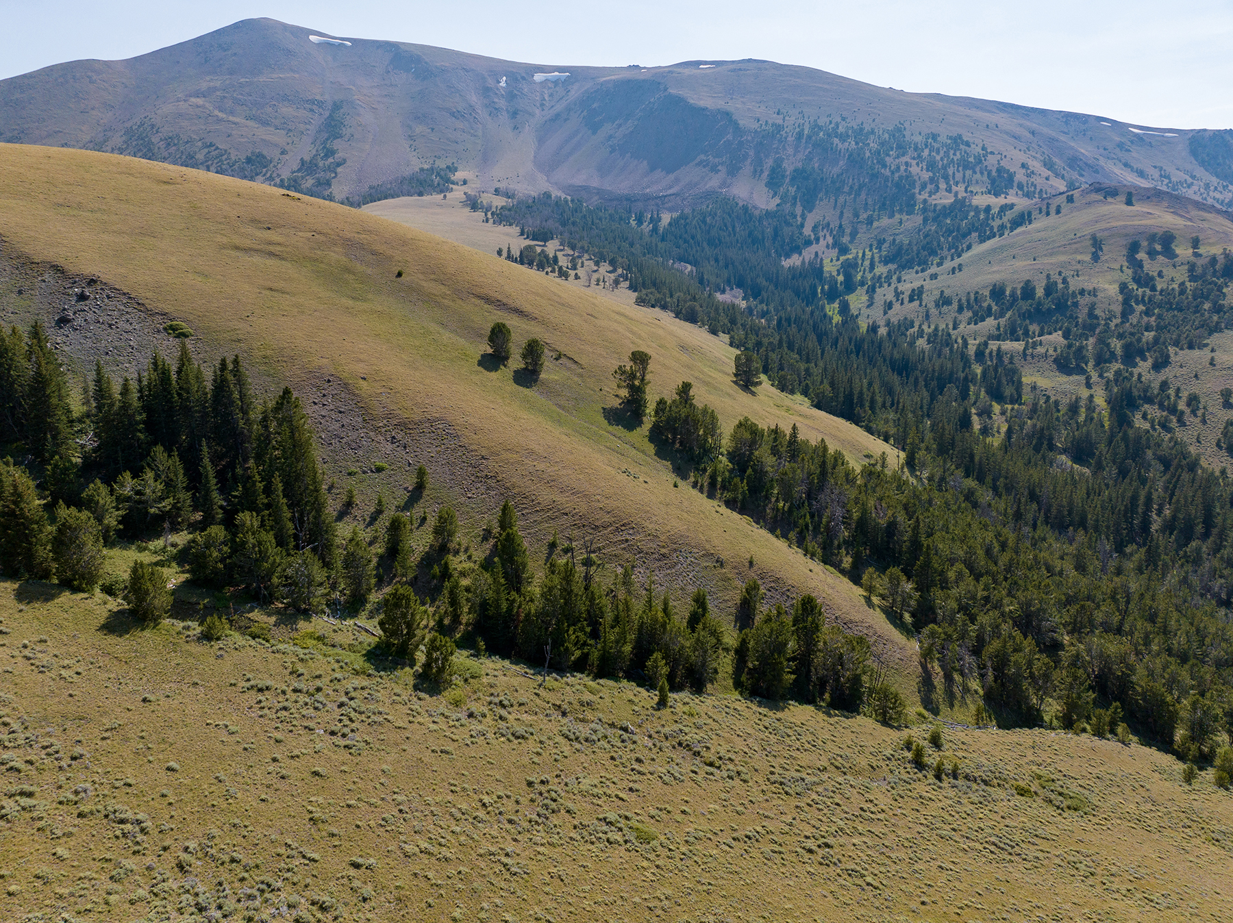
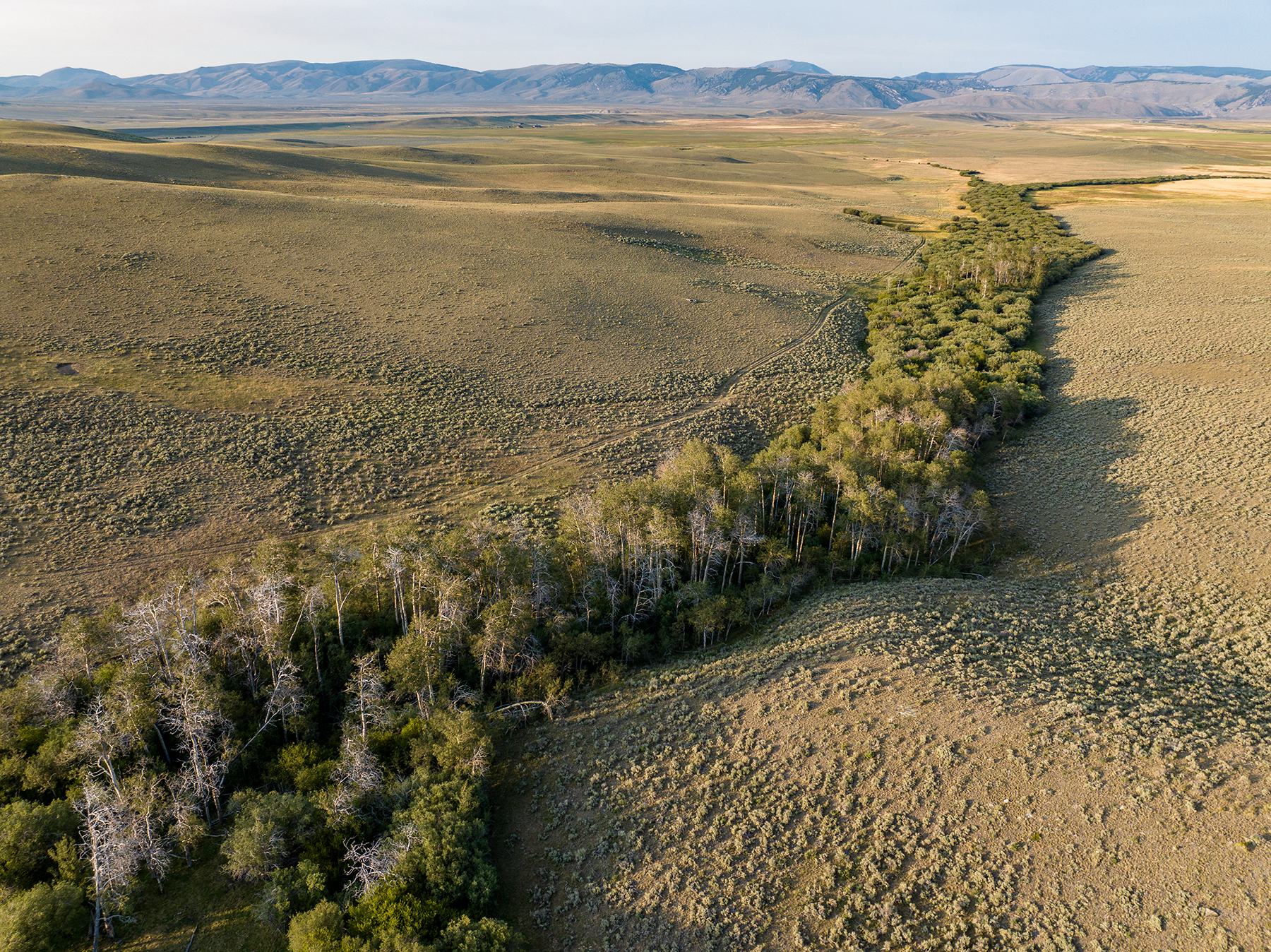
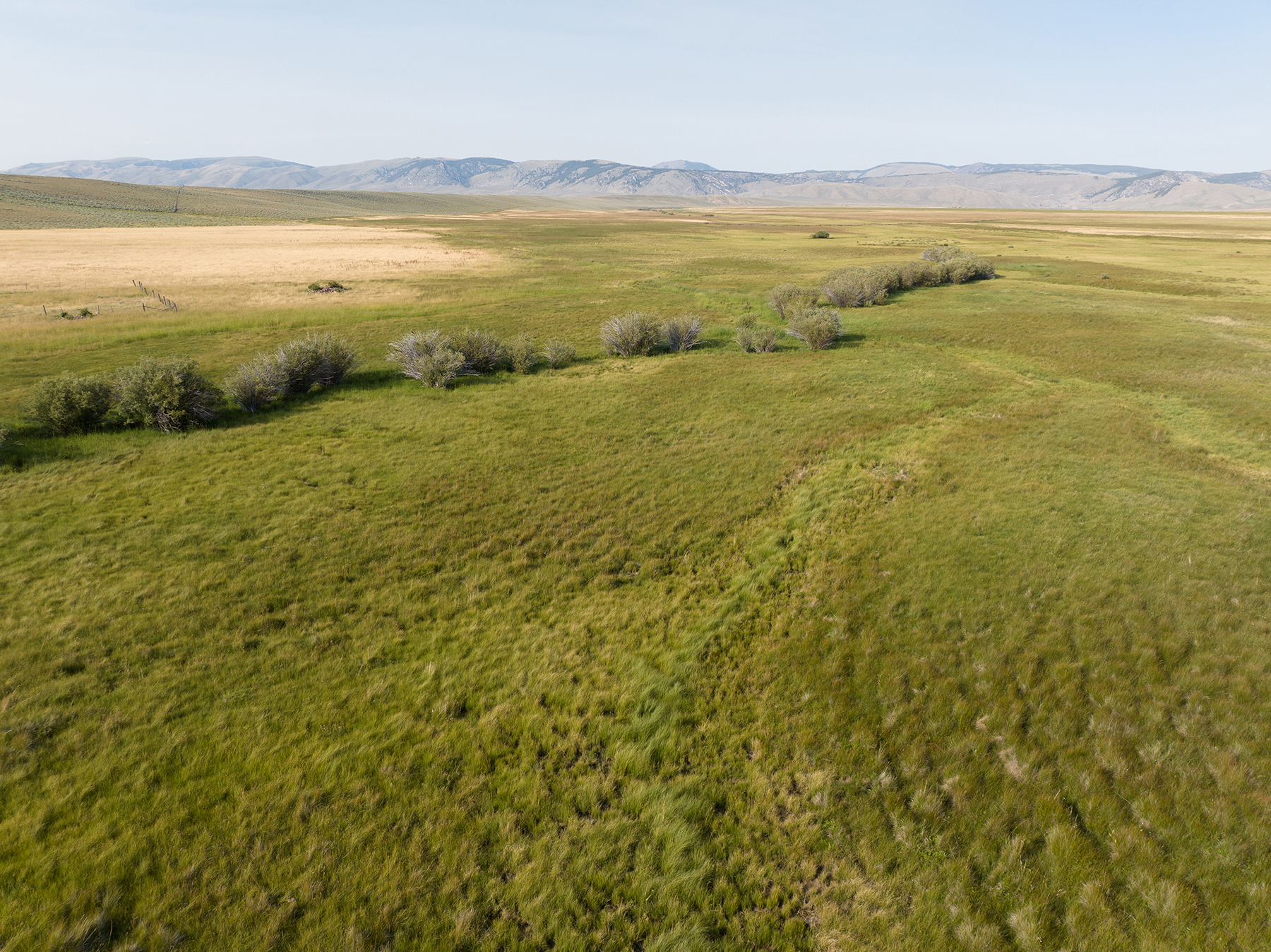
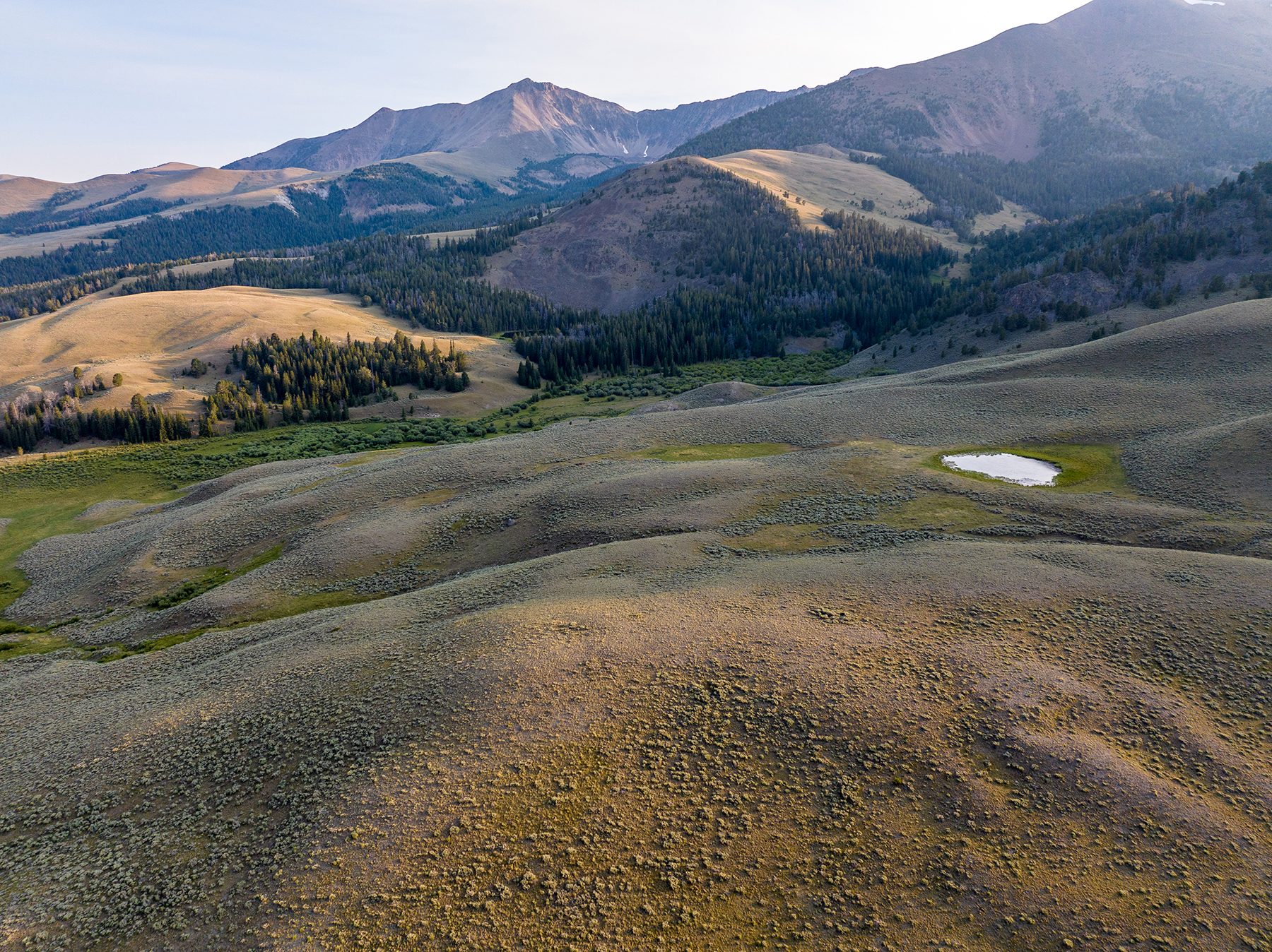
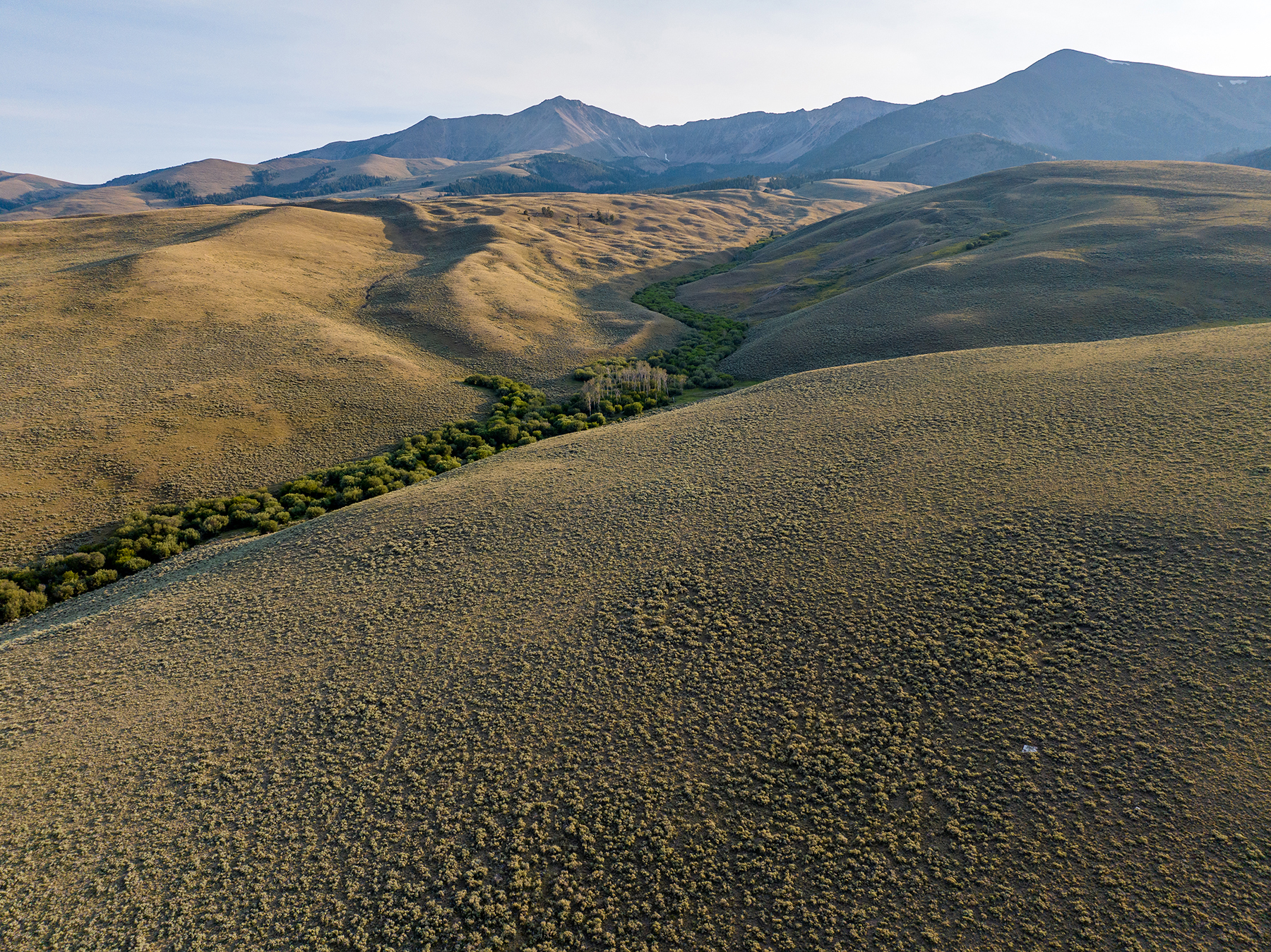
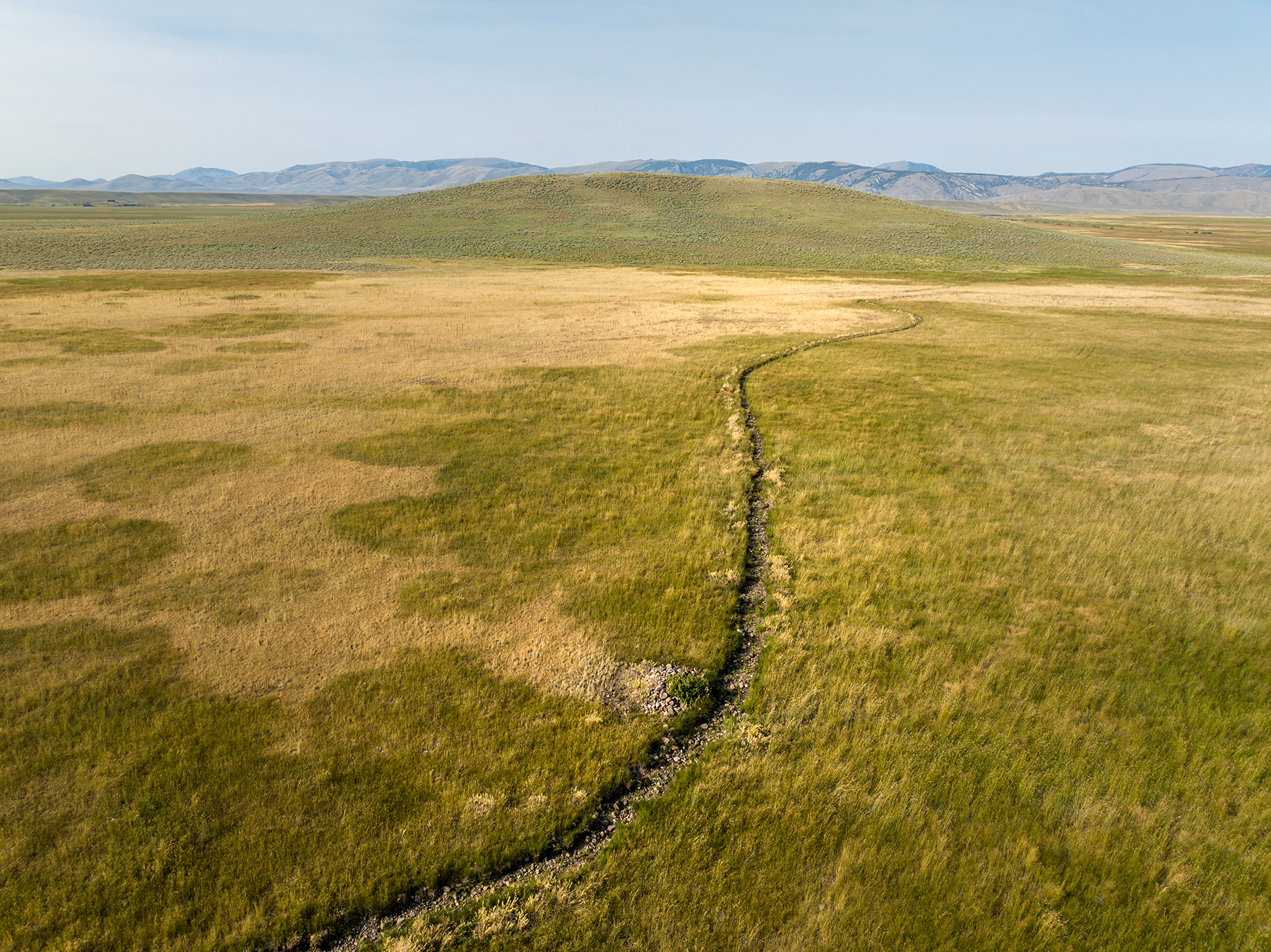
Visually, this is a vast basin in a high-hanging valley whose base elevation of 7,000 feet is still towered over by giant mountain peaks that rise to over 11,000 feet. It is quite dramatic to see in person. The tall mountains drip with flowing springs that collect and combine into larger systems as they progress down the valley and into the canyon below. Open rolling basins of native range are interspersed with lush green irrigated and sub-irrigated hay meadows and are lined with dense willows. The tentacles of ridgelines that reach across the deeded lands extend back up into the mountain foothills and into the dense forests that grow at the limits of their elevation. All of it is navigable on foot, most by horse, and some by UTV.
This remote and elevated landscape also provides some of the darkest skies to observe the celestial display above. With intrusive light pollution nearly 100 miles distant, and the air somewhat thinner at elevation, the night's display is as good as it gets for stargazers. And with literally only a handful of neighbors in the entire basin, yard lights are inconsistent at best.
First and foremost, this is an operating ranch that happens to be in a spectacularly scenic and remote location. Today, complete solitude is becoming a more sought after attribute yet is becoming increasingly harder to come by. The daily working routine may at times be perceived as a job, but is, in its essence, a lifestyle. With an easily filled daily to-do list, it is important to make the time to fully realize the importance of the existence of a ranch like this. Explore the region that surrounds it on foot, on a saddle, on a seat, or even by air to help grasp its significance. Fish its waters, discover the dancing grouse in the spring, listen to the fall elk rut. Pack into the Italian Peaks during the summer months. Wander through the ghost town of Bannack and rediscover the past. Drive out to the scenic byway. Explore the Red Rock Refuge during the spring or fall migration. Attend rodeo events in Dillon. These are some of the most amazing experiences in life, and unique to places such as this. Live the American West in its purest state.
The ranch is approximately 18 miles west of Dell, Montana, in Beaverhead County, off the Big Sheep Creek/Medicine Lodge Scenic Byway up Nicholia Creek Road. The Scenic Byway stretches approximately 52 miles from end to end and is a well-maintained, all-weather gravel road. Idaho Falls lies approximately 140 miles south, and Butte lies approximately 121 miles to the north, providing commercial air services. The region's hub is Dillon, located 59 miles to the north, offering a wide range of services including a fully equipped hospital, grocery stores, legal services, fly shops, and banking. Dillon is also home to a small college, equipment and auto dealers, and a broad selection of saloons and restaurants. The small towns of Lima and Dell, situated along Interstate 15, provide a modest range of amenities—including a church, school, motel, gas station, and a surprisingly delightful array of down-home cooking restaurants. Dell also features a beacon-lit 7,000-foot paved airstrip with a private fuel depot. The airstrip was originally built to accommodate World War II bombers transferring across the U.S. to the Pacific theatre. It was fully reconstructed and brought up to modern standards about 15 years ago and has more recently been resurfaced. Jackson Hole, Wyoming, Bozeman, Montana, and Yellowstone National Park are all within a two-to-three-hour drive.
The area is comprised of larger, traditional, multi-generational livestock operations, with recreational properties coming on the scene as a broader cross-section of landowners have begun to appreciate the area’s amenities, with its natural beauty and remoteness, well away from the more traditional recreation areas in Montana and Idaho. This is a region where the ranching tradition exists in concert with the raw nature of a vast, unspoiled landscape where Mother Nature dictates her mood and remains in full control.
The Big Sheep Creek/Medicine Lodge Scenic Byway passes through the valley on its 50-mile loop through the deep canyons and valleys separating the Bitterroot Range, which runs along the Continental Divide, from the Tendoy Mountains. Directly north of the ranch at the north end of the Horse Prairie Valley is Bannack State Park. Bannack was the site of Montana’s first big gold strike and the state’s first Territorial Capitol. Today, it is a well-preserved ghost town available for public enjoyment.
The upper Big Sheep Valley, of which Nicholia Creek Ranch is a significant part, was inhabited by the Shoshone Indians into the early 1900s, most notably led by Chief Tendoy, whose name is immortalized by the mountain range to the northeast. The area was, and still is, rich in game, and the Shoshone utilized this area for hunting through the summer months. This rich history is reflected in the numerous tipi rings and ancient pictographs etched into the limestone cliffs and hidden within the area’s many scattered caves. The pictographs depict scenes of buffalo hunts and many other activities. The main attraction for the Shoshone was the availability and ease of harvesting the bighorn sheep and jackrabbits that inhabit the area.
Annual precipitation averages 14 to 18 inches, usually as heavy winter snowpacks, resulting in lush green summers with ample irrigation water reserves. The precipitation throughout the area varies from high amounts in and around the mountains to a semi-arid environment on the valley floors, which are often snow-free in the winter. The ranch, located at over 7,500 feet in elevation, has a short growing season and boasts comfortable summer temperatures and cool nights. In fact, during the heat of the late summer months, there is no better place to be.
The deeded lands encompass roughly 3,445± acres. Although hard to calculate, the leased lands and permits add thousands of additional acres.
The permit numbers and stocking details are as follows:
Conservation Easement
A conservation easement is in place on all but a reserved 40-acre tract of land dedicated purely to a potential site for a residence. The Trust is managed by The Nature Conservancy, which has focused its efforts on this valley and the neighboring ones, recognizing them as vital conserved open spaces where three wilderness corridor systems converge, creating a rich habitat for diverse plant and animal life. The easement provides replacement of the existing buildings in the area in which they reside, along with the ability to add any additional agricultural buildings as needed. A copy of the Grant of Easement is available upon request.
There are nominal improvements to the ranch, including remnant buildings and cabins in various locations. The main set of buildings serves as a cowboy camp. Central to the ranch is a metal shop building and a Temple Grandin-designed, full set of working pens with an adjacent calving barn. There is also a certified scale within the main set of pens.
There are beautiful locations for a new owner to explore options for additional improvements to the ranch.
There are approximately 300,000 water rights on file with the Montana Department of Natural Resources and Conservation (DNRC). In general terms, a water right allows water to be used in a prescribed manner while the state maintains the ownership of the resource itself. Water rights in Montana have defined attributes, including source, flow rate, volume, priority date, point of diversion from the source, allowable place of use, and purpose of use, such as livestock water or irrigation water for crop production. Water rights holders must use the water in accordance with the parameters of their water rights. One key attribute of water rights in Montana is the priority date. Montana operates under the prior appropriation system, under which the most senior rights have priority to receive their water in times of water supply shortages. This concept is often referred to as “first in time, first in right.”
Water rights with priority dates senior to 1973 go through the court adjudication process. Water use that began after 1973 goes through a permitting process through the state agency, the DNRC. Over the past few decades, the State of Montana has been undergoing a statewide adjudication process to verify the parameters of the pre-1973 senior water rights. This adjudication process is anticipated to take many more years, if not decades. Due to the ongoing adjudication process and the impact of historical water use on the validity of the claims, water rights are typically transferred without warranty. Water rights in Montana are complex, and landowners should always solicit professional advice regarding their individual claims.
Multiple irrigation and stock water claims are on file with the DNRC and can be provided upon request.
Annual property taxes are approximately $4,500.00.
The fishing throughout the area is also very good. The watershed begins as springs high in the mountains, forming trout-filled lakes which are scattered through the valley. The Sheep Creek drainage collects water from multiple mountain streams, several running through the ranch, including Nicholia Creek. Nicholia Creek is a free-flowing mountain stream that is a collection of springs that merge and push their way through a virtual forested veil of willows, creating fierce resistance to the pull of downstream gravity. Here, the trout reside in a completely undisturbed environment. The stream, on average, is six to eight feet wide with decent velocity and an endless amount of willow roots sunk deep into the banks, creating an ideal trout habitat. The fishing in Nicholia Creek is virtually undiscovered.
Further downstream from the ranch, most of this water disappears underground through fractured rock formations before reemerging down valley. As it resurfaces, the pure and cold water becomes nutrient-filled from the limestone formations it is filtered through, as a watercress-laden environment perfect for supporting a vibrant population of brown, rainbow, and native cutthroat trout.
Multiple small mountain streams, including Meadow, Rock, Bear, and Nicholia, flow through the ranch and are used for irrigation and livestock water as well as remaining a habitat for aquatic species. These small tributaries become Big Sheep Creek as it forms and flows east just below the ranch into the Red Rock River, which in succession forms the Beaverhead, Jefferson, and eventually the Missouri River, merging with many of the fabled southwest Montana trout fisheries en route. Within a one-to-two-hour drive, an angler can be wading in some of the finest trout water in the world.
Various mountain lakes can be found throughout the national forest in this region. Convenient to the ranch are the Harkness Lakes, and further to the south, Deadman’s Lake hangs in a perched basin. The adventurous travel to and from and are rewarded by the spectacular scenery and the abundance of small native trout that inhabit the lakes for high-mountain angling adventures.
Given the ranch's location, a juncture between three giant ecosystems, recreational pursuits are seemingly boundless.
The wildlife that inhabits the ranch and the surrounding landscape is beyond ordinary, both in quantity and diversity. Species such as sage grouse, which are ever decreasing in population throughout the west, thrive in this basin and are commonly found in large flocks all summer and fall as they return to their leks to raise their broods prior to fall migration. It would not be surprising to see a wolverine roaming through the hills or a pine marten in the higher country. The water moving through the basin is a collection of small flowing springs that ultimately feed a larger system, which are the extreme upper tributaries of the Missouri River. Interestingly, the streams become disconnected outside of the high-water season, and the trout in these small flowing springs are genetically pure westslope cutthroat. This serves as a genetic bank for that species of fish, which is becoming rarer in modern times. This further emphasizes the ecological importance of the Nicholia Creek Ranch and its surrounding landscape.
The ranch and surrounding area host almost every Rocky Mountain big game species as well as a large variety of non-game species. Bighorn sheep, moose, mule deer, and black bear are commonly seen, and the hunting for elk and antelope is excellent. It is quite common to find elk rutting in the creek bottoms in September as they move out of the higher country to gather their harem prior to their journey to winter range over the state line into Idaho. The antelope fawn and then spend the summer in greater quantity, generally staying around well into fall until the winter snows trigger their migration to the north. A few resident moose are generally found on the deeded lands. The habitat is excellent, with tall granite alpine peaks, dark timbered basins, and grassy hillsides descending into multiple willow-lined creek drainages. The timber blends into the grass and sage-covered lower terrain, where big game animals cannot resist the temptation of the inviting irrigated ground. There are areas of densely covered giant sage that are critical to the ungulates that fawn and calve there in late spring and early summer.
To the distant east of the ranch is the Red Rocks National Wildlife Refuge, a 74,000± acre waterfowl staging area designated to benefit migrating Trumpeter Swans and a “bucket list” destination for ornithologists.
A vast forest environment flanks the ranch, including the forest service allotments, continuing well over the Continental Divide into Idaho’s Targhee National Forest. For the horseback riding or hiking enthusiast, the remoteness of this region provides little human intrusion and new adventures for backcountry treks or rides over countless miles. This area has also become quite popular with biking enthusiasts. In fact, during the peak summer months, it is more common to see a cyclist peddling the byway than a vehicle. Day tripping the 52-mile stretch of road is a pleasant experience. Whether interested in climbing tall peaks or packing into a high alpine lake, the area provides tremendous variety and terrain.
The ranch is currently utilized as a flexible, low-overhead seasonal grazing unit by a large area ranch owner. Beginning early to mid-May, around 300 mother cows are brought in to calve and reside there for the remainder of the season through fall weaning and shipping. When conditions are right, irrigation begins on the roughly 1,000± flood irrigated acres of tame grasses, which later will be utilized for grazing as irrigated pasture. In early June, an additional 500 mother cows are brought in and staged in the upper native pastures before utilizing the forest service grazing permits, allowable on July 1st but dependent on summer conditions. Once the irrigated pastures mature in mid-June, the first group of cows with their young calves will move onto the irrigated pastures, or alternatively, upwards of 800 yearlings will be brought in to graze the wet meadows through summer up to the middle of September. The forest service grazing permits are contiguous to the ranch, so cattle can trail off the deeded lands onto the permitted land, where 475 AUs remain until October 1st. Weaning and shipping of the calves occurs around October 20th, and dry cows will remain on the residual pastures until around December 1st. May calves average 475 pounds at weaning weight, while yearling steers average 1,025 pounds, which indicates the abundance of quality seasonal forage and three-pound daily gains on irrigated pasture.
The deeded lands are flat to slightly gradient with long ridges that follow the various drainages lined by willow, aspen, and other woody species. Native range grasses are strong, putting weight on cattle. Stands of sage, some of which are giant, are interspersed throughout the range lands, trapping winter moisture while also providing cover for calving elk and antelope, which are commonly found in the spring. The irrigated fields are long, flat meadows in line with the ridges described above. Various streams converge and run through a long series of ditches and headgates, allowing the water to spread reasonably well through the meadows and into the season. The hay meadows combine native and tame grasses, dominated by timothy in most pastures.
The ranch is perimeter fenced and cross-fenced throughout the deeded acres. The leased lands within the forest service permit rise into forests with huge mountain pastures that are fenced and maintained. As mentioned, the skyline that dominates the western horizon is of the tallest peaks in Montana. The permits continue into the steep country with large stands of conifers and deep canyons. This provides a natural boundary that the cattle don’t inhabit; consequently, a boundary does not have to be artificially maintained. The older herd cows that are a part of this operation generally tend to keep the herd on the grassy hills lower down, where there is also more of an abundance of water.
Notably, a small number of ranchers run cattle year-round in the basin. Historically, the ranch was run full-time with a base herd of 450-475 AUs. A future owner will want to contemplate the risks and costs of a wintering herd as an option to seasonal utilization.
Tim brought two colleagues to the property initially, leveraging years of experience and perspective related to valuation.
I had the pleasure of working with Tim Murphy on the sale of a family property in Paradise Valley, Montana. I interviewed four agents in the Bozeman and Livingston markets and selected Hall and Hall because of the agency’s reputation for expertise in high-end ranch property and global marketing....